
Leave No One Behind: Spatial AI Enabled Settlement Mapping to Enhance WASH Access for Vulnerable Populations
This project, funded by Google's AI for Social Good program aims to advance AI techniques to map vulnerable populations from satellite imagery in Africa to support intelligent and timely delivery of subsidies and resources of water supply, sanitation and hygiene (WASH).
Collaborative Research: EarthCube Capabilities: ICESpark: An Open-Source Big Data Platform for Science Discoveries in the New Arctic and Beyond
The Arctic climate system is undergoing rapid change with rising air and sea surface temperatures, accompanied by declines in the Greenland Ice Sheet, Arctic glaciers, sea ice, permafrost and snow cover on land. Increases in global air temperatures and ice-sheet mass loss are driving sea level rise around the globe. As the Arctic thaws, maritime and commercial activities in the region are expanding, presenting new opportunities as well as societal and cultural challenges.
CRII: III: Discovering Complex Mixture Patterns in Spatial Data to Advance Resilience of Communities
The project titled “CRII: III: Discovering Complex Mixture Patterns in Spatial Data to Advance Resilience of Communities” is funded through CISE’s Information & Intelligent Systems (IIS) division, and the Information Integration and Informatics (III) program. Collaborators of the project are Professors
Shumilo, Leonid
Leonid
Shumilo
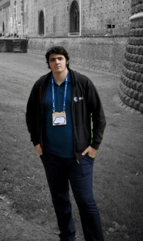
Leonid Shumilo is researcher and specialist in the remote sensing and agricultural monitoring. He's key studies are:
1) Sustainable agriculture and the analysis of climate change impact on the food production;
2) The impact of Russian agression in Ukraine on the European environment
3) Forestry and tree cover loss.
Geospatial Information Science and Remote Sensing
Land Cover - Land Use Change
Position Title
Doctoral Student, Research Assistant, NASA FINESST Fellow, RSE top 10 reviewer
Email
lshumilo@umd.edu
Room and Building
4600 River Road, Suite 309J2 (send mail to 2181 LeFrak)
Personal Website
Degrees Held
Applied Mathematics, National Technical University of Ukraine “Kyiv Polytechnic Institute”, 2018 - BS
Applied Mathematics, National Technical University of Ukraine “Kyiv Polytechnic Institute”, 2020 - MS
Student Status
PhD
Faculty Advisors
Resop, J.P.; Lehmann, L.; Hession, W.C. Quantifying the Spatial Variability of Annual and Seasonal Changes in Riverscape Vegetation Using Drone Laser Scanning. Drones 2021, 5, 91.
Elamin, Elamin M.
Elamin M.
Elamin
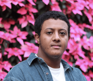
Geospatial Information Science and Remote Sensing
Human Dimensions of Global Change - Coupled Human and Natural Systems
Area of Interest
Wildlife Conservation
Conservation Criminology
Wildlife Trafficking
Position Title
Doctoral Student, Teaching Assistant, Graduate Research Assistant
Email
eelamin@umd.edu
Room and Building
4600 River Road, Suite 309K (send mail to 2181 LeFrak)
Student Status
PhD
Faculty Advisors