

UMD Researchers Join National Effort to Use GeoAI to Predict Food System Instability
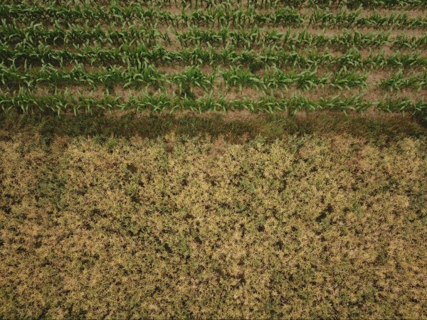
The initiative aims to help humanitarian and food security analysts detect emerging agricultural crises before they escalate.
A new collaboration involving researchers at the University of Maryland is helping develop next-generation geospatial tools designed to anticipate food insecurity, monitor conflict-related disruptions and support more resilient agricultural systems around the world.
Announced May 27 through the Geospatial Innovation for Food Security (GIFS) Challenge, the project brings together researchers from Arizona State University, the University of Maryland, Washington University in St. Louis, including the NASA Goddard Space Flight Center and the Famine Early Warning Systems Network (FEWS NET). The initiative is one of three awardees selected by Taylor Geospatial, a nonprofit organization focused on advancing geospatial artificial intelligence (GeoAI) for public benefit. Each team will receive up to $550,000 in funding and 18 months of support to move their concepts toward operational deployment.
The collaboration is developing a GeoAI capability that can detect early signals of instability in food systems by combining satellite data with natural-language queries. The system is designed to help decision-makers quickly interpret rapidly changing conditions in regions affected by conflict, climate stress and supply chain disruptions.
“Decision-makers often have to assess food security risks with limited and delayed information about what is happening on the ground,” said Inbal Becker-Reshef, a research professor in the Department of Geographical Sciences and UMD’s NASA Harvest co-director. “By generating more timely and transparent information, it will help address critical gaps and support organizations working to anticipate emerging food security risks.”
The platform aligns in-season satellite-based data with question-driven search tools, allowing users to generate accessible insights while also communicating levels of uncertainty. Through this work, NASA Harvest is helping expand access to actionable, decision-relevant agricultural information for food security analysts and agricultural practitioners worldwide.
“The portable GeoAI platform under development aims to dismantle significant technical barriers, providing food security analysts with more reliable and verifiable estimates of food production disruptions caused by conflict. This capability is particularly critical for analysts who are unable to conduct on-the-ground assessments in high-risk zones,” said Catherine Nakalembe, an assistant professor in the Department of Geographical Sciences and Africa lead for UMD’s NASA Harvest. “By integrating satellite-based data with advanced natural-language queries, the tool allows decision-makers to rapidly interpret shifting conditions in regions facing climate stress, supply chain issues and active warfare.”
The team plans to test the open-source tool in active conflict regions including Sudan, Ukraine, Syria and Haiti, with the potential for broader global application.
The GIFS Challenge was created to bridge the gap between geospatial research and real-world implementation, emphasizing tools that can operate under the constraints of time, scale and uncertainty.
“These projects prioritize execution over theory, ensuring that the work functions under the real-world constraints of time, scale, and uncertainty,” said Rachel Opitz, GIFS program manager at Taylor Geospatial. “The GIFS awardees are not just producing research; they are building tools that can be used to manage resources more efficiently and that humanitarian teams in conflict zones can use to identify food system risks before they become crises.”
Other funded projects include a collaboration between the World Food Programme and the REACH Initiative to strengthen food supply monitoring in Afghanistan, and a precision agriculture initiative led by the University of Missouri focused on improving nitrogen application decisions through satellite imagery and machine learning.
More in Taylor Geospatial's Press Release
Photo by Alexander Pell on Unsplash
Published on Wed, 05/27/2026 - 09:41