
Taylor Oshan's Unwavering Path in Geospatial Data Science
Assistant Professor Taylor Oshan's path from a childhood spent tinkering to his current role in academia is a testament to his curiosity-driven approach and willingness to seize opportunities and confront challenges as they come.
Growing up on Long Island, NY, where the fast pace of New York City blends with suburban tranquility, Oshan displayed an innate ability to immerse himself in his interests, from spending hours playing with Legos to building computers for his family and friends. Despite his introverted nature, Oshan's thirst for exploration prevailed.
“I learned how to be an extrovert,” said the former painfully shy child. Oshan said his analytical brain comes from his father who operated his own business and his creativity comes from his mother who was an artist.
Oshan's academic journey began with a foray into civil engineering at the University of Delaware, but he wasn’t convinced that this was his calling. His interests were eclectic and he continued to explore. Though he naturally gravitated towards science and innovation, he was fascinated by the social sciences and humanities. He ended up with a bachelor’s degree in history, with an interest in archaeology and emerging technologies in the field. This included geospatial technology, along with surveying, remote sensing and spatial analysis. As a result, he also earned a graduate certificate in geographic information systems (GIS).
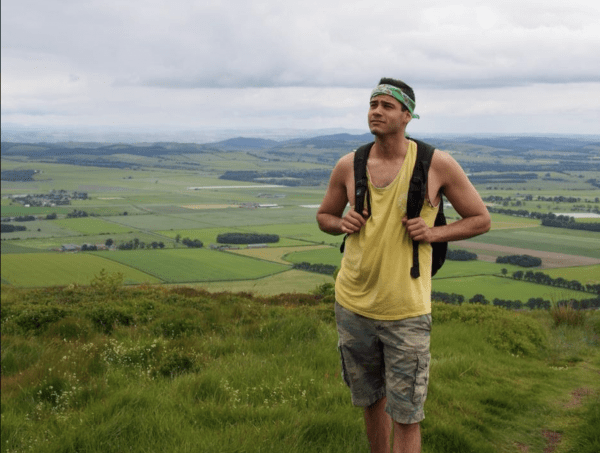
As an undergraduate student, Oshan relished opportunities to expand his horizons. He seized several international travel opportunities, including participation on an Etruscan archaeological excavation in Italy where he applied his skills as a GIS specialist. Oshan recalls having lived with a roommate majoring in geography who initially sparked his interest in GIS and how it can be applied within archaeology. However, he soon realized the versatility of GIS and geospatial technology and was hooked.
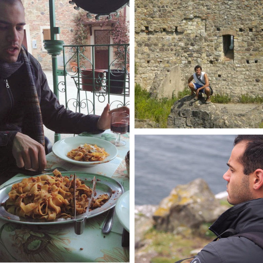
Through travel, he also became passionate about food and culinary culture. Meanwhile, back at home he took on roles as an ESL tutor at UD’s English Language Institute, a GIS intern at the university’s Center for Historic Architecture and Design, and worked part time at a local sandwich shop. He even began learning how to brew beer styles from around the world. Oshan recalls that it was a mixture of these passions and experiences that set him on his current path.
After Delaware, Oshan moved back to New York and pursued a masters’ program in geography and geoinformatics at Hunter College. There, he had the opportunity to build a foundation in geographical knowledge, begin honing his scientific writing skills, and expand his technical skills in mathematics, statistics, programming, web technology and more. During this time, Oshan met colleagues who inspired him to delve even more into the geographical sciences. His master’s thesis combined his interests in spatial analysis and archaeology and incorporated techniques ranging from simulation to network analysis methods.
With his newfound expertise, Oshan embarked on a series of transformative experiences. He took on a faculty-specialist type role in Scotland, and soon after was admitted to the Ph.D program in the Department of Geographical Sciences and Urban Planning at Arizona State University. Surrounded by luminaries in the field, Oshan immersed himself in GIScience, exploring spatial optimization, regression techniques and open-source software.
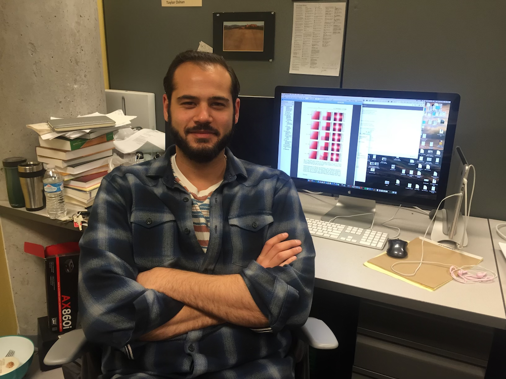
After obtaining his Ph.D., Oshan secured an assistant professor position at GEOG in the fall of 2018. Reflecting on his journey, he shared the sentiment expressed by other faculty members: "You can make your own path in geography." This phrase resonates deeply with Oshan as it underscores the ethos of independence and innovation that has guided his academic journey.
A few months after joining GEOG, Oshan was involved in a car accident that resulted in a spinal cord injury. Despite becoming paralyzed, Oshan observed that he had not lost his cognitive abilities and was determined to continue his intellectual pursuits. Early in his rehabilitation, Oshan was exposed to adaptive technology that allowed him to continue working on his computer. Through dictation software and alternative peripheral devices, he learned to adapt so that he could continue collaborating, working on research projects, and eventually teach. Oshan remembered how good it felt as he proved to himself that he could still conduct these activities, especially the first journal publication that was entirely conceived and conducted after the injury.
One of Oshan’s approaches to his work is to build on knowledge that persists over time. He maintains an eclectic portfolio, with current interests centered on developing geospatial analytics and urban applications and innovating spatial data infrastructure. “I am able to wax and wane between taking on a lot of different things but then becoming hyper-focused on one or more at the same time,” he explained.
Oshan advises his students to skill up even if they don’t intend to pursue a technical career or have an area of specialization selected yet. “You can always apply them to whatever you want,” he said, “but it is important to have passion projects for motivation because it's difficult to skill up in a vacuum.” Technical proficiency is also important for working in non-technical roles where you need to be able to work with diverse teams and organizations, he added.
During his upcoming sabbatical in 2024-2025, Oshan plans to focus on dissemination and collaboration. He aims to seek new partners in fields such as criminology, sociology and psychology, both locally and while visiting other U.S. universities. He also plans to spend time in Rome building international collaborations in the area of spatial demography. He looks forward to working on new research papers, writing proposals for new projects, and scoping a new book on multiscale spatial analysis techniques.
As he looks toward the future, Oshan's commitment to collaboration, innovation and the pursuit of knowledge continues to inspire, leaving an indelible mark on both the academic landscape and those fortunate enough to embark on this journey alongside him.
All images courtesy of Taylor Oshan
Published on Thu, 02/29/2024 - 13:45