
Students Collaborate Across Courses to Build a Digital Atlas of Natural Disasters
Rather than simply studying case studies in a textbook, GEOG140 students were tasked with researching and entering data on a natural disaster. Meanwhile, students in GEOG473 designed a digital dashboard to organize, visualize and analyze the collected information.
When Professor George Hurtt visited senior lecturer Naijun Zhou’s GEOG473 class on GIS Day 2024, he was struck by how easily Zhou demonstrated the power of geographical information systems to analyze data. It got him thinking—what if his GEOG140 students could do more than just learn about natural disasters? What if they could help build something that mapped them across the globe?
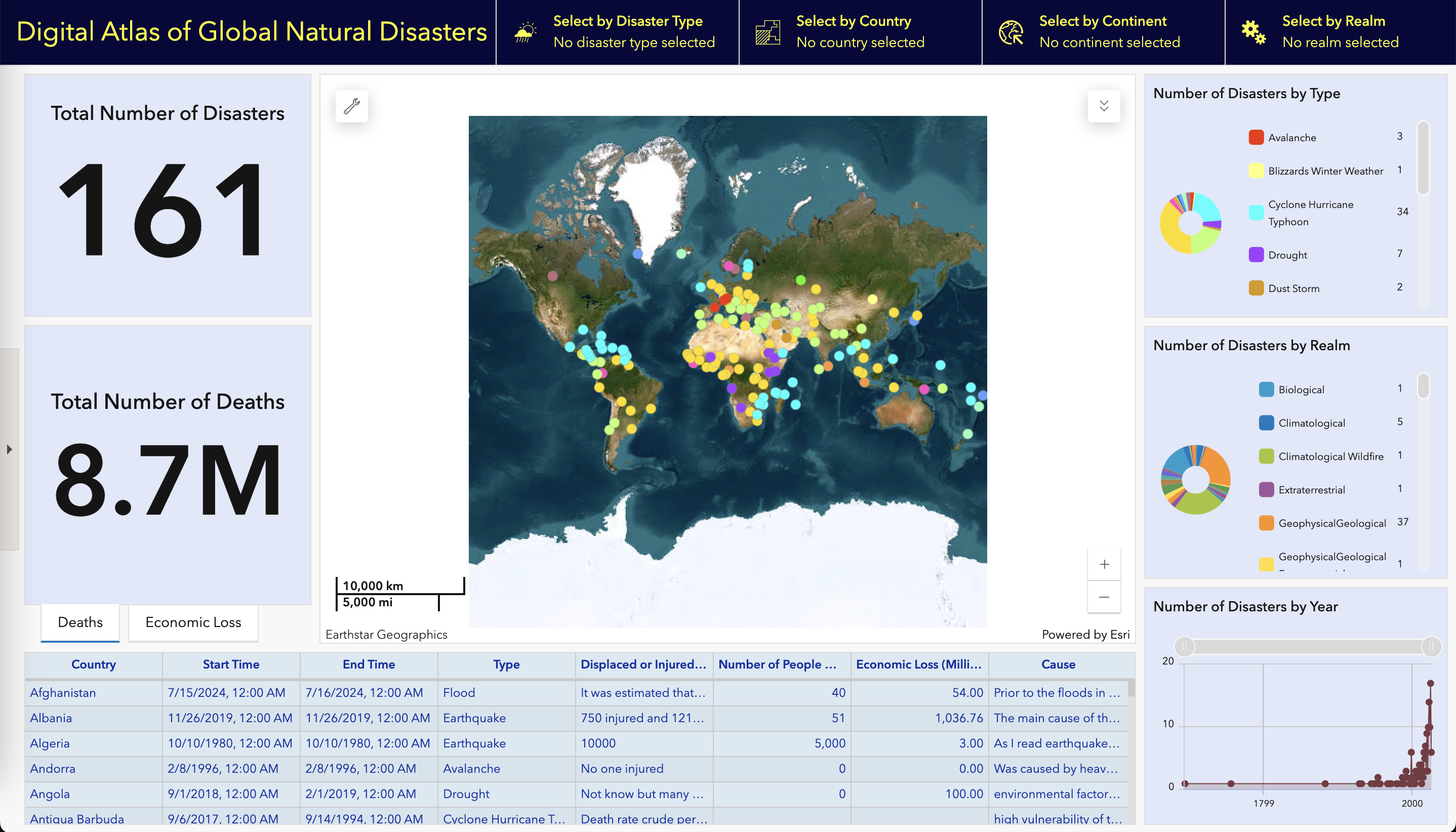
That idea sparked a cross-course collaboration between GEOG140 (Natural Disasters) and GEOG473 (Spatial Analysis with GIS), where students worked together to build a comprehensive Digital Atlas of Natural Disasters—an interactive web-based platform that maps and analyzes disaster data from around the world.
Hurtt saw an opportunity to rethink the way he taught the course. “I decided to change it up this year and engage students in the development of a global database of natural disasters,” he said.
Here’s how it worked: GEOG140 students researched and entered information about a natural disaster in a specific country. Meanwhile, students from GEOG473 designed and built the dashboard that brings it all together.
Released on March 31, the Digital Atlas of Natural Disasters lets users explore patterns of natural disasters globally through an interactive interface. "It's an amazing example of engaged teaching, where students are actively participating in research and discovery related to the topics they're studying," Hurtt explained. "It's also amplified by students in two different course levels working together toward a common goal."
Zhou created a manual and assembled a team of five volunteer students with diverse backgrounds—including information science, GIS, computer science, and government and politics—to develop the web-based dashboard. Despite the fact that web-based GIS aren't currently covered in undergraduate curricula, the students quickly mastered the necessary skills with Zhou's guidance and made a prototype in four days.
“I was surprised by how simple the process was of creating a dashboard with ArcGIS Online,” said GEOG473 student Neola Dsouza, who is pursuing a double degree in computer science and geospatial data science. “I was expecting a lot of coding, but Esri's dashboards have easy-to-understand components that made us focus more on the design and user interface of the dashboard, since all of the complex functionality was abstracted.”
"This dashboard is a typical Web-based GIS system," noted Zhou. "GIS is a very important skill, which is why we had five volunteers eager to participate in this project.”
That hands-on opportunity was a key part of the experience, according to GEOG140’s teaching assistant Elamin M. Elamin. “This project gave students the opportunity to contribute to a living database,” he said. “They were able to tangibly see and use their contributions that directly came from concepts taught in the class.”
GEOG140 students said the project brought a deeper layer of understanding to natural disasters. Autumn Seay-Gaffier, a double major in psychology and criminal justice/criminology, researched the 1992 Cairo Earthquake, which caused 545 fatalities and over $300 million in damages.
Autumn focused on key aspects of the earthquake’s impact, including the causes, aftermath and recovery efforts. “This project allowed me to apply my research skills and gain a deeper understanding of the long-term effects of natural disasters on both communities and infrastructure," she said.
Working on the project was also a valuable experience for Ameerah Austin, a government and politics major with an international relations concentration. She focused her research on Cyclone Freddy, a storm that brought widespread destruction to Malawi between February and March 2023.
“The project offered a unique way to encourage students to explore the dangers and real-world relevance of natural disasters,” Ameerah said. “Not only did it help us become familiar with real-life examples, but it also allowed us to apply course concepts and practice working with data in a meaningful way.”
Ameerah sees a direct connection between this experience and her career goals, which involve resolving global conflict and fostering communication across diverse cultures. “Understanding natural disasters is highly relevant to the field of international relations, as these events are not just environmental. They also impact diplomacy, international cooperation, and even political conflict. The ability to address these global challenges is an important part of working in foreign service.”
Next Steps: Analyzing Global Trends
The project is far from finished. Next, GEOG140 students will dive into the data they helped compile, using the dashboard to identify trends and explore global patterns in natural disasters—from frequency and severity to where they’re happening and why. Thanks to the groundwork laid by GEOG473, they have a dynamic tool at their fingertips to guide that exploration.
Zhou is already planning for future iterations. “This dashboard will be upgraded, and hopefully the database will continue to grow each year,” he said. “Then we can have GIS students to work on this each year.”
For Hurtt, the project embodies teaching at its best. “More than 175 students worked together to create an integrated database and GIS dashboard more powerful than any of them could have created on their own ,” he said. “It will be exciting to see the inspirations and discoveries that follow.”
Explore the Digital Atlas of Natural Disasters
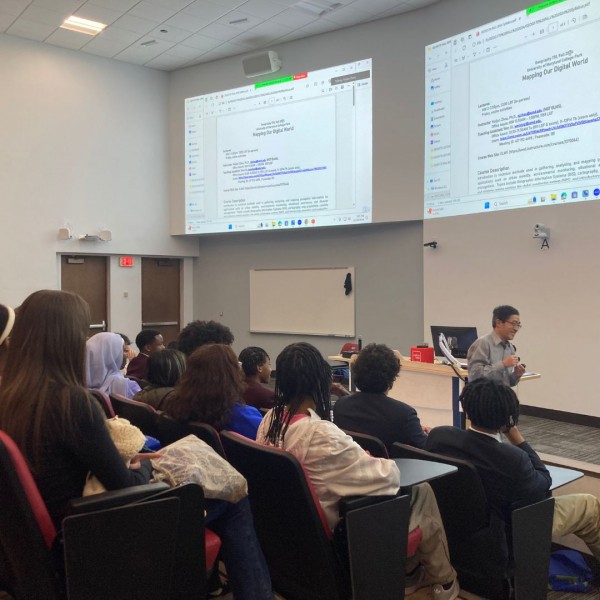
Main image: High school students, hosted by Professor George Hurtt, attend senior lecturer Naijun Zhou’s GEOG473 class on Nov. 15, GIS Day 2024.
Correction: Elamin M. Elamin is a teaching assistant for GEOG 140, not GEOG 473 as previously stated.
Published on Mon, 05/05/2025 - 12:31