
Regional Workshop Empowers Nine African Nations With AI-Driven Crop Yield Forecasting
GEOG-led training in Kenya helps national teams turn satellite data into actionable food security insights.
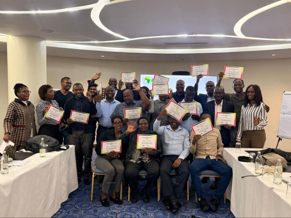
The University of Maryland’s NASA Harvest Africa, in collaboration with AGRA and COMESA, concluded a three-day Regional Crop Yield Forecasts and Food Security Workshop 2026 in Nairobi, Kenya, on March 6.
This event brought together technical leads from nine African countries — Kenya, Malawi, Tanzania, Uganda, Rwanda, Zambia, Zimbabwe, Ethiopia and Burundi — with the shared goal: to operationalize an automated crop yield forecasting pipeline.
Led by Catherine Nakalembe, assistant professor in the Department of Geographical Sciences and director of the XylemLab, the workshop focused on transferring technical knowledge to national partners. The aim was to enable teams to co-produce high-quality data and translate complex satellite observations into actionable insights for managing food security and stabilizing regional markets.
Xylem YieldWatch and Autopilot
The training emphasized bridging the gap between advanced data analysis and the decision-makers who rely on it. Participants were introduced to Xylem YieldWatch, an integrated forecasting pipeline designed to help national offices monitor crop health and predict yields months before harvest.
The system combines multiple biophysical signals to provide early warning of potential production shocks. An automated reporting engine, Xylem Autopilot, converts raw satellite analysis into publication-ready bulletins, reducing production time from days of manual work to less than 30 minutes. This allows team members to generate bulletins without specialized GIS knowledge.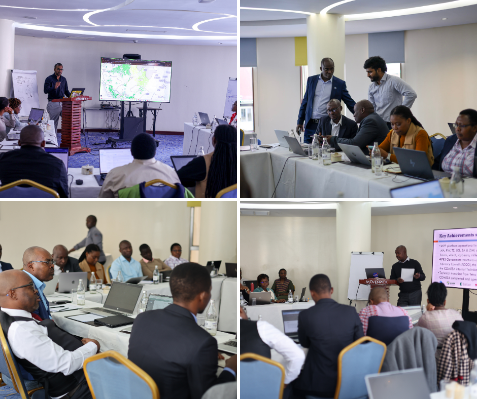
Participants engage in hands-on sessions, using UMD/XylemLab-developed tools to generate bulletins for their respective countries.
Addressing a Critical Data Bottleneck
A significant portion of the workshop addressed the difficulty in acquiring high-quality field data. Nakalembe described this as the "critical bottleneck in EO/ML crop analytics — not the models themselves." Because models rely heavily on historical data, a lack of current-season validation data can introduce bias, particularly in undersampled regions.
To address the data challenge, the team reviewed two innovative approaches:
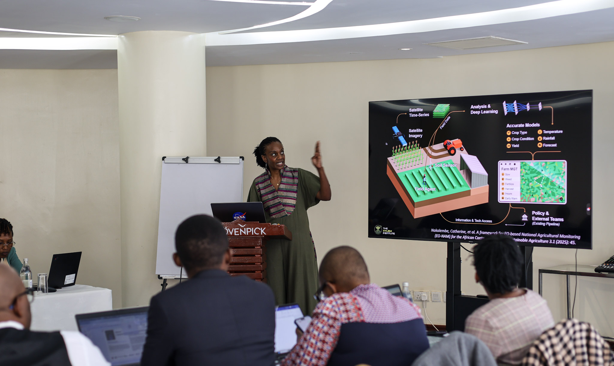 Nakalembe presents cutting-edge EO and ML solutions to regional partners to enhance the accuracy of national crop production estimation.
- ECAAS Data Collection: Nakalembe highlighted the Enabling Crop Analytics at Scale (ECAAS) pilot in Kenya, which successfully collected more than 1000 crop-type data points and more than 500 crop-cut measurements across 18 counties. Key lessons from the pilot emphasized the necessity of more lead time for planning and training field agents.
- Helmet Labeling Project: Faculty specialist Diana Botchway Frimpong presented an approach that uses GoPro cameras mounted on vehicles, combined with deep learning, to collect street-level imagery for scalable, low-cost crop type mapping. The approach was validated in the peer-reviewed study “Helmets Labeling Crops: Kenya Crop Type Dataset Created via Helmet-Mounted Cameras and Deep Learning” (Nakalembe et al., Scientific Data 12(1), 1496), demonstrating how large volumes of street-level imagery can strengthen and verify satellite-based models.
The workshop concluded by establishing key outcomes to ensure knowledge transfer leads to sustainable institutional ownership. Participants left with enhanced technical understanding of AI-driven yield estimation methods — as seen in the new paper "Optimizing satellite-based cropland area estimation through integrated map accuracy assessment and stratified sampling design across six African countries" (Adebayo et al., International Journal of Applied Earth Observation and Geoinformation 148 (2026): 105223) — and operational proficiency in the Crop Yield Prediction Workflow, including dataset management and machine learning model training.
The final focus of the event was on long-term sustainability and national leadership. Instead of depending on external reports, the technical leads will be fully equipped to manage these complex forecasting pipelines within their respective ministries.
All photos courtesy of Catherine Nakalembe and her team
This article was written by faculty specialist Monica Adjei.
Published on Wed, 04/08/2026 - 16:22