New Research Offers Streamlined Way to Assess Forests for Climate Policy
A collaboration between GEOG researchers and a wide range of forest experts shares a satellite-based method to estimate global forests in line with the Intergovernmental Panel on Climate Change (IPCC).
Maps created using satellite data can provide a consistent and replicable view of the world’s forests, showing how much forest biomass—woody plant materials like trees—exists above ground. This data is valuable for countries reporting their efforts to curb climate change to international organizations, such as the United Nations Framework Convention on Climate Change (UNFCCC). However, as of 2024, only a few countries are using satellite-based maps in such reports, partly because the data isn’t provided in a suitable format or because there aren’t enough guidelines to help them incorporate this information into policy.
To address this issue, researchers from the University of Maryland's Department of Geographical Sciences, in collaboration with space agencies, experts from the Intergovernmental Panel on Climate Change (IPCC) and several other research groups, have developed a framework that uses Earth Observation (EO) data to estimate forest biomass in line with IPCC guidelines for National Greenhouse Gas Inventories. Their work, published in Nature Scientific Data, presents a method consistent with the approaches set by the IPCC.
The current IPCC default values, called Tier 1, are provided for countries that don't have their own data to measure the amount of carbon stored in their forests or how it's changing over time.
“Our work develops and demonstrates a new framework to estimate IPCC's Tier 1 default biomass values, not from ground-based inventories (as is currently done), but from data from spaceborne instruments calibrated to ground data,” said lead author Neha Hunka, assistant research professor at the Department of Geographical Sciences.
A New Era in Forest Estimation
“In the face of climate change, the need for precise and actionable data on forest biomass is increasingly pressing,” wrote Hunka in a blog post. She noted that traditional methods of estimating forest biomass, such as IPCC’s Tier 1, provide valuable data, but are limited by incomplete geographical coverage, particularly in tropical and subtropical regions.
The new framework compiles the wealth of knowledge on global forest conditions known today and harnesses space-based technologies to provide complete and consistent data on Aboveground Biomass Density (AGBD) for forests on a global scale.

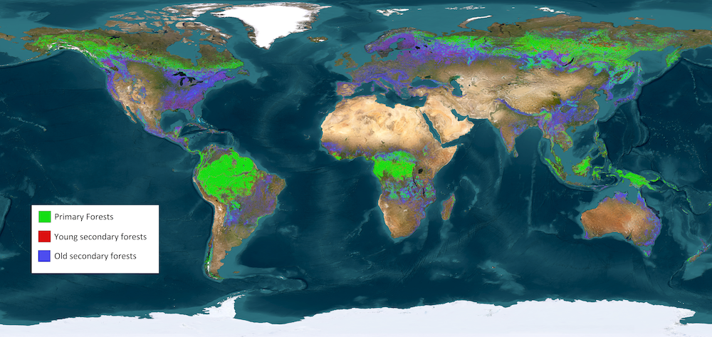
As Hunka explained, the framework first had to classify the world's forests into primary, young secondary and old secondary forests, as done by the IPCC. Then, it used various geospatial datasets produced by researchers across the globe, including many GEOG researchers, to recreate this classification for the year 2020. Lastly, it derived precise biomass estimates for each class in the classification, re-creating and filling gaps in IPCC’s Tier 1 default values.
"Instead of the static snapshot of forest biomass provided by the IPCC, space-based instruments produce data that can be regularly calibrated and updated to provide forest biomass estimates, and can reflect ongoing changes in forest as our climate changes,” Hunka said.
Derived from missions such as NASA’s Global Ecosystem Dynamics Investigation (GEDI) and ICESat-2, JAXA’s ALOS-2 PALSAR-2 and ESA’s Sentinel-1A and -1B satellites that make the ESA CCI Biomass product, the new datasets are designed to be incorporated into the IPCC’s Emission Factors Database.
The published framework ensures transparency and allows future datasets to be easily integrated, making the system flexible and adaptable as new EO technologies emerge.
"The open science component of this work is critical—we want policy users to trust our maps, and putting them into a framework that is already aligned with policy reporting, but with all of the data and code totally open, will hopefully facilitate uptake. The framework can be rapidly updated with the latest data,” said GEOG Associate Professor Laura Duncanson. "This is important as we improve our mapping of forest biomass all the time, and this would enable these improvements to rapidly be integrated into a policy-friendly framework."
International Collaboration for Global Impact
This effort is the result of extensive collaboration between research teams from GEDI at the Department of Geographical Sciences, the U.S. Forest Service, NASA Goddard, European Commission’s JRC, GAMMA Remote Sensing, the GFOI and other global partners. As Hunka observed, “Different space-agencies, IPCC authors and research groups were needed to come together and produce a comprehensive picture of the Earth's forests known to date.”
The collaborative exercise of compiling numerous datasets for the work is done under the umbrella of the Biomass Harmonization Activity. With the support of the Committee on Earth Observing Satellites (CEOS), Biomass Harmonization is a global effort to align forest-carbon estimates from space data, making them compatible with policy guidelines to support climate reporting, while promoting transparency and collaboration through open science frameworks.
The article in Nature Scientific Data lists 27 co-authors. In addition to Hunka and Duncanson, it includes GEOG researchers John Armston, Ralph Dubayah, Peter Potapov, Svetlana Turubanova, Alexandra Tyukavina, Mikhail Urbazaev and Adrián Pascual.
Supporting Climate Goals
These satellite-based forest biomass estimates aim to help countries and policymakers, especially in regions where ground-based data is hard to obtain. The framework offers the opportunity to continually produce consistent, up-to-date information on forest biomass, providing a resource for countries in carbon reporting, as well as a resource for reviewers of policy reports.
Looking toward the future, the article suggests that satellite-based estimates generated as such may serve as independent and regular contributions of forest biomass estimates for the Global Stocktake (GST) of 2028 under the Paris Agreement.
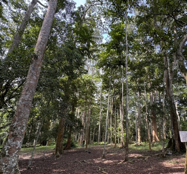
Main image: Bobiri Forest, Ghana by Neha Hunka
Published on Thu, 10/17/2024 - 11:57


