UMD College of Behavorial & Social Sciences UMD College of Behavorial & Social Sciences
MENU

Topbar Menu

  • About Us
  • People
  • Alumni and Giving
  • Undergraduate
    • Prospective Students
    • Courses & Facilities
    • Advising
    • Special Programs
    • Graduation
    • Geography Club
  • Graduate
    • Prospective Ph.D. Students
    • Graduate Courses
    • Graduate Student Publications
    • Graduate Student Awards
    • Graduate Students
    • Master of Science and Graduate Certificate Programs
    • Combined BS/MS Program
  • Research
    • Research Areas
      • Geospatial-Information Science and Remote Sensing
      • Human Dimensions of Global Change
      • Land Cover and Land Use Change
      • Carbon, Vegetation Dynamics and Landscape-Scale Processes
    • Centers
      • Center for Geospatial Information Science
      • International Center for Innovation in Geospatial Analytics & Earth Observation
  • High School Hub
    • Program Overview
    • High School Awards
    • High School Internship Program
    • GIS Day
    • Request a Geographer
  • Resources
    • Graduate Student Organization
    • Student Life
    • Graduate School
    • Responsible Conduct of Research
    • Emergency Preparedness
    • Job Opportunities
    • Graduation
Search

Main navigation

  • Undergraduate
    • Prospective Students
    • Courses & Facilities
    • Advising
    • Special Programs
    • Graduation
    • Geography Club
  • Graduate
    • Prospective Ph.D. Students
    • Graduate Courses
    • Graduate Student Publications
    • Graduate Student Awards
    • Graduate Students
    • Master of Science and Graduate Certificate Programs
    • Combined BS/MS Program
  • Research
    • Research Areas
      • Geospatial-Information Science and Remote Sensing
      • Human Dimensions of Global Change
      • Land Cover and Land Use Change
      • Carbon, Vegetation Dynamics and Landscape-Scale Processes
    • Centers
      • Center for Geospatial Information Science
      • International Center for Innovation in Geospatial Analytics & Earth Observation
  • High School Hub
    • Program Overview
    • High School Awards
    • High School Internship Program
    • GIS Day
    • Request a Geographer
  • Resources
    • Graduate Student Organization
    • Student Life
    • Graduate School
    • Responsible Conduct of Research
    • Emergency Preparedness
    • Job Opportunities
    • Graduation
  • About Us
  • People
  • Alumni and History
  • Diversity

Search our site:

New Project Helps Rhode Island Track How Trees Combat Climate Change

Breadcrumb

  • Home
  • Featured Content
  • New Project Helps Rhode Island Track How Trees Combat Climate Change
A large, multi-story coastal house sits atop a grassy bluff overlooking a rocky shoreline. Under a gray, overcast sky, small waves from the ocean crash against a heavy stone revetment that lines the coast to prevent erosion. The hillside is covered in green and autumnal shrubbery, with a single tall, bare-branched tree standing in the foreground.

A collaboration with the UMD's Global Ecology Lab will apply high-resolution satellite data and advanced modeling to improve Rhode Island’s forest carbon estimates.

As Rhode Island works to meet its climate goals, the state is turning to researchers at the University of Maryland for help measuring one of its biggest natural assets: trees. This new initiative will track how forests and urban tree canopies store carbon and help reduce greenhouse gas emissions across the state.

The project uses high-resolution remote sensing data and an advanced modeling system developed through NASA’s Carbon Monitoring System. Led by Professor George Hurtt in the Global Ecology Lab, with Lei Ma, assistant research professor, Quan Shen, postdoctoral associate, and Janna Chapman, faculty specialist, the system estimates changes in tree canopy and carbon storage over time at a 30-meter resolution, offering a far more detailed picture of how trees contribute to climate mitigation.

Rhode Island will become the second state in the country—after Maryland—to integrate this approach into its official greenhouse gas inventory. 

The effort is a collaboration between the Rhode Island Department of Environmental Management, the University of Maryland and The Nature Conservancy. 

Trees play a critical role in regulating Earth’s climate. Healthy forests absorb carbon dioxide from the atmosphere, while damaged or decaying forests release it back into the air. In Rhode Island, trees currently remove more carbon than they emit, offsetting nearly 8% of the state’s annual greenhouse gas emissions. 

Until now, measuring carbon stored in forests has relied largely on a limited number of field plots sampled every few years and extrapolated across broad areas. Because forest conditions can vary significantly across the state, those estimates carry substantial uncertainty. 

The new approach combines satellite observations with advanced modeling to provide more precise, frequently updated estimates of carbon storage and tree canopy change. 

“The improved data will help Rhode Island better track how carbon storage in forests changes over time, reduce uncertainty in its annual greenhouse gas inventory and identify the most effective ways to protect and expand tree canopy in communities across the state,” said Hurtt. 

More than half of Rhode Island is forested, making natural landscapes an important part of the state’s climate strategy. 
Officials say the project supports implementation of the state’s 2025 Climate Action Strategy and its goals for conserving forests, managing land sustainably and expanding urban tree canopy. 

Beyond storing carbon, trees provide a range of additional benefits, including reducing urban heat, improving air and water quality and strengthening resilience to climate change. 

By improving how carbon stored in forests and urban landscapes is measured, researchers say Rhode Island will be better equipped to develop targeted climate programs that benefit both the environment and local communities.

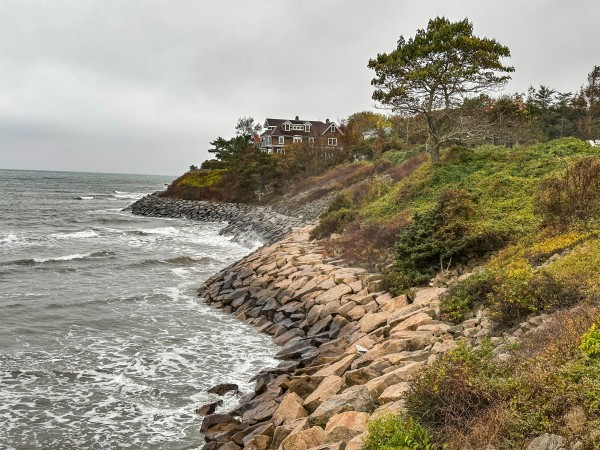
Photo of Newport, Rhode Island, by Rich Martello on Unsplash

Published on Thu, 05/21/2026 - 15:43

College of Behavioral & Social Sciences
  • Facebook
  • Twitter
  • Instagram
  • YouTube
  • LinkedIn
  • Zenfolio

Department of Geographical Sciences

2181 Samuel J. LeFrak Hall, 7251 Preinkert Drive,
University of Maryland, College Park, MD 20742
Phone: 301-405-4050

Subscribe to Our Newsletter

Contact Us

Links
  • UMD Land Acknowledgement
  • UMD Staff Directory
  • Give to GEOG
  • UMD Web Accessibility
  • Alumni
© 2026 College of Behavioral & Social Sciences. All Rights Reserved.
Login