
High School Students Discover How Forests Are Measured From Space
Associate Research Professor Adrián Pascual Arranz and faculty specialists Talia Schwelling and Andrew Sager engaged students at Eleanor Roosevelt High School with hands-on lidar demonstrations and insights from NASA’s GEDI and EDGE missions.
More than 200 students at Eleanor Roosevelt High School got a firsthand look at space-based forest science this winter when researchers from the Global Ecosystem Dynamics Investigation (GEDI) mission visited their campus in Greenbelt, Maryland.
In a presentation titled “May the Forest Be With You: Understanding Earth from Space with GEDI,” the team explained how the mission uses spaceborne lidar to measure forest height, structure and biomass across the globe from its location aboard the International Space Station.
Housed in the Department of Geographical Sciences and led by Distinguished University Professor Ralph Dubayah under NASA, GEDI provides critical data to understand how forests store carbon and respond to climate change.
Students also got a preview of the next chapter in NASA’s forest monitoring efforts.
NASA recently selected the Earth Dynamics Geodetic Explorer (EDGE) mission, co-led by GEOG researchers, for launch as early as 2030. The satellite will be the first global imaging laser altimeter system using swath-imaging lidar technology to map the 3D structure of forests and woodlands worldwide while also producing detailed measurements of land and sea ice across Earth’s polar regions. Building on GEDI’s success, EDGE will expand forest observations to a truly global scale.
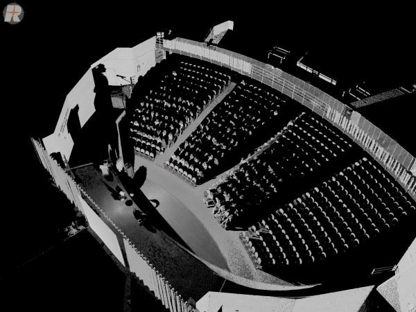
To make the technology tangible, the team set up a terrestrial laser scanner inside the school auditorium, capturing 3D point cloud data in real time. Faculty specialist Andrew Sager explained how ground-based lidar instruments support GEDI science, helping calibrate and validate measurements collected from space.
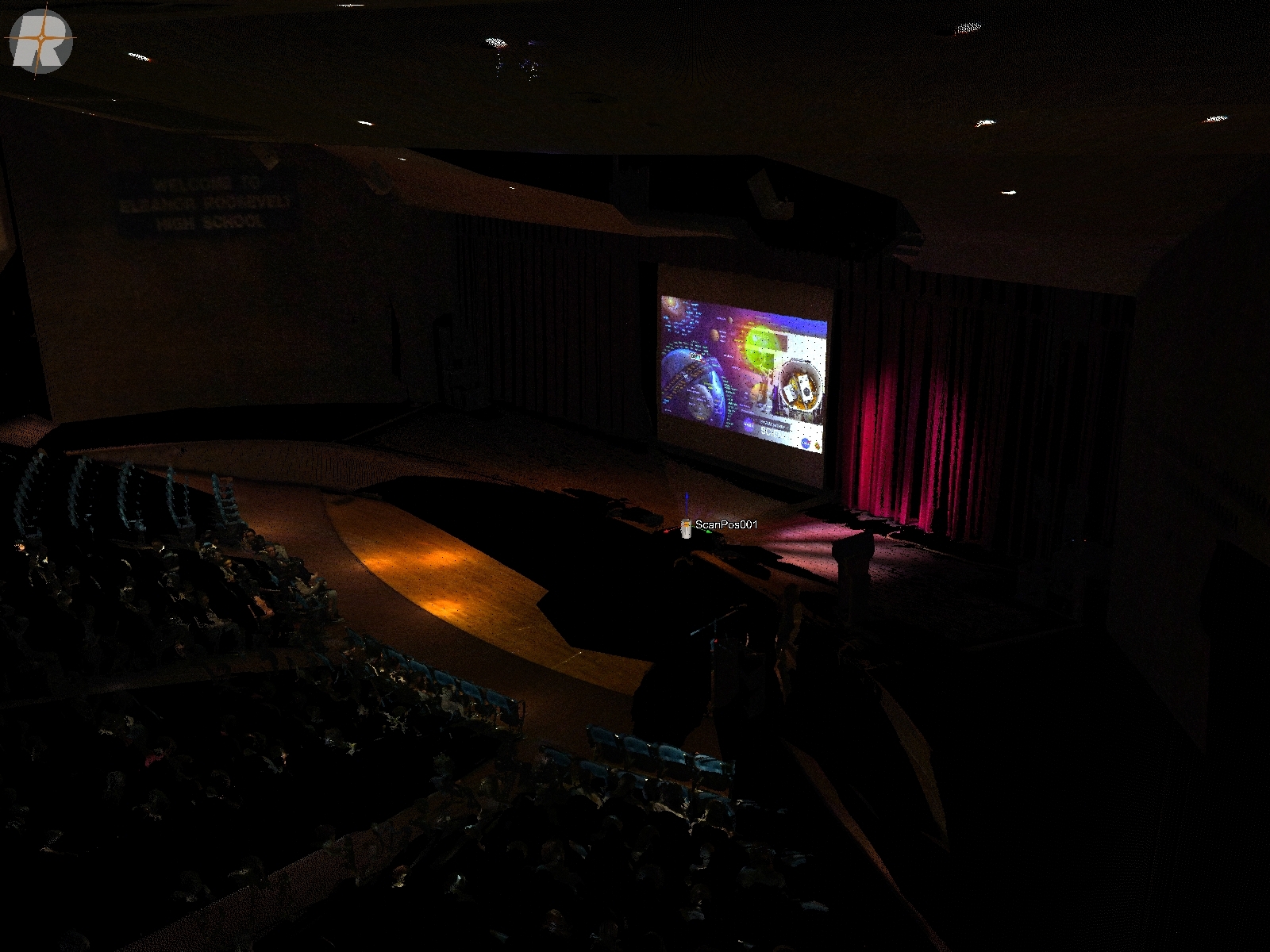
From the terrestrial laser scanner’s vantage point, the auditorium comes into focus as lidar data and space-based observations are projected on screen, linking ground-based measurements with GEDI science. Courtesy of the GEDI team
The outreach activities will continue in 2026 as GEDI seeks a new NASA extension and EDGE advances toward launch. If approved, GEDI could operate from the International Space Station through 2030, creating a longer, continuous record that, together with EDGE, would help scientists track forest change and support resilient stewardship.
The GEDI visit went beyond the presentation. On Feb. 4, Associate Research Professor Adrián Pascual Arranz returned to Eleanor Roosevelt High School as one of the judges for the school’s 2026 STEM Fair, reviewing projects in plant and Earth sciences.
“I was greatly surprised by the precision in the language used by the students when defending their work and answering my questions,” Pascual Arranz said. “It is encouraging to see early career students caring about the environment and putting high-level, critical thinking and solutions to societal problems on the environment.”
Main image: A terrestrial laser scanner maps the school auditorium in real time, producing a detailed 3D point cloud. By pairing lidar data with RGB imagery, the system creates colorized models that help calibrate and validate measurements collected from space for GEDI science. Courtesy of the GEDI team
Want GEDI to Visit Your High School?
Contact Renata Johnson, outreach coordinator, at @email or Request a Geographer.
Published on Mon, 02/09/2026 - 15:02