
High School Interns Explore Global Challenges Through Geographical Sciences at UMD
Students harness cutting-edge tools in GIS, AI and remote sensing to tackle real-world problems, from climate change to public health.
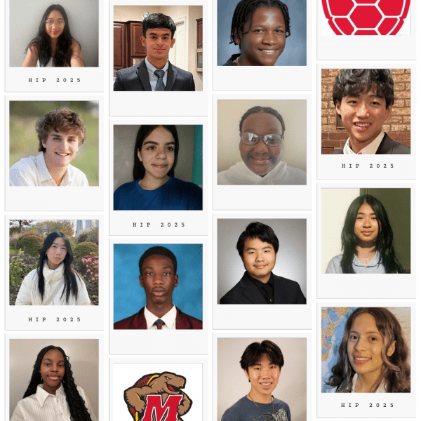
The University of Maryland’s Department of Geographical Sciences welcomed a new cohort of high school researchers this summer through its 2025 High School Internship Program (HIP), immersing students in state-of-the-art research that reflects the critical importance and wide-ranging scope of modern geographical sciences.
Over the course of six weeks, 14 students representing high schools across Maryland collaborated with faculty, graduate mentors and each other to produce original research addressing pressing environmental and societal challenges. Working closely with faculty and lab teams, the students applied advanced geospatial tools such as Google Earth Engine, RStudio, ArcGIS Pro and machine learning models.
“This is modern geographical sciences,” said Professor George Hurtt, who launched HIP in 2023 and leads one of the participating labs. “We applied state-of-the-art methods of remote sensing, computer modeling and other techniques to topics of critical environmental and societal importance. And in a short period of time, these students were able to produce college-level research presentations.”
Real Research, Real Impact
This year’s seven student-led projects explored a diverse range of topics:
- "AI-Driven Analysis of Aerial Data for New Tree Verification and Monitoring" by Vivi Phan and Walter Sha, mentored by Professor George Hurtt, Ph.D. student Quan Shen, faculty specialist Janna Chapman. Contributed to Maryland’s 5 Million Trees initiative by using high-resolution remote sensing and GIS to detect newly planted trees.
- "Assessing the Legal Gaps in China’s Trade of Globally Distributed Scalloped Hammerhead Shark" by Daisy Ramirez and Melanie Hanciles, mentored by Professor Meredith Gore. Informed an ongoing NSF project by analyzing marine biodiversity risks and international trade policy.
- "Evaluating Deep Learning Models for Agricultural Parcel Segmentation: A U.S. Case Study" by Christopher Seykere and Jeff Minsona Leba, mentored by Assistant Professor Xiaopeng Song and Ph.D. student Zhuoning Gu. Evaluated AI models for detecting agricultural land use, contributing to food security and environmental monitoring goals.
- "Mapping Solar Farms in Maryland Using Very High Resolution (VHR) Imagery in Maryland" by Skyler Xue and Jack Grossman, mentored by Professor Tatiana Loboda and Associate Research Professor Dong Chen. Used AI tools like random forest classifiers to analyze solar development and its implications for land use and sustainability.
- "Mapping the Relationship Between PM2.5 Exposure and Dementia in Los Angeles" by Isabel Tang and Nuri Park, mentored by Associate Professor Kuishuang Feng, Ph.D. student Jiaxun Sun. Mapped air pollution against dementia incidence to explore environmental drivers of neurological conditions.
- "Tree Mortality Detection Using Machine Learning in California" by Peter Jin and Krish Pruthi, mentored by Assistant Professor Yiqun Xie and Ph.D. student Zhihao Wang. Developed AI-enhanced models to detect dead trees, highlighting public health implications such as respiratory risk.
- "Understanding the Climate Vulnerability in Cameroon" by Indira Olson and Amaris Worae, mentored by Assistant Professor Catherine Nakalembe and faculty specialist Diana Frimpong. Analyzed temperature and precipitation variability using satellite data and statistical tools to understand regional climate resilience.
Student Reflections: From First Code to Big Picture Thinking
For Jeff Minsona Leba, a student at the Academy of Health Sciences at Prince George’s Community College, the project began as a puzzle. Tasked with classifying agricultural land use through an AI modeling technique, he admitted, “I had no idea how we were going to begin. “But my mentor had everything laid out for us.” As he worked with tools like Quantum GIS and Google Earth Pro, his confidence grew. “No doubt I’ll include this in the next project I work on.”
From Thomas S. Wootton High School, Isabel Tang brought a passion for environmental justice and an interest in geography’s role in public health. Her research, which explored the potential link between PM2.5 pollution and dementia risk, challenged her technically and intellectually. “I managed to use Python to model spatial relationships and visualize data through maps,” she said. “It took a lot of trial and error—but in the end, it was definitely rewarding.”
Another project explored the intersection of public health, environmental science and deep learning. Peter Jin of James M. Bennett High School and Krish Pruthi of Poolesville High School used high-resolution aerial imagery to detect dead trees and examine their connection to respiratory disease. The research highlighted how technology can reveal complex links between environmental change and human health. “Seeing how tree mortality links to respiratory disease really demonstrated the complex relationships in scientific research,” Peter said. “It made me realize how many ways geography and technology can work together to tackle global challenges,” added Krish.
Indira Olson from College Park Academy took on climate variability in Cameroon, analyzing temperature and precipitation data from 1981 to 2020. Working across platforms like Google Earth Engine and R, she addressed the overall lack of data for meteorological sensing. “This developed so many skills for me,” she said. “It also pushed me to find ways to mend gaps in the climate data we rely on.”
Skyler Xue of Montgomery Blair High School and Jackman Grossman from Sidwell Friends School partnered on a project investigating solar development and its implications for land use. Skyler explained, “It opened my eyes to technical limitations and the importance of choosing the right tools … ArcGIS Pro allowed us to create better conclusions when we analyzed solar panels in Maryland using AI modeling tools such as a random forest algorithm.” For Jackman, the internship revealed how maps can tell stories and uncover hidden patterns. “This experience helped me understand the tradeoffs between advancing renewable energy and preserving local food sources and economic stability,” he said. “I’d love to continue this research.”
From Wheaton High School, Vivi Phan combined aerial imagery with AI modeling to verify tree planting across Maryland. “This experience has given me a fresh perspective on how software can enhance our understanding of the real world,” she said. “I'm eager to continue to explore the intersection between computer science and climate science.”
One project shifted the lens from technology to policy. Melanie Hanciles of Oxon Hill High School investigated legal loopholes in shark protection laws, examining the trade of scalloped hammerhead sharks in regions like China. “The fact that it was so new made it much more intriguing for me to dive into,” she said. “Something that surprised me the most was learning that research is never a linear process. It takes a lot of organization, dedication and efficiency.”
Mentorship and Collaboration
The program’s success depended heavily on the commitment of faculty and staff.
Hurtt praised his mentees for their ambitious scope and quick learning curve: “With little to no prior experience, Walter and Vivi navigated everything from AI modeling to GIS to contribute meaningfully to a statewide initiative. I’ve never seen so much ground covered so fast.”
Behind the scenes, Chapman and graduate mentor Quan Shen were instrumental in supporting both the science and logistics of the interns. “None of this would have been possible without Quan and Janna,” said Hurtt. “This was a true lab-wide effort.”
In her first year co-organizing the internship, faculty specialist Janna Chapman was impressed with the cohort’s initiative and growth: “All of the students learned a new tool—whether Google Earth Engine, R, Python, or policy research—that will benefit them in whatever field they pursue. Some even expressed interest in continuing their research beyond the internship.”
More Than Just a Summer Program
HIP is part of a broader mission within the Department of Geographical Sciences to expand public understanding of the discipline and engage younger students in meaningful ways.
“We have a special challenge in this field: many people don’t know what geographical sciences is,” said Hurtt. “We hope that programs like HIP, and events like GIS Day and our annual high school banquet, help students and their families see the relevance of our work and career opportunities for themselves to address the world’s most urgent issues.”
The Department of Geographical Sciences would like to thank this year’s HIP mentors:
- Faculty Specialist Janna Chapman
- Associate Research Professor Dong Chen
- Associate Professor Kuishuang Feng
- Faculty Specialist Diana Frimpong
- Professor Meredith Gore
- Ph.D. student Zhuoning Gu
- Professor George Hurtt
- Professor Tatiana Loboda
- Assistant Professor Catherine Nakalembe
- Ph.D. student Quan Shen
- Assistant Professor Xiaopeng Song
- Ph.D. student Jiaxun Sun
- Ph.D. student Zhihao Wang
- Assistant Professor Yiqun Xie
HIP is supported by the University of Maryland’s Grand Challenges Institutional Grant, the department’s Young Researcher’s Fund and individual donors. You can support the High School Hub by making a donation. Students receive a $900 stipend for their participation, and many continue their projects into the academic year or science fair season.
Published on Tue, 08/05/2025 - 16:06