UMD College of Behavorial & Social Sciences UMD College of Behavorial & Social Sciences
MENU

Topbar Menu

  • About Us
  • People
  • Alumni and Giving
  • Diversity
  • Undergraduate
    • Prospective Students
    • Courses & Facilities
    • Advising
    • Special Programs
    • Graduation
    • Geography Club
  • Graduate
    • Prospective Ph.D. Students
    • Graduate Courses
    • Graduate Student Publications
    • Graduate Student Awards
    • Graduate Students
    • Master of Science and Graduate Certificate Programs
    • Combined BS/MS Program
  • Research
    • Research Areas
      • Geospatial-Information Science and Remote Sensing
      • Human Dimensions of Global Change
      • Land Cover and Land Use Change
      • Carbon, Vegetation Dynamics and Landscape-Scale Processes
    • Centers
      • Center for Geospatial Information Science
      • International Center for Innovation in Geospatial Analytics & Earth Observation
  • High School Hub
    • Program Overview
    • High School Awards
    • High School Internship Program
    • GIS Day
  • Resources
    • Graduate Student Organization
    • Student Life
    • Graduate School
    • Responsible Conduct of Research
    • Emergency Preparedness
    • Job Opportunities
    • Graduation
Search

Main navigation

  • Undergraduate
    • Prospective Students
    • Courses & Facilities
    • Advising
    • Special Programs
    • Graduation
    • Geography Club
  • Graduate
    • Prospective Ph.D. Students
    • Graduate Courses
    • Graduate Student Publications
    • Graduate Student Awards
    • Graduate Students
    • Master of Science and Graduate Certificate Programs
    • Combined BS/MS Program
  • Research
    • Research Areas
      • Geospatial-Information Science and Remote Sensing
      • Human Dimensions of Global Change
      • Land Cover and Land Use Change
      • Carbon, Vegetation Dynamics and Landscape-Scale Processes
    • Centers
      • Center for Geospatial Information Science
      • International Center for Innovation in Geospatial Analytics & Earth Observation
  • High School Hub
    • Program Overview
    • High School Awards
    • High School Internship Program
    • GIS Day
  • Resources
    • Graduate Student Organization
    • Student Life
    • Graduate School
    • Responsible Conduct of Research
    • Emergency Preparedness
    • Job Opportunities
    • Graduation
  • About Us
  • People
  • Alumni and History
  • Diversity

Search our site:

GEOG Faculty selected for NASA ICESat-2 Science Team

Breadcrumb

  • Home
  • Featured Content
  • GEOG Faculty Selected For NASA ICESat-2 Science Team
NASA ICESat-2

Geographical Sciences Faculty, Dr. Sinead L. Farrell and Dr. Laura Duncanson, were among those recently selected by NASA to serve as members of the NASA ICESat-2 Science Team.


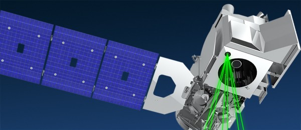
The Ice, Cloud, and Land Elevation Satellite-2 (ICESat-2) is the 2nd-generation of Earth-orbiting laser altimeters, which was launched in September 2018 to precisely measure Earth’s elevation. ICESat-2 quantifies changes in the height of Earth’s ice sheets, sea ice, forests and more, in unprecedented detail. The satellite mission has four major science objectives:

  • Measure melting ice sheets and investigate how this effects sea level rise,
  • Measure and investigate changes in the mass of ice sheets and glaciers,
  • Estimate and study sea ice thickness,
  • Measure the height of vegetation in forests and other ecosystems worldwide


Farrell and Duncanson’s research proposals were two of 24 selected by NASA, out of a pool of 96 submissions. Farrell will serve as a science team PI (principal investigator), with research focusing on advancing knowledge of sea ice properties and processes with ICESat-2. Farrell’s primary goals are to investigate recent and widespread changes in the thickness of Arctic sea ice, and improve understanding about the factors driving these changes. Duncanson serves as Co-I on a project to estimate boreal-wide forest biomass density with ICESat-2. This research expands upon another recently funded proposal under the NASA Terrestrial Ecology ABoVE program titled “Mapping boreal forest biomass density for the ABoVE domain circa 2020 with ICESat-2” led by Dr. Duncanson (PI) and Dr. Neuenschwander (Co-I).


The first major results from NASA's ICESat-2 mission were released in a new study published in the journal Science on April 30, and map 16 years of melting ice sheets. NASA ICESat-2 data can be accessed at the National Snow and Ice Data Center and visualized at Open Altimetry.


Image credit: NASA Goddard Space Flight Center

Published on Mon, 05/04/2020 - 15:53

College of Behavorial & Social Sciences
  • Facebook
  • Twitter
  • Instagram
  • YouTube
  • LinkedIn
  • Zenfolio

Department of Geographical Sciences

2181 Samuel J. LeFrak Hall, 7251 Preinkert Drive,
University of Maryland, College Park, MD 20742
Phone: 301-405-4050

Join Our Newsletter

Contact Us

Links
  • UMD Land Acknowledgement
  • UMD Staff Directory
  • Give to GEOG
  • UMD Web Accessibility
  • Alumni
© 2025 College of Behavorial & Social Sciences. All Rights Reserved.
Login