

Finding Her Path: How Professor Kathleen Stewart Became a Geographical Scientist
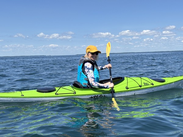
From climatology and early computer mapping to GIS, geospatial health and mobility, Stewart’s career has been shaped by curiosity, opportunity and a willingness to try something new.
When Kathleen Stewart was in high school just outside of Ottawa, Canada she already knew what she wanted to study in college.
Geography.
That may not sound unusual for a professor in the Department of Geographical Sciences. But her early certainty is not common in the United States where high schools rarely teach geography as a standalone subject. In Canada, she took every course on offer, initially imagining a future in human or economic geography.
She did not, however, imagine becoming a scientist.
“I think there are a lot of people who think you have to know what you’re going to do with your life,” Stewart said. “You don’t.”
More than four decades after starting at McMaster University, Stewart has worked across climatology, GIS, spatial information science, geospatial health and mobility science. She has mentored generations of students, helped build geospatial programs and directed UMD’s Center for Geospatial Information Science (CGIS). Now, as graduate director in the Department of Geographical Sciences, she’s thinking about what’s next for herself, her students and a field being reshaped by AI.
Looking back, though, there was never a grand plan. Her career unfolded one step at a time, following opportunities as they arose.
A Field Trip Changes Everything
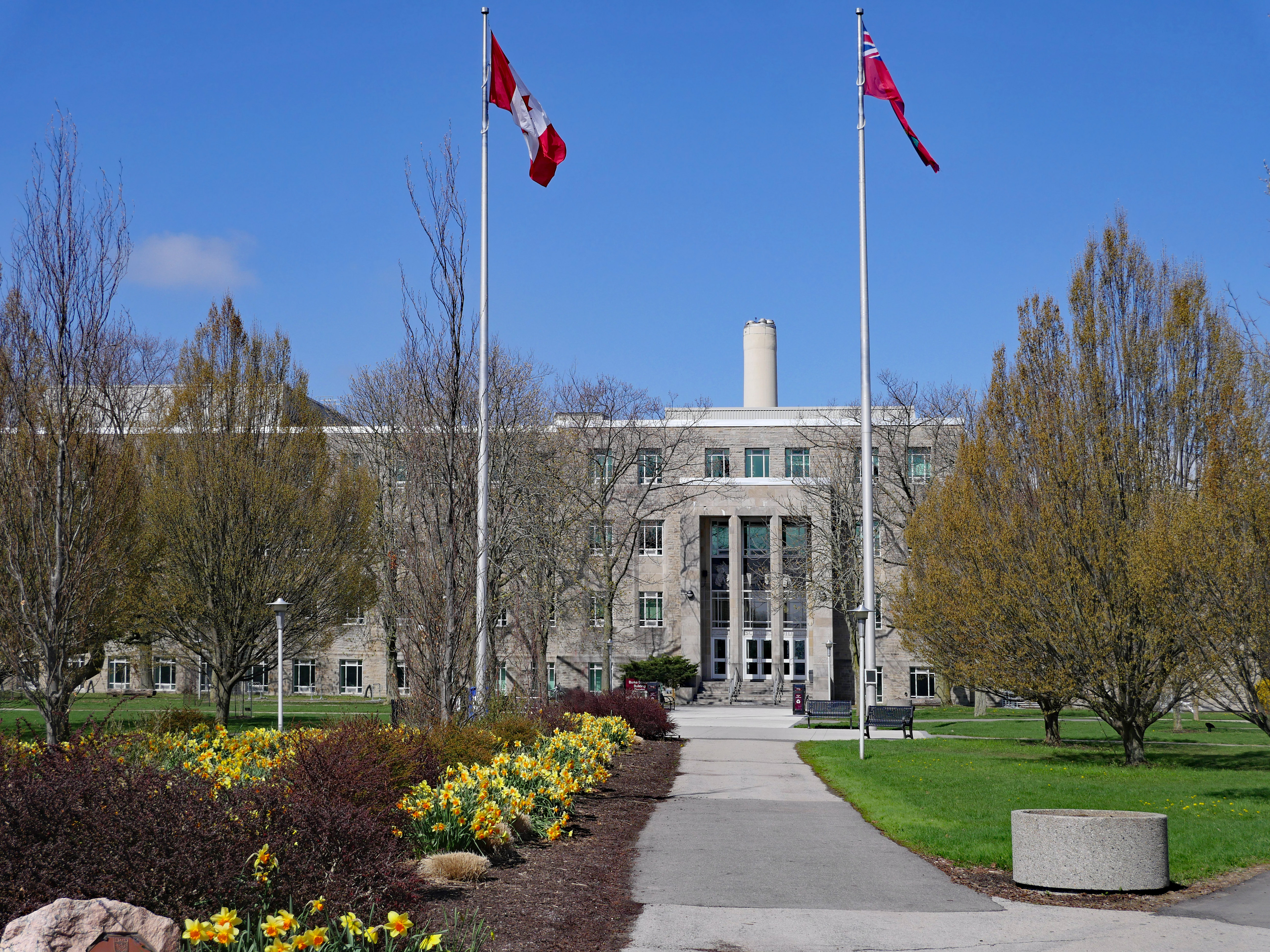 McMaster University, Hamilton, Canada. Credit: Adobe Stock
Stewart’s first major career pivot happened during her undergraduate years.
She arrived at McMaster University in Hamilton, Canada planning to study human geography. During her second year, she began spending time with physical geography students. When they mentioned a summer field course in Nantucket, Massachusetts, she decided to go along.
She knew very little about physical geography.
“I got permission to go, and I just kind of relied on one of my friends who was in the field,” she said.
The experience changed the direction of her studies. Stewart became fascinated by physical geography and shifted her focus to climatology, eventually doing fieldwork on solar radiation and aerosol optical depth.
Then came another unexpected encounter: this time with computers.
During the summer between her undergraduate and graduate studies, Stewart worked on a biomass mapping project with Canada’s National Research Council. Her supervisor asked her to use GIS. There was just one problem: She barely knew what GIS was.
“It was very early days,” Stewart said. “My supervisor basically assumed that if you were a geographer, you knew GIS.”
Computer mapping was still a developing technology. Stewart worked with rudimentary software and produced what she now describes as primitive maps, at a time when programs were still very basic and glitchy to use.
She did not immediately pursue GIS. She went on to the University of British Columbia for a master’s degree in climatology. After completing her master’s degree, Stewart took a break from academia and moved to Scotland, where she spent several years working for an academic publisher. It was a completely different world from geography, but she loved it.
“I think back on it, and it was really kind of magical,” she said.
Eventually, she moved to the United States and settled in Maine. There, another unexpected opportunity appeared.
Finding GIS in Maine
At the University of Maine in Orono, Stewart met some researchers who were just starting to put together the National Center for Geographic Information and Analysis (NCGIA), an NSF-funded research consortium involving GIS researchers at UMaine, SUNY Buffalo and UC Santa Barbara that helped advance geographic information science in the United States and beyond.
Stewart initially encountered the center through a professional and administrative position. She was intrigued and began learning more about GIS and the research taking place at the center. Before long, she recognized that she did not just want to work around the emerging field.
"I realized, like, 'Oh, no, I could do this too,'" she said. "This is something that I want to get into."
That realization led her back to school, this time for a Ph.D. in spatial information science and engineering at the University of Maine.
It was a significant decision. Stewart was a few years older than many of her fellow doctoral students and was also raising two young children, born in Maine. It wasn’t always easy, but she found herself surrounded by supportive colleagues and fellow parents in graduate school, sharing babysitting and helping each other manage.
“Somehow, somehow we made it work,” Stewart said.
There were stressful moments, she acknowledges, but with time, those concerns faded.
“It just shows that over time, many of those concerns disappear, and you don’t think about that anymore,” she said.
It’s advice she now gives her daughter, who is an attorney with a young child.
“Just make it work for today, and you can figure things out tomorrow,” she said.
The stresses faded. The relationships didn’t. Her doctoral adviser, Max Egenhofer, was a leading researcher in GIS, well known for his work on spatial and topological relations. Stewart remains connected to him and many of his other former students.
Those professional connections have continued through her career.
“You build these friendships with colleagues, and they can be a support network for you,” she said. “So you’re really not just doing things alone.”
Shaping Programs and Communities
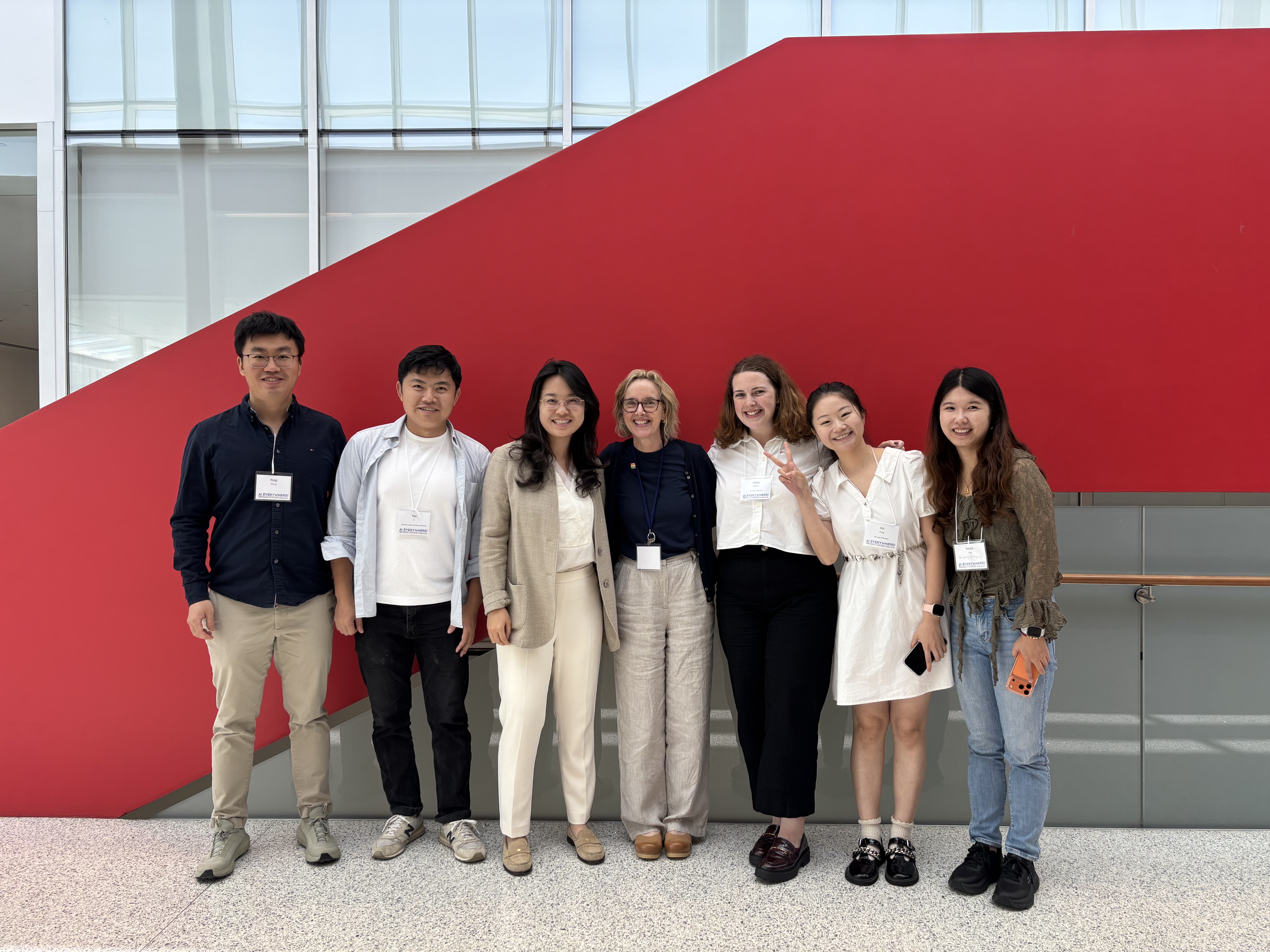
Kathleen Stewart (in the middle), with former and current students (from left to right) Peiqi Zhang (Western University, Canada), Yao Li (UNC Charlotte), Yingrui Zhao, Haley Mullen, Xin Dong and Yanjia Cao (UHK) in June 2026
After finishing her Ph.D., Stewart stayed at Maine in a postdoctoral role, then moved to a tenure-track position at the University of Iowa.
In 2015, Maryland came calling. UMD was expanding its geospatial science efforts and wanted Stewart to help build its CGIS. Within a year, the center’s founding director left, and Stewart stepped into the leadership role.
She helped strengthen the undergraduate GIS curriculum, expand graduate offerings and incorporate AI into coursework. The Master of Science in Geospatial Intelligence launched, the Master of Science in GIS grew, and the CGIS developed a regular series of speakers and events.
But ask Stewart what she's proudest of, and she doesn't point to programs. She points to people.
"I've had great students," she said. "And I remain in touch with almost all of them."
Her Ph.D. students, she said, stay connected to one another long after graduation — meeting at conferences and checking in on each other's work. Several of these students have their own faculty positions now or work in the geospatial industry.
"My Maryland Ph.D. students are all networked to each other because of being my students," she said. "It is a very strong bond. I am still in touch with my PhD students from Iowa as well.”
That focus on people carries into her current role as graduate director, where she’s particularly interested in building a strong graduate community, including for international students.
What Comes Next
Stewart’s career has tracked many of the changes in geographical science: from punch-card computing and early GIS to today’s artificial intelligence.
She’s enthusiastic about what AI can do, but pushes back on the idea that it risks making geographers obsolete. It can speed up a workflow, she said, but someone still has to frame the question, decide what data matters and judge whether the output makes sense.
“You still need people who understand what is needed and what the results mean,” she said.
For Stewart, today’s AI tools are also connected to ideas GIScience researchers have been pursuing for decades. One longstanding goal was to allow people to interact with spatial databases using ordinary language rather than specialized query syntax. Large language models are now making that kind of interaction possible.
She expects geographical science to continue evolving, with potential intersections emerging in areas such as quantum computing, particularly for precision location and location-based information.
That evolution is playing out in her own work as well. Her current research is moving into new territory—much of it focuses on geospatial health, with additional interests in transportation, mobility and safety. One collaboration with colleagues in the School of Medicine at the University of Maryland Baltimore has been focused on geospatial approaches for understanding malaria parasite migration patterns as well as environmental factors relating to malaria in Thailand.
She’s also involved in an emerging project examining noise from AI data centers and its potential effects on nearby schools, working with speech and hearing researchers to understand whether that noise could affect children’s learning.
Say Yes
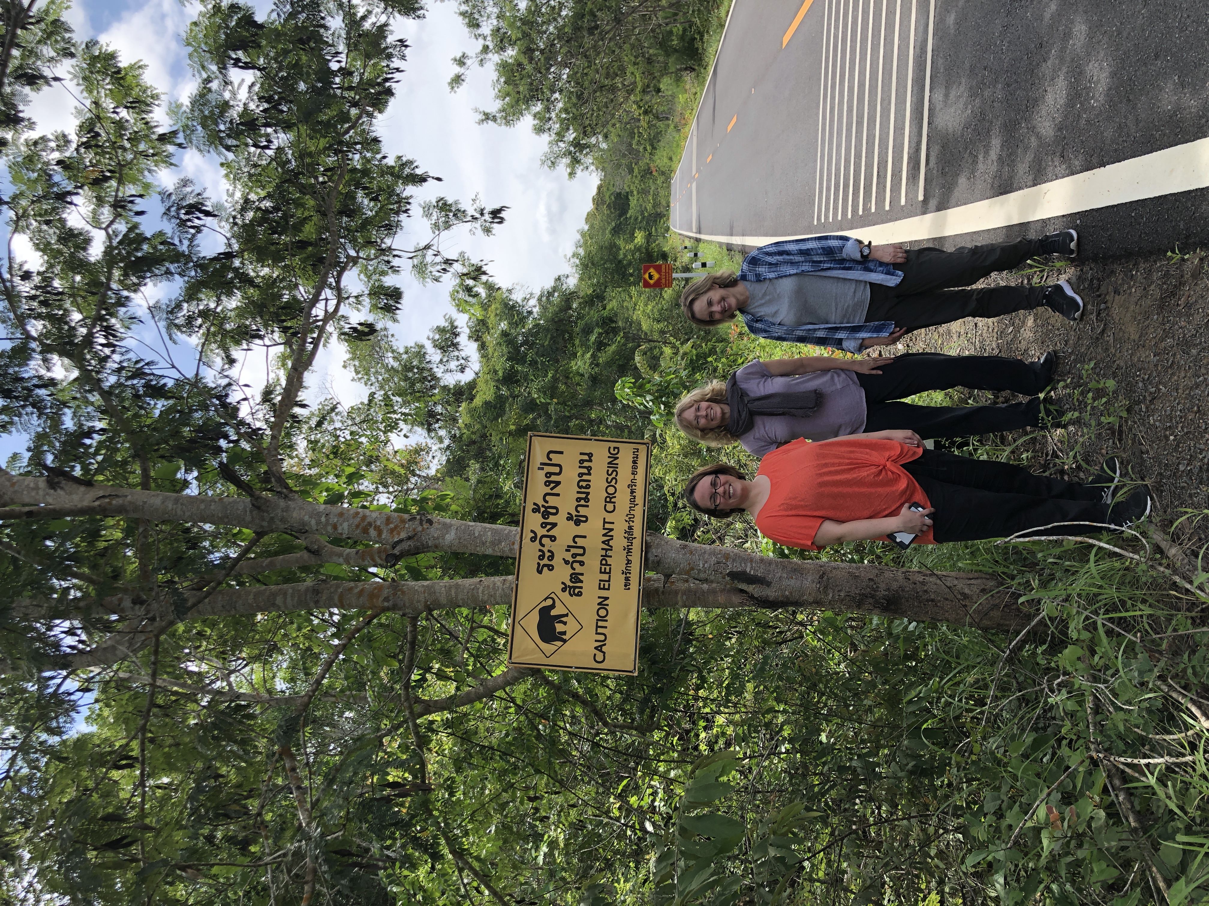 Kathleen Stewart (right), with colleagues Michelle Spring (center) and Shannon Takala Harrison (left) in Thailand, 2019
If there’s one piece of advice Stewart would give students trying to figure out their futures, it is simple: Say yes.
Throughout her career, she has accepted opportunities without knowing where they would lead: from a college field course to the research center that eventually brought her to Maryland.
“You don’t know what saying yes will do,” she said. “You don’t know who you’re going to meet doing that thing, or what other opportunity is going to come your way.”
That doesn’t mean every opportunity works out. Sometimes saying yes means discovering that something is not right for you. Stewart sees that as useful, too.
“You learn something from that,” she said.
She encourages students weighing graduate school to explore it even when they’re unsure it’s the right choice. They might discover a new field, meet someone who opens another door or find an interest they never knew they had.
“You’ve got to think, sort of, where’s your strength?” she said. “You might not know it right away, but over time, you kind of figure it out.”
One Step at a Time
Outside of work, Stewart enjoys knitting and spending time outdoors, kayaking near her cottage in Canada. These days there’s a new fixture, too: near-daily video calls with her 2-year-old granddaughter.
Her life today looks very different from that of the high school student in Ottawa interested in geography. That student couldn't have imagined the field course that would redirect her studies, the primitive maps that would introduce her to GIS, the years in publishing, or the doctorate pursued while raising two children — let alone the programs and students she'd help shape at Maryland.
Stewart doesn’t see those twists and turns as detours. They are the story.
“I’ve had a very fulfilling career,” she said. “Really because of all the people I’ve met and the time working in universities, which I have really enjoyed.”
Now, she’s helping a new generation of graduate students begin their own journeys, without expecting them to know exactly where those will lead.
“That’s for the next generation to discover,” she said. “And for the next generation to make their own connections and develop their own story.”
Images courtesy of Kathleen Stewart. Main image: Kayaking on a favorite lake in July 2025
Published on Wed, 09/16/2026 - 14:47