
Geographic Information Science
Geographic Information Science
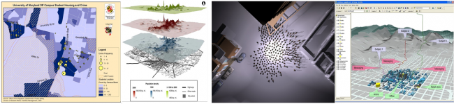
From local events to multi-scale processes, the department is developing and applying advanced Geographical Information Systems (GIS) that will help us to develop the next generation of GIS technologies and progress our understanding of the world’s geography. Our strengths include advanced computer modeling, geographic visualization, geocomputing, and spatial statistics. Students in this track will learn technical GIS skills that are broadly applicable to both the human and physical systems.
- Requirements -
GIS Major
- Career options
Cartographer and Photogrammetrist
Digital Cartographer
Surveying and Mapping Technician
Geospatial Information Scientist and Technologist
Geospatial Analyst
Graphics Editor
GIS Developer
Logisitics Analyst
Transportation Planner
Environmental Consultant
Commercial Pilot
Surveyor
GIS Technician
Statistical Assistant
Architect
(see esri's website for more possibilities)
- Advisor
Dr. Ronald Luna
Geographical Sciences
2181M Lefrak Hall
(301) 405-4073
Email: @email