UMD College of Behavorial & Social Sciences UMD College of Behavorial & Social Sciences
MENU

Topbar Menu

  • About Us
  • People
  • Alumni and Giving
  • Diversity
  • Undergraduate
    • Prospective Students
    • Courses & Facilities
    • Advising
    • Special Programs
    • Graduation
    • Geography Club
  • Graduate
    • Prospective Ph.D. Students
    • Graduate Courses
    • Graduate Student Publications
    • Graduate Student Awards
    • Graduate Students
    • Master of Science and Graduate Certificate Programs
    • Combined BS/MS Program
  • Research
    • Research Areas
      • Geospatial-Information Science and Remote Sensing
      • Human Dimensions of Global Change
      • Land Cover and Land Use Change
      • Carbon, Vegetation Dynamics and Landscape-Scale Processes
    • Centers
      • Center for Geospatial Information Science
      • International Center for Innovation in Geospatial Analytics & Earth Observation
  • High School Hub
    • Program Overview
    • High School Awards
    • High School Internship Program
    • GIS Day
  • Resources
    • Graduate Student Organization
    • Student Life
    • Graduate School
    • Responsible Conduct of Research
    • Emergency Preparedness
    • Job Opportunities
    • Graduation
Search

Main navigation

  • Undergraduate
    • Prospective Students
    • Courses & Facilities
    • Advising
    • Special Programs
    • Graduation
    • Geography Club
  • Graduate
    • Prospective Ph.D. Students
    • Graduate Courses
    • Graduate Student Publications
    • Graduate Student Awards
    • Graduate Students
    • Master of Science and Graduate Certificate Programs
    • Combined BS/MS Program
  • Research
    • Research Areas
      • Geospatial-Information Science and Remote Sensing
      • Human Dimensions of Global Change
      • Land Cover and Land Use Change
      • Carbon, Vegetation Dynamics and Landscape-Scale Processes
    • Centers
      • Center for Geospatial Information Science
      • International Center for Innovation in Geospatial Analytics & Earth Observation
  • High School Hub
    • Program Overview
    • High School Awards
    • High School Internship Program
    • GIS Day
  • Resources
    • Graduate Student Organization
    • Student Life
    • Graduate School
    • Responsible Conduct of Research
    • Emergency Preparedness
    • Job Opportunities
    • Graduation
  • About Us
  • People
  • Alumni and History
  • Diversity

Search our site:

UMD Team Featuring GEOG Scientist Among Semifinalists in Global XPRIZE Wildfire Challenge

Breadcrumb

  • Home
  • Featured Content
  • UMD Team Featuring GEOG Scientist Among Semifinalists In Global XPRIZE Wildfire Challenge
Crossfire homepage screenshot

Experts from several disciplines are working together to use an advanced drone-based system to detect and extinguish wildfires within minutes.

A multidisciplinary team, including Associate Research Professor Evan Ellicott, has been selected as a semifinalist in the international XPRIZE Wildfire competition.

“The XPRIZE challenge is exciting because it draws together expertise across a variety of disciplines to address a real problem society faces: wildfires," Ellicott said. "We are pushing the boundaries of technology for a solution."

Led by the Department of Fire Protection Engineering (FPE), team "Crossfire” is one of 29 global teams invited to participate in the semifinals, which will take place in March and October 2025. The group brings together strong expertise in fire protection engineering, robotics, autonomous systems, and vertical-flight systems.

Crossfire has advanced in a challenge to develop a system that can locate and suppress a wildfire in an area spanning a thousand square kilometers with challenging wind and terrain conditions in just under 10 minutes. Ellicott is leading the sensor and fire detection design.

The team’s solution is based on multiple drones, including a large, long-endurance Unmanned Aerial Vehicle (UAV) and small multicopter UAVs. It uses standard communication and navigation technologies, dual fire detection technologies (thermal and optical cameras), and enhanced water-based fire suppression (water containers featuring an innovative rupture and dispersion mechanism), all integrated into a System of Systems using optimization methods, artificial intelligence  and machine learning algorithms.

Through participation in the XPRIZE competition, the group is part of a larger effort to find new ways to detect, localize and suppress wildfires.

Ellicott has recently joined NASA’s FireSense program, which also includes GEOG Professor and Chair Tatiana Loboda and Assistant Research Professor Adrián Pascual. The program focuses on challenges in U.S. wildland fire management.

This article is based on a news story published by the Department of Fire Protection Engineering.

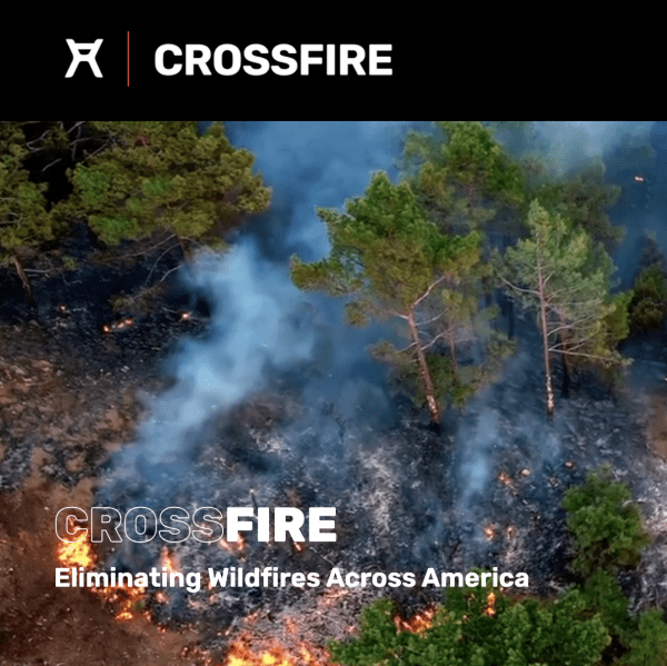
Image: Crossfire homepage screenshot

Published on Thu, 11/07/2024 - 02:57

College of Behavorial & Social Sciences
  • Facebook
  • Twitter
  • Instagram
  • YouTube
  • LinkedIn
  • Zenfolio

Department of Geographical Sciences

2181 Samuel J. LeFrak Hall, 7251 Preinkert Drive,
University of Maryland, College Park, MD 20742
Phone: 301-405-4050

Join Our Newsletter

Contact Us

Links
  • UMD Land Acknowledgement
  • UMD Staff Directory
  • Give to GEOG
  • UMD Web Accessibility
  • Alumni
© 2025 College of Behavorial & Social Sciences. All Rights Reserved.
Login