UMD College of Behavorial & Social Sciences UMD College of Behavorial & Social Sciences
MENU

Topbar Menu

  • About Us
  • People
  • Alumni and Giving
  • Diversity
  • Undergraduate
    • Prospective Students
    • Courses & Facilities
    • Advising
    • Special Programs
    • Graduation
    • Geography Club
  • Graduate
    • Prospective Ph.D. Students
    • Graduate Courses
    • Graduate Student Publications
    • Graduate Student Awards
    • Graduate Students
    • Master of Science and Graduate Certificate Programs
    • Combined BS/MS Program
  • Research
    • Research Areas
      • Geospatial-Information Science and Remote Sensing
      • Human Dimensions of Global Change
      • Land Cover and Land Use Change
      • Carbon, Vegetation Dynamics and Landscape-Scale Processes
    • Centers
      • Center for Geospatial Information Science
      • International Center for Innovation in Geospatial Analytics & Earth Observation
  • High School Hub
    • Program Overview
    • High School Awards
    • High School Internship Program
    • GIS Day
  • Resources
    • Graduate Student Organization
    • Student Life
    • Graduate School
    • Responsible Conduct of Research
    • Emergency Preparedness
    • Job Opportunities
    • Graduation
Search

Main navigation

  • Undergraduate
    • Prospective Students
    • Courses & Facilities
    • Advising
    • Special Programs
    • Graduation
    • Geography Club
  • Graduate
    • Prospective Ph.D. Students
    • Graduate Courses
    • Graduate Student Publications
    • Graduate Student Awards
    • Graduate Students
    • Master of Science and Graduate Certificate Programs
    • Combined BS/MS Program
  • Research
    • Research Areas
      • Geospatial-Information Science and Remote Sensing
      • Human Dimensions of Global Change
      • Land Cover and Land Use Change
      • Carbon, Vegetation Dynamics and Landscape-Scale Processes
    • Centers
      • Center for Geospatial Information Science
      • International Center for Innovation in Geospatial Analytics & Earth Observation
  • High School Hub
    • Program Overview
    • High School Awards
    • High School Internship Program
    • GIS Day
  • Resources
    • Graduate Student Organization
    • Student Life
    • Graduate School
    • Responsible Conduct of Research
    • Emergency Preparedness
    • Job Opportunities
    • Graduation
  • About Us
  • People
  • Alumni and History
  • Diversity

Search our site:

UMD Researcher Shared GEDi’s Lidar-Radar Carbon Mapping at ASEAN Workshop in Indonesia

Breadcrumb

  • Home
  • Featured Content
  • UMD Researcher Shared GEDi’s Lidar-Radar Carbon Mapping At ASEAN Workshop In Indonesia
First slide of Pascual' presentation

Adrian Pascual Arranz underscored GEDI and TanDEM-X’s potential in forest carbon credit verification in Southeast Asia.

Assistant Research Professor Adrian Pascual Arranz participated as an invited speaker at the ASEAN Region Carbon Trading Workshop on Aug. 22 in Jakarta, Indonesia. Organized by the U.S. State Department, the workshop brought together experts and stakeholders from across Southeast Asia to explore the role of carbon markets through digitalization.

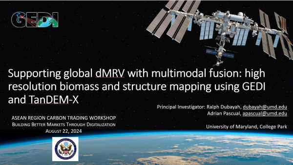
Pascual's presentation, titled "Supporting Global dMRV with Multimodal Fusion: High Resolution Biomass and Structure Mapping Using GEDI and TanDEM-X," was part of the session "Digital Tools for Voluntary Carbon Markets." His talk highlighted the innovative work being done by the GEDI (Global Ecosystem Dynamics Investigation) mission, which operates under NASA and is housed at the Department of Geographical Sciences and led by Professor Ralph Dubayah. 

"Spaceborne lidar metrics from the NASA GEDI mission provide unique and unmatched information on forest canopy height and biomass stocks over areas lacking reference data and where accessing is extremely difficult," Pascual explained. "Our project with DLR (German Aerospace Agency) expands what GEDI can offer as we propose a fusion of lidar (GEDI) and radar (TanDEM-X mission from DLR) to create pantropical maps of height and biomass from which to derive carbon stocks and their annual flux."

For the GEDI mission, the workshop served as a strategic platform to connect with Southeast Asian stakeholders and solidify its role in advancing the measurement, reporting and verification (MRV) of forest carbon credits in the region. GEDI is growing in the MRV sector. For instance, the World Bank is also integrating measurements and estimates from GEDI into the MRV for calibration and validation. 

"Our goal was to present the possibilities of GEDI and GEDI-TanDEM-X products for MRV of Forest Carbon Credits, especially in Southeast Asia, where large-scale restoration and carbon projects have been rapidly expanding and where relevant actors are eager to integrate GEDI science products into operations and real-world applications."

Pascual showcased GEDI’s cutting-edge methods to a diverse group of stakeholders, including private companies and government agencies. The session also focused on other carbon sequestration efforts, such as blue carbon mapping, with particular emphasis on seagrass and mangrove restoration projects.

"The workshop was a great mix of private companies and agencies involved in the MRV sector—not only for forests but also for blue carbon mapping," said Pascual. "I learned about the new VERRA standards and about the mechanisms available to implement a carbon credit system in place for countries."

Image courtesy of Adrian Pascual Arranz

Published on Fri, 08/23/2024 - 11:59

College of Behavorial & Social Sciences
  • Facebook
  • Twitter
  • Instagram
  • YouTube
  • LinkedIn
  • Zenfolio

Department of Geographical Sciences

2181 Samuel J. LeFrak Hall, 7251 Preinkert Drive,
University of Maryland, College Park, MD 20742
Phone: 301-405-4050

Join Our Newsletter

Contact Us

Links
  • UMD Land Acknowledgement
  • UMD Staff Directory
  • Give to GEOG
  • UMD Web Accessibility
  • Alumni
© 2025 College of Behavorial & Social Sciences. All Rights Reserved.
Login