UMD College of Behavorial & Social Sciences UMD College of Behavorial & Social Sciences
MENU

Topbar Menu

  • About Us
  • People
  • Alumni and Giving
  • Diversity
  • Undergraduate
    • Prospective Students
    • Courses & Facilities
    • Advising
    • Special Programs
    • Graduation
    • Geography Club
  • Graduate
    • Prospective Ph.D. Students
    • Graduate Courses
    • Graduate Student Publications
    • Graduate Student Awards
    • Graduate Students
    • Master of Science and Graduate Certificate Programs
    • Combined BS/MS Program
  • Research
    • Research Areas
      • Geospatial-Information Science and Remote Sensing
      • Human Dimensions of Global Change
      • Land Cover and Land Use Change
      • Carbon, Vegetation Dynamics and Landscape-Scale Processes
    • Centers
      • Center for Geospatial Information Science
      • International Center for Innovation in Geospatial Analytics & Earth Observation
  • High School Hub
    • Program Overview
    • High School Awards
    • High School Internship Program
    • GIS Day
  • Resources
    • Graduate Student Organization
    • Student Life
    • Graduate School
    • Responsible Conduct of Research
    • Emergency Preparedness
    • Job Opportunities
    • Graduation
Search

Main navigation

  • Undergraduate
    • Prospective Students
    • Courses & Facilities
    • Advising
    • Special Programs
    • Graduation
    • Geography Club
  • Graduate
    • Prospective Ph.D. Students
    • Graduate Courses
    • Graduate Student Publications
    • Graduate Student Awards
    • Graduate Students
    • Master of Science and Graduate Certificate Programs
    • Combined BS/MS Program
  • Research
    • Research Areas
      • Geospatial-Information Science and Remote Sensing
      • Human Dimensions of Global Change
      • Land Cover and Land Use Change
      • Carbon, Vegetation Dynamics and Landscape-Scale Processes
    • Centers
      • Center for Geospatial Information Science
      • International Center for Innovation in Geospatial Analytics & Earth Observation
  • High School Hub
    • Program Overview
    • High School Awards
    • High School Internship Program
    • GIS Day
  • Resources
    • Graduate Student Organization
    • Student Life
    • Graduate School
    • Responsible Conduct of Research
    • Emergency Preparedness
    • Job Opportunities
    • Graduation
  • About Us
  • People
  • Alumni and History
  • Diversity

Search our site:

UMD Honors NASA Harvest Scientist for Advancing Remote Sensing in Agriculture and Fire Monitoring

Breadcrumb

  • Home
  • Featured Content
  • UMD Honors NASA Harvest Scientist For Advancing Remote Sensing In Agriculture and Fire Monitoring
MIke Humber, wearing glasses, a suit and a tie, looks straight to the camera.

Associate Research Professor Michael Humber receives Provost’s Excellence Award for his leadership in satellite-based research that supports food security, climate resilience and wildfire response.

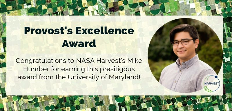
NASA Harvest, NASA’s Food Security and Agriculture Program led by GEOG researchers, is pleased to announce that Dr. Michael Humber has been selected to receive the University of Maryland’s prestigious Provost’s Excellence Award for Professional Track Faculty for his outstanding contributions and accomplishments in research. The award recognizes Dr. Humber’s impactful work in remote sensing and his leadership in advancing geospatial science for global and domestic applications.

Dr. Humber plays a critical role in two major NASA initiatives: he serves as Deputy Director of the NASA Acres consortium and Data Lead and Markets, Trade & Supply Chains Lead for the NASA Harvest consortium. He is also the Lead Scientist for Climate Smart Agriculture under the Climate Resilience Network, a UMD Grand Challenges project. These roles highlight his expertise in satellite-based agricultural and environmental monitoring. The award committee praised Dr. Humber for his commitment to research, his leadership, and innovation in remote sensing for agricultural monitoring and fire detection.

Agricultural Monitoring Using Remote Sensing

Dr. Humber’s agricultural research focuses on developing satellite-based data products that support agricultural decision-making on local, national, and global scales. Through his work with NASA Harvest and NASA Acres, he leads a team that designs data pipelines and applications using high-performance computing and cloud-native platforms. These tools deliver timely, accurate information to farmers, researchers, and humanitarian partners. His work emphasizes stakeholder engagement, promoting a collaborative user-focused research design that ensures the needs of local communities are met while improving the resilience of agricultural systems.

Wildfire Monitoring Using Remote Sensing

In the field of wildfire monitoring, Dr. Humber contributes to algorithm development and data validation for NASA’s official burned area products, including those derived from MODIS and VIIRS satellites. He is actively involved in making these datasets accessible for real-time fire response and long-term analysis. Additionally, he is leading the transition of Landsat-based fire detection systems to a cloud-based architecture on Amazon Web Services. This innovation will reduce costs and improve the speed of fire detection, supporting the operational needs of the NASA’s Fire Information Resource Management System (FIRMS) and enabling faster, data-driven responses to wildfires across North America.

This article was originally published on the NASA Harvest website.

Published on Wed, 05/07/2025 - 13:27

College of Behavorial & Social Sciences
  • Facebook
  • Twitter
  • Instagram
  • YouTube
  • LinkedIn
  • Zenfolio

Department of Geographical Sciences

2181 Samuel J. LeFrak Hall, 7251 Preinkert Drive,
University of Maryland, College Park, MD 20742
Phone: 301-405-4050

Join Our Newsletter

Contact Us

Links
  • UMD Land Acknowledgement
  • UMD Staff Directory
  • Give to GEOG
  • UMD Web Accessibility
  • Alumni
© 2025 College of Behavorial & Social Sciences. All Rights Reserved.
Login