UMD College of Behavorial & Social Sciences UMD College of Behavorial & Social Sciences
MENU

Topbar Menu

  • About Us
  • People
  • Alumni and Giving
  • Undergraduate
    • Prospective Students
    • Courses & Facilities
    • Advising
    • Special Programs
    • Graduation
    • Geography Club
  • Graduate
    • Prospective Ph.D. Students
    • Graduate Courses
    • Graduate Student Publications
    • Graduate Student Awards
    • Graduate Students
    • Master of Science and Graduate Certificate Programs
    • Combined BS/MS Program
  • Research
    • Research Areas
      • Geospatial-Information Science and Remote Sensing
      • Human Dimensions of Global Change
      • Land Cover and Land Use Change
      • Carbon, Vegetation Dynamics and Landscape-Scale Processes
    • Centers
      • Center for Geospatial Information Science
      • International Center for Innovation in Geospatial Analytics & Earth Observation
  • High School Hub
    • Program Overview
    • High School Awards
    • High School Internship Program
    • GIS Day
    • Request a Geographer
  • Resources
    • Graduate Student Organization
    • Student Life
    • Graduate School
    • Responsible Conduct of Research
    • Emergency Preparedness
    • Job Opportunities
    • Graduation
Search

Main navigation

  • Undergraduate
    • Prospective Students
    • Courses & Facilities
    • Advising
    • Special Programs
    • Graduation
    • Geography Club
  • Graduate
    • Prospective Ph.D. Students
    • Graduate Courses
    • Graduate Student Publications
    • Graduate Student Awards
    • Graduate Students
    • Master of Science and Graduate Certificate Programs
    • Combined BS/MS Program
  • Research
    • Research Areas
      • Geospatial-Information Science and Remote Sensing
      • Human Dimensions of Global Change
      • Land Cover and Land Use Change
      • Carbon, Vegetation Dynamics and Landscape-Scale Processes
    • Centers
      • Center for Geospatial Information Science
      • International Center for Innovation in Geospatial Analytics & Earth Observation
  • High School Hub
    • Program Overview
    • High School Awards
    • High School Internship Program
    • GIS Day
    • Request a Geographer
  • Resources
    • Graduate Student Organization
    • Student Life
    • Graduate School
    • Responsible Conduct of Research
    • Emergency Preparedness
    • Job Opportunities
    • Graduation
  • About Us
  • People
  • Alumni and History
  • Diversity

Search our site:

UMD Collaborates on Largest Open-Source Crop Data Resource for Africa

Breadcrumb

  • Home
  • Featured Content
  • UMD Collaborates On Largest Open-Source Crop Data Resource For Africa
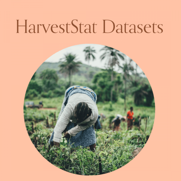
HarvestStat Datasets over a photo of someone working the field

HarvestStat Africa provides detailed subnational data on crop production, yields and harvested areas across 33 countries.

A new dataset is providing specific information on crop production across Sub-Saharan Africa, a region where agriculture supports millions of livelihoods and reliable data is often limited.

HarvestStat Africa compiles subnational crop statistics for 33 countries and 94 crop types, covering the period from 1980 to 2022. The dataset includes production, harvested area and yield data at provincial, district and local levels, offering a more detailed view than national statistics alone.

“The importance of this work is not only that we are collating and digitizing crop production data but also that we are making it freely available,” said Weston Anderson, an assistant research professor at the Department of Geographical Sciences, who has worked on the dataset. “This has catalyzed innovation among researchers and practitioners alike.”

The dataset draws from more than 14 million records collected by the Famine Early Warning Systems Network (FEWS NET) and its partners, including NASA Harvest at UMD, Harvard University and the Stockholm Environment Institute. Data points have been standardized and calibrated across changing administrative boundaries, creating a consistent time series suitable for both research and operational planning.

HarvestStat Africa is designed to support a range of applications:

  • Local Food Security Analysis: Provides historical crop data to inform early warning systems and help target aid where it is needed.
  • Yield Forecasting: Supports crop yield models to anticipate potential food shortages.
    Scientific Research: Offers the largest public database of subnational crop production statistics for collaboration and study.
  • Risk Management: Can be used to support parametric insurance programs, which pay out when measurable conditions, like rainfall thresholds, are met.

The dataset is publicly available through HarvestStat’s website and GitHub. The team behind HarvestStat Africa continues to update and expand the resource to support research, policy and humanitarian decision-making.

Learn more:

FEWS NET post on Medium

“HarvestStat Africa – Harmonized Subnational Crop Statistics for Sub-Saharan Africa.” Donghoon Lee, Weston Anderson, Xuan Chen, Frank Davenport, Shraddhanand Shukla, Ritvik Sahajpal, Michael Budde, James Rowland, Jim Verdin, Liangzhi You, Matthieu Ahouangbenon, Kyle Frankel Davis, Endalkachew Kebede, Steffen Ehrmann, Christina Justice & Carsten Meyer. Scientific Data volume 12, Article number: 690 (2025) https://doi.org/10.1038/s41597-025-05001-z  

Image: Screenshot of HarvestStat website

Published on Thu, 09/18/2025 - 16:26

College of Behavioral & Social Sciences
  • Facebook
  • Twitter
  • Instagram
  • YouTube
  • LinkedIn
  • Zenfolio

Department of Geographical Sciences

2181 Samuel J. LeFrak Hall, 7251 Preinkert Drive,
University of Maryland, College Park, MD 20742
Phone: 301-405-4050

Join Our Newsletter

Contact Us

Links
  • UMD Land Acknowledgement
  • UMD Staff Directory
  • Give to GEOG
  • UMD Web Accessibility
  • Alumni
© 2025 College of Behavioral & Social Sciences. All Rights Reserved.
Login