
Study: Majority of Cleared Lands in Indonesia are Unused—and at Risk of Becoming Palm Oil Plantations
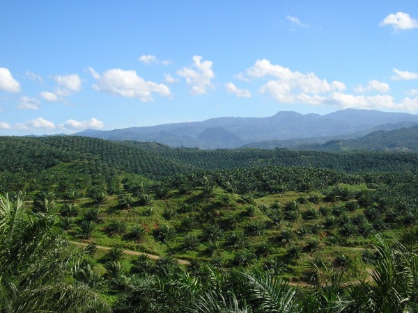
Indonesia is the world’s largest producer of palm oil, which has been widely criticized for its role in deforestation, habitat destruction and biodiversity loss.
Renowned for its biodiversity and rainforests, Indonesia has undergone significant changes over the past three decades. Since 1990, the country has lost 25% of its old-growth forests—and substantial areas of that cleared land are sitting idle and unused.
This was the key finding of a new study on Indonesian deforestation trends from 1991 to 2020 that was recently published in the Proceedings of the National Academy of Sciences. According to the study, 7.8 million hectares of land had been converted into palm oil plantations by 2020, while an additional 8.8 million hectares—roughly the size of Maine—remain vacant.
Of all the land deforested since 1990, over half remained idle for at least one year. Forty-four percent were idle for five years or more.
“The fact that such a large area of old-growth forest has been cleared then left empty is surprising,” said Diana Parker, a postdoctoral associate in the University of Maryland Department of Geographical Sciences, and lead author of the paper.
Contrary to assumptions that forest fires were the main cause of idle lands, the study found that 54% of idle lands were cleared mechanically, either through manual clearing or using heavy machinery.

The study authors suggest that timber demand is not the primary cause, as most forests were logged or degraded before clearing. Rather, they say there is a link between idle-land creation and speculation for future palm oil production.
“The satellite imagery can’t tell us exactly how idle land creation and the palm oil industry are linked, but the land use trends suggest a relationship,” said Parker. “In some cases, companies or individuals may intend to sell deforested land but are waiting for land prices to rise. Or they may plan to develop the land later, holding it as part of their land bank.”
Land speculation and delayed development may contribute to global concerns about palm oil production, which has been widely criticized for its role in deforestation, habitat destruction and biodiversity loss—especially in Indonesia, the largest producer of palm oil in the world.
However, the study also included some hopeful news for the country’s remaining forests: From 2017-2020, Indonesia experienced the lowest deforestation rates observed during the entire study period.
“Indonesia is one of the few tropical forest countries that has been able to successfully slow deforestation,” said GEOG Professor Matthew Hansen, paper co-author and project supervisor. “Given how much idle land is currently available, Indonesia could stop clearing forests altogether while still increasing palm oil production.”
Governments and private companies have progressively adopted policies designed to eliminate deforestation from commodity supply chains. Under the European Union Deforestation Policy (EUDR), set to be implemented later this year, certain commodities, including palm oil, cannot be imported into the EU if they were produced on land deforested after 2020.
“This research shows that Indonesia contains vast areas of land deforested before 2020 that are underutilized,” Hansen said. “Using these areas for commodity expansion could allow Indonesia to comply with the EUDR while protecting its remaining natural forests.”
Read the full study in the Proceedings of the National Academy of Sciences.
Published on Thu, 08/08/2024 - 11:45