UMD College of Behavorial & Social Sciences UMD College of Behavorial & Social Sciences
MENU

Topbar Menu

  • About Us
  • People
  • Alumni and Giving
  • Diversity
  • Undergraduate
    • Prospective Students
    • Courses & Facilities
    • Advising
    • Special Programs
    • Graduation
    • Geography Club
  • Graduate
    • Prospective Ph.D. Students
    • Graduate Courses
    • Graduate Student Publications
    • Graduate Student Awards
    • Graduate Students
    • Master of Science and Graduate Certificate Programs
    • Combined BS/MS Program
  • Research
    • Research Areas
      • Geospatial-Information Science and Remote Sensing
      • Human Dimensions of Global Change
      • Land Cover and Land Use Change
      • Carbon, Vegetation Dynamics and Landscape-Scale Processes
    • Centers
      • Center for Geospatial Information Science
      • International Center for Innovation in Geospatial Analytics & Earth Observation
  • High School Hub
    • Program Overview
    • High School Awards
    • High School Internship Program
    • GIS Day
  • Resources
    • Graduate Student Organization
    • Student Life
    • Graduate School
    • Responsible Conduct of Research
    • Emergency Preparedness
    • Job Opportunities
    • Graduation
Search

Main navigation

  • Undergraduate
    • Prospective Students
    • Courses & Facilities
    • Advising
    • Special Programs
    • Graduation
    • Geography Club
  • Graduate
    • Prospective Ph.D. Students
    • Graduate Courses
    • Graduate Student Publications
    • Graduate Student Awards
    • Graduate Students
    • Master of Science and Graduate Certificate Programs
    • Combined BS/MS Program
  • Research
    • Research Areas
      • Geospatial-Information Science and Remote Sensing
      • Human Dimensions of Global Change
      • Land Cover and Land Use Change
      • Carbon, Vegetation Dynamics and Landscape-Scale Processes
    • Centers
      • Center for Geospatial Information Science
      • International Center for Innovation in Geospatial Analytics & Earth Observation
  • High School Hub
    • Program Overview
    • High School Awards
    • High School Internship Program
    • GIS Day
  • Resources
    • Graduate Student Organization
    • Student Life
    • Graduate School
    • Responsible Conduct of Research
    • Emergency Preparedness
    • Job Opportunities
    • Graduation
  • About Us
  • People
  • Alumni and History
  • Diversity

Search our site:

South America Lost 21.6 Soccer Fields of Natural Land Per Minute for 34 Years

Breadcrumb

  • Home
  • Featured Content
  • South America Lost 21.6 Soccer Fields of Natural Land Per Minute For 34 Years
Soybean fields Bolivia

UMD Geographical Sciences Researchers Reveal Human Impact on Natural Land on a Continental Scale

A new study by geographical sciences researchers reveals that the South American continent lost 20% of its natural ecosystems since 1985—equivalent to 21.6 soccer fields of natural land being degraded or converted by human activity every single minute for more than three decades.

Researchers in the Global Land Use and Discovery (GLAD) laboratory completed a comprehensive analysis of satellite data between 1985 and 2018 to examine the human impact on natural land across South America. Results published April 2 in Science Advances show a substantial expansion of pastures, croplands, and tree plantations (increasing by 23%, 160%, and 288% respectively), enabling the transformation of the continent into a global center of agricultural commodity production. Researchers also discovered approximately 136 million acres of land—an area roughly the size of Spain—that had been altered from their natural state, yet did not have any discernable use, representing a significant loss of ecosystem services without any economic benefits.

“In recent years, we have seen fires rage and deforestation rise across South America’s forests, causing global outcry,” said Viviana Zalles, a post-doctoral researcher in the Department of Geographical Sciences who was the lead author on the study. “Our results highlight the fact that these events are only the most recent manifestation of an ongoing transformation of South America’s ecosystems, the unprecedented scale of which we present in our paper.”

This is the first continental-scale analysis of land-use changes in South America using the full data archive available from joint NASA/U.S. Geological Survey Landsat program—the longest continuous global record of the Earth's surface. The GLAD lab has a 25-petabyte high performance computing system that allows for efficient processing of large volumes of satellite imagery. Researchers hope their findings prompt policymakers and stakeholders to consider the costs of ecosystem loss alongside the potential economic benefits from agricultural expansion when making decisions regarding the allocation of their land resources.

The study was supported by the Gordon and Betty Moore Foundation and directed by Professors Matt Hansen and Peter Potapov from the Department of Geographical Sciences. Collaborators included Laerte Ferreira and Leandro Parente of the Image Processing and GIS Lab (LAPIG) at the Federal University of Goiás in Brazil, as well as Stephen Stehman of the College of Environmental Science and Forestry at the State University of New York.

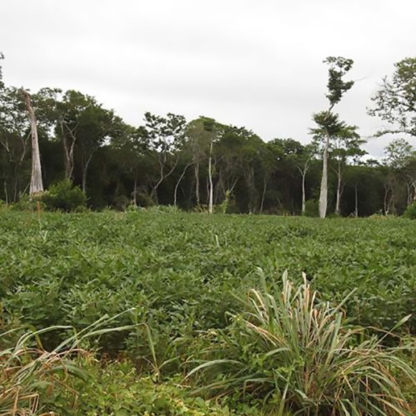
Soybean field in a deforestation frontier in San José de Chiquitos, Bolivia. Photo credit: GLAD Lab. Story originally posted on April 2, 2021 by the College of Behavioral and Social Sciences.

Published on Wed, 05/12/2021 - 09:25

College of Behavorial & Social Sciences
  • Facebook
  • Twitter
  • Instagram
  • YouTube
  • LinkedIn
  • Zenfolio

Department of Geographical Sciences

2181 Samuel J. LeFrak Hall, 7251 Preinkert Drive,
University of Maryland, College Park, MD 20742
Phone: 301-405-4050

Join Our Newsletter

Contact Us

Links
  • UMD Land Acknowledgement
  • UMD Staff Directory
  • Give to GEOG
  • UMD Web Accessibility
  • Alumni
© 2025 College of Behavorial & Social Sciences. All Rights Reserved.
Login