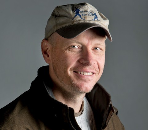
Professor Matthew Hansen Awarded 1.2M Grant to Monitor Tropical Land Use Change
The Gordon and Betty Moore Foundation funds innovative research on global land use dynamics.
Matthew Hansen, professor at the Department of Geographical Sciences, has received a $1.2 million grant from the Gordon and Betty Moore Foundation to advance global monitoring of tropical land cover and assess patterns of land use change. The foundation, which supports scientific discovery and environmental conservation, has a long history of funding projects that address global challenges and promote sustainable practices. The Global Land Analysis and Discovery lab (GLAD), led by Hansen, will implement the research.
“Natural lands provide key ecosystem services in maintaining our environment, from forests regulating climate, to wetlands mitigating flood risk, to all intact ecosystems harboring biodiversity,” Hansen said. “We are in a period of rapid, large-scale land conversion and our task is to map the expansion of commodity land uses, such as soybean and oil palm, information that can be used to support policies aimed at reducing the loss of natural lands.”
Hansen and his team will use satellite data to track how forests and other natural areas across the tropics are being cleared for crops, mining and other uses. These developments are often driven by the production of commodities such as soybeans in Brazil and oil palm in Indonesia.
“We are working to track the expansion of commodity land uses throughout the tropics, which are the regions with the highest rates of modern land use change,” Hansen said. “These conversions occur at the expense of important natural capital, such as rainforests that harbor the highest terrestrial biodiversity, regulate climate and are home to indigenous populations.”
The project is part of the foundation’s Conservation and Markets Initiative, which aims to separate—or “decouple”— commodity production from deforestation. Hansen’s team is collaborating with a wide network of researchers including economists, conservation biologists and other remote sensing scientists who study where commodities are grown, where they end up and how those supply chains affect forests.
In the project’s first phase, running through early next year, the team will build an integrated land use mapping system that depicts tropical drivers of conversion, including forestry, surface mining, pasture, sugar cane and rice cultivation. The system will show when and where land is being converted, and augment current data sets being made by the GLAD team.
“Results will support policies such as the European Union’s Deforestation Regulation as well as the industry commitments that seek to limit sourcing products from newly deforested/cleared lands,” Hansen said.
Hansen’s work builds on his previous research at UMD’s Global Land Analysis & Discovering (GLAD) lab using satellite imagery to monitor land cover at global scales. By combining cutting-edge technology with collaboration across disciplines, the team hopes to provide a clearer picture of how human activity is reshaping tropical landscapes and how to reduce its impacts on people and the planet.
Published on Tue, 10/21/2025 - 10:24


