

Ph.D. Student Participates in European Space Agency's First Biomass Hackathon
New approaches to satellite data could improve forest structure mapping and help scientists study the effects of fire.
Ph.D. student Abhilash Dutta Roy in the Department of Geographical Sciences (GEOG) was the only participant selected from outside Europe to attend the European Space Agency's (ESA) first Biomass Hackathon in Darmstadt, Germany. The weeklong event brought together international researchers to explore data from ESA's Biomass satellite and develop new approaches to mapping forest structure.
Selected for this expertise in tropical forest research and radar remote sensing, Dutta Roy worked with ESA scientists and researchers from other institutions to investigate how Biomass observations could be combined with data from NASA's Global Ecosystem Dynamics Investigation (GEDI), a spaceborne lidar instrument led by GEOG Professor Ralph Dubayah.
“It was a great chance for me to learn from experts and to showcase our work at UMD GEOG in this area,” Dutta Roy said.
Combining Satellite Data to Map Forests
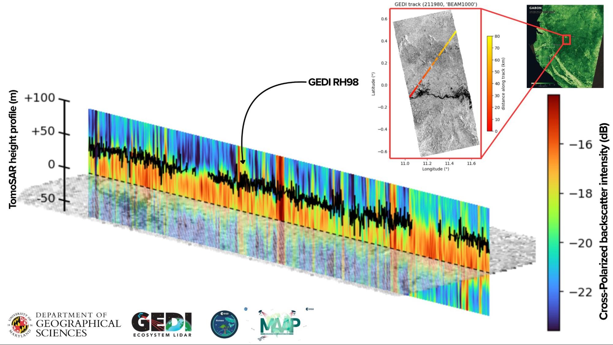
A radar slice through the forest shows the strength of the European Space Agency's Biomass radar signal at different heights along a roughly 80-kilometer GEDI path in Gabon. Warmer colors indicate stronger signals. The black line traces GEDI’s lidar-based estimate of canopy-top height along the same path. Plotting the two together lets researchers test how well radar and lidar agree and at which heights.
Understanding forest structure, including the height and distribution of forest canopy, can help scientists assess forest conditions and changes over time. But no single satellite mission provides every measurement researchers need.
ESA's Biomass satellite uses long-wavelength radar to measure forest structure, including information from within the canopy. A technique called radar tomography allows researchers to develop vertical profiles showing how vegetation structure is distributed at different heights under the canopy.
GEDI, by contrast, uses laser measurements to capture detailed information about forest height and three-dimensional structure. Its observations follow discrete tracks across Earth's surface rather than providing continuous coverage.
Scientists could use GEDI measurements to help calibrate Biomass observations, supporting more comprehensive maps of forest structure.
During the hackathon, Dutta Roy led a team that compared radar tomographic profiles from Biomass with GEDI measurements over Lopé National Park in Gabon. The analysis revealed a measurable relationship between the datasets, with the strongest correspondence in the middle of the forest canopy.
The results offer an early indication that the mission's complementary measurements could be integrated. Further work will be needed as the datasets and processing methods continue to mature.
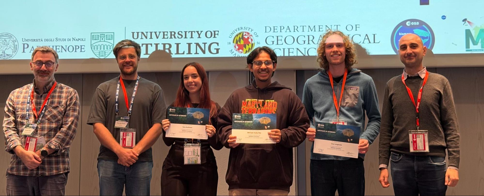
Dutta Roy (fourth from the left) and his teammates who linked ESA Biomass radar with NASA GEDI lidar data over Gabon.
The team used the Multi-Mission Algorithm and Analysis Platform, a cloud-based workspace developed by NASA and ESA, to analyze data from both missions. The platform allowed researchers to access and compare observations from multiple satellite missions during the event.
“If the two can be linked reliably, GEDI’s estimates of forest height and three-dimensional structure can be used to calibrate Biomass’s wall-to-wall coverage,” Dutta Roy said. “That could give complete maps of forest height and structure.”
Advancing Research on Forest Change
The hackathon also provided Dutta Roy with new techniques relevant to his doctoral research, which aims to combine GEDI measurements with data from NISAR, a joint NASA-Indian Space Research Organization radar mission, to investigate how fire affects forest structure.
Although Dutta Roy entered the Ph.D. program with experience in GEDI and radar remote sensing, the event introduced him to radar tomography and new ways to interpret vertical forest profiles.
“I came into the PhD program knowing GEDI and radar well but almost nothing about tomography,” Dutta Roy said. “Experts at ESA taught me how to read and interpret height profiles.”
ESA researchers also introduced techniques for distinguishing radar signals associated with different forest heights. Dutta Roy is now testing those methods for canopy-height and forest structure modeling.
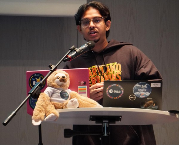
Main image: Ph.D. student Abhilash Dutta Roy presents his team’s results comparing how forests look through two spaceborne instruments, NASA’s GEDI lidar and ESA’s Biomass radar.
All images courtesy of Dutta Roy
Published on Thu, 10/22/2026 - 10:04