UMD College of Behavorial & Social Sciences UMD College of Behavorial & Social Sciences
MENU

Topbar Menu

  • About Us
  • People
  • Alumni and Giving
  • Diversity
  • Undergraduate
    • Prospective Students
    • Courses & Facilities
    • Advising
    • Special Programs
    • Graduation
    • Geography Club
  • Graduate
    • Prospective Ph.D. Students
    • Graduate Courses
    • Graduate Student Publications
    • Graduate Student Awards
    • Graduate Students
    • Master of Science and Graduate Certificate Programs
    • Combined BS/MS Program
  • Research
    • Research Areas
      • Geospatial-Information Science and Remote Sensing
      • Human Dimensions of Global Change
      • Land Cover and Land Use Change
      • Carbon, Vegetation Dynamics and Landscape-Scale Processes
    • Centers
      • Center for Geospatial Information Science
      • International Center for Innovation in Geospatial Analytics & Earth Observation
  • High School Hub
    • Program Overview
    • High School Awards
    • High School Internship Program
    • GIS Day
  • Resources
    • Graduate Student Organization
    • Student Life
    • Graduate School
    • Responsible Conduct of Research
    • Emergency Preparedness
    • Job Opportunities
    • Graduation
Search

Main navigation

  • Undergraduate
    • Prospective Students
    • Courses & Facilities
    • Advising
    • Special Programs
    • Graduation
    • Geography Club
  • Graduate
    • Prospective Ph.D. Students
    • Graduate Courses
    • Graduate Student Publications
    • Graduate Student Awards
    • Graduate Students
    • Master of Science and Graduate Certificate Programs
    • Combined BS/MS Program
  • Research
    • Research Areas
      • Geospatial-Information Science and Remote Sensing
      • Human Dimensions of Global Change
      • Land Cover and Land Use Change
      • Carbon, Vegetation Dynamics and Landscape-Scale Processes
    • Centers
      • Center for Geospatial Information Science
      • International Center for Innovation in Geospatial Analytics & Earth Observation
  • High School Hub
    • Program Overview
    • High School Awards
    • High School Internship Program
    • GIS Day
  • Resources
    • Graduate Student Organization
    • Student Life
    • Graduate School
    • Responsible Conduct of Research
    • Emergency Preparedness
    • Job Opportunities
    • Graduation
  • About Us
  • People
  • Alumni and History
  • Diversity

Search our site:

New UMD-led project funded by NASA to map boreal aboveground biomass with ICESat-2 satellite data

Breadcrumb

  • Home
  • Featured Content
  • New UMD-led Project Funded By NASA To Map Boreal Aboveground Biomass With ICESat-2 Satellite Data
Image credit: Artist concept of ICESat-2 from NASA's Goddard Space Flight Center

A new project led by Department of Geographical Sciences faculty member Laura Duncanson has recently been selected by the NASA Terrestrial Ecology program. The project, ‘Mapping Boreal Forest Biomass Density for the ABoVE Domain Circa 2020 with ICESat-2’ includes Co-Investigators Ralph Dubayah and John Armston from the department, as well as Amy Neuenschwander from the University of Texas at Austin, and Paul Montesano from NASA Goddard Space Flight Center. They will use existing field and airborne lidar data, in combination with ICESat-2 photon counting lidar (which launched September 15, 2018), to create a boreal forest aboveground biomass map representative of 2020 structural conditions. They will also work with collaborators from the Canadian Forest Service, Joanne White and Mike Wulder, to analyze the biomass change over the last decade. The change assessment will use a combination of older biomass maps from 2010, and Landsat change products to understand which disturbance processes are driving changes in aboveground biomass in these climate and disturbance-sensitive northern forests. Other collaborators on the project are Sabrina Delgado from NASA GSFC and Steve Hancock at the University of Edinburgh. This is particularly exciting for UMD as the datasets and algorithms from this project will allow biomass mapping north of the GEDI domain.


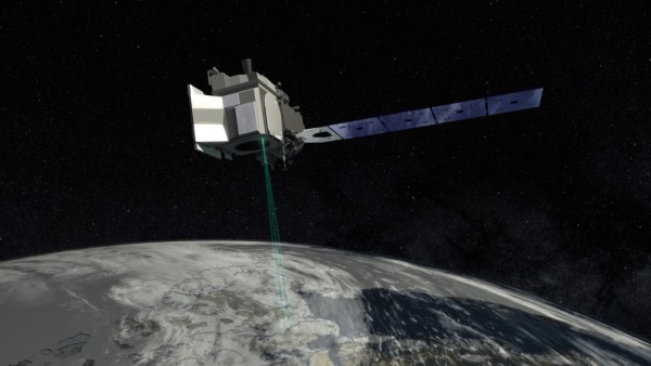
Image credit: NASA's Goddard Space Flight Center

Published on Thu, 03/28/2019 - 12:31

College of Behavorial & Social Sciences
  • Facebook
  • Twitter
  • Instagram
  • YouTube
  • LinkedIn
  • Zenfolio

Department of Geographical Sciences

2181 Samuel J. LeFrak Hall, 7251 Preinkert Drive,
University of Maryland, College Park, MD 20742
Phone: 301-405-4050

Join Our Newsletter

Contact Us

Links
  • UMD Land Acknowledgement
  • UMD Staff Directory
  • Give to GEOG
  • UMD Web Accessibility
  • Alumni
© 2025 College of Behavorial & Social Sciences. All Rights Reserved.
Login