UMD College of Behavorial & Social Sciences UMD College of Behavorial & Social Sciences
MENU

Topbar Menu

  • About Us
  • People
  • Alumni and Giving
  • Diversity
  • Undergraduate
    • Prospective Students
    • Courses & Facilities
    • Advising
    • Special Programs
    • Graduation
    • Geography Club
  • Graduate
    • Prospective Ph.D. Students
    • Graduate Courses
    • Graduate Student Publications
    • Graduate Student Awards
    • Graduate Students
    • Master of Science and Graduate Certificate Programs
    • Combined BS/MS Program
  • Research
    • Research Areas
      • Geospatial-Information Science and Remote Sensing
      • Human Dimensions of Global Change
      • Land Cover and Land Use Change
      • Carbon, Vegetation Dynamics and Landscape-Scale Processes
    • Centers
      • Center for Geospatial Information Science
      • International Center for Innovation in Geospatial Analytics & Earth Observation
  • High School Hub
    • Program Overview
    • High School Awards
    • High School Internship Program
    • GIS Day
  • Resources
    • Graduate Student Organization
    • Student Life
    • Graduate School
    • Responsible Conduct of Research
    • Emergency Preparedness
    • Job Opportunities
    • Graduation
Search

Main navigation

  • Undergraduate
    • Prospective Students
    • Courses & Facilities
    • Advising
    • Special Programs
    • Graduation
    • Geography Club
  • Graduate
    • Prospective Ph.D. Students
    • Graduate Courses
    • Graduate Student Publications
    • Graduate Student Awards
    • Graduate Students
    • Master of Science and Graduate Certificate Programs
    • Combined BS/MS Program
  • Research
    • Research Areas
      • Geospatial-Information Science and Remote Sensing
      • Human Dimensions of Global Change
      • Land Cover and Land Use Change
      • Carbon, Vegetation Dynamics and Landscape-Scale Processes
    • Centers
      • Center for Geospatial Information Science
      • International Center for Innovation in Geospatial Analytics & Earth Observation
  • High School Hub
    • Program Overview
    • High School Awards
    • High School Internship Program
    • GIS Day
  • Resources
    • Graduate Student Organization
    • Student Life
    • Graduate School
    • Responsible Conduct of Research
    • Emergency Preparedness
    • Job Opportunities
    • Graduation
  • About Us
  • People
  • Alumni and History
  • Diversity

Search our site:

New Data from UMD GLAD Shows Forest Fires are Worsening

Breadcrumb

  • Home
  • Featured Content
  • New Data From UMD GLAD Shows Forest Fires Are Worsening
Forest fire

Forest fires are becoming more widespread, burning almost twice as much tree cover today as they did twenty years ago, according to a new analysis of data from the UMD Global Land Analysis and Discovery (GLAD) Lab. The findings, presented in a blog post by the World Resources Institute’s Global Forest Watch (GFW), were made possible by a recent GLAD study of global forest loss due to fire since the year 2000, recently updated to include 2020 and 2021. 

”We are now able to look at the long-term trends of tree cover loss due to fires in more detail than ever before,” said Sasha Tyukavina, assistant research professor in geographical sciences and lead author of the study. Using Landsat satellite imagery, Tyukavina and their team mapped global tree cover loss from 2001 to 2021, distinguishing forest loss due to fires from other drivers such as logging, agriculture, and expansion of settlements. 

The separation of forest loss due to fire from other drivers is key, according to Tyukavina, who said that the new data provide critical insights into trends in tree cover loss. “With the new data, we can see which areas are experiencing the most forest loss due to fire, whether increased rates of forest loss are due to increased fire activity, and whether the trend of tree cover loss remains or changes if we remove fire-related forest loss.” 

Analysts from GFW, for example, were able to determine that a large spike in forest loss in Brazil in 2016 was driven primarily by fires rather than other causes. Without the GLAD data, this information was not readily available. 

Tyukavina points out that the new data are also useful outside the realm of research, as key inputs for land management and policy development and implementation. "The new maps of forest fire extent and rates of change match the high resolution of state-of-the-art forest change maps—also produced by UMD GLAD—which are widely accepted in the research community, the industry and the policy sectors as a primary source of global data on forest changes,” they said.

With the new data, both research and policymaking communities are better equipped to understand the current and future states of global forest loss, what must be done to protect forests and mitigate the damage already done, and how to prepare for the impacts of future fire-driven forest loss. 

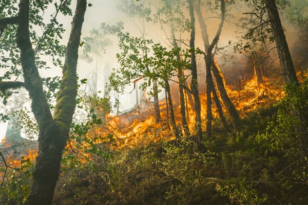
Photo by Karsten Winegeart via Unsplash. 

Published on Tue, 09/06/2022 - 12:02

College of Behavorial & Social Sciences
  • Facebook
  • Twitter
  • Instagram
  • YouTube
  • LinkedIn
  • Zenfolio

Department of Geographical Sciences

2181 Samuel J. LeFrak Hall, 7251 Preinkert Drive,
University of Maryland, College Park, MD 20742
Phone: 301-405-4050

Join Our Newsletter

Contact Us

Links
  • UMD Land Acknowledgement
  • UMD Staff Directory
  • Give to GEOG
  • UMD Web Accessibility
  • Alumni
© 2025 College of Behavorial & Social Sciences. All Rights Reserved.
Login