
NASA Grant to Support Prescribed Fire Mapping in the Everglades
Assistant Research Professor Maria Zubkova will lead a project to address critical gaps in prescribed fire data to support conservation and community resilience.
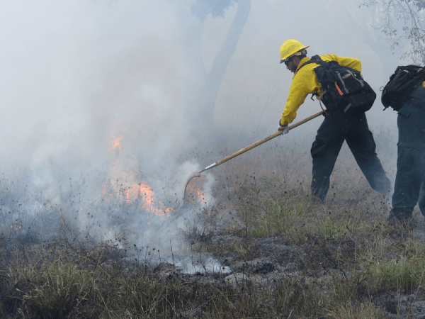
In Florida’s Everglades Headwaters, fire is a vital tool for preserving ecosystems—but managing it is no easy task. To protect habitats and reduce wildfire risks, limited resources are spent hand-digitizing imagery of prescribed burns. Now, with new funding from NASA, a UMD researcher aims to improve this process, using satellite technology to automate fire mapping and make it faster, more precise and accessible to those working to keep Florida’s landscapes resilient.
Assistant Research Professor Maria Zubkova’s research proposal is one of 10 projects out of 79 submissions selected by NASA under its Earth Action: Wildland Fires program. Her proposal, titled “A Decision Support System for Automated Precise Prescribed Fire Mapping in the Everglades Headwaters,” will receive $908,350 for developing an innovative tool to map prescribed fires accurately in Florida’s Everglades Headwaters region.
Zubkova’s project aims to address a significant gap in current fire data. In the southeastern U.S., prescribed fires are used extensively to manage habitats, reduce wildfire risks and promote biodiversity, particularly in fire-adapted ecosystems like those in Florida. Although the Southeast accounts for 70% of all prescribed burns in the U.S., data on the extent and severity of these burns are limited due to the relatively small size and controlled nature of prescribed fires, which often go undocumented in traditional fire datasets.
“Tracking spatio-temporal patterns of prescribed fires in the U.S. is surprisingly difficult,” Zubkova said. Government records, like those of the Florida Forest Service, provide estimates for prescribed fires where managers must request burn permits. However, this data includes only the location and timing—not the size or intensity—of burns, with some prescribed fires often going undocumented in traditional fire datasets.
With the Decision Support System (DSS), Zubkova explained, land managers will simply enter the approximate location and date of their prescribed burn, and the system will do the rest. Each year, it will also generate a comprehensive map of all prescribed fires in the study area using NASA’s remote sensing data and records from the Southeastern U.S. Prescribed Fire Permit Database.
“This data will be the only currently existing dataset that provides accurate information on prescribed fire extents, allowing researchers and practitioners to analyze the effects of prescribed fires with various seasonality, frequency and size on flora and fauna in Central Florida,” she said.
Because the NASA grant emphasizes collaboration with end-users, Zubkova reached out to her network, including Vivienne Sclater of Archbold Biological Station, to learn directly about challenges in prescribed fire management. Sclater shared that while Archbold has conducted prescribed burns since 1977, they still rely on labor-intensive manual mapping. Automating this process would allow them to focus resources on broader fire and invasive species management.
“I was excited to hear that since the idea was precisely within my expertise and, most importantly, once completed, the project will have tangible benefits, especially for biodiversity conservation, a field that is close to my heart,” Zubkova said.
NASA’s Earth Action: Wildland Fires program is part of the Research Opportunities in Space and Earth Sciences (ROSES) initiative, which fosters the use of Earth observation data to enhance wildland fire management practices.
Published on Mon, 11/11/2024 - 15:59