
UMD College of Behavorial & Social Sciences UMD College of Behavorial & Social Sciences
MENU

Topbar Menu

  • About Us
  • People
  • Alumni and Giving
  • Undergraduate
    • Prospective Students
    • Courses & Facilities
    • Advising
    • Special Programs
    • Graduation
    • Geography Club
  • Graduate
    • Prospective Ph.D. Students
    • Graduate Courses
    • Graduate Student Publications
    • Graduate Student Awards
    • Graduate Students
    • Combined BS/MS Program
    • Master of Science and Graduate Certificate Programs
    • MPS in GeoAI and Healthcare
  • Research
    • Research Areas
      • Geospatial-Information Science and Remote Sensing
      • Human Dimensions of Global Change
      • Land Cover and Land Use Change
      • Carbon, Vegetation Dynamics and Landscape-Scale Processes
    • Centers
      • Center for Geospatial Information Science
      • International Center for Innovation in Geospatial Analytics & Earth Observation
  • High School Hub
    • Program Overview
    • High School Awards
    • High School Internship Program
    • GIS Day
    • Request a Geographer
  • Resources
    • Graduate Student Organization
    • Student Life
    • Graduate School
    • Responsible Conduct of Research
    • Emergency Preparedness
    • Job Opportunities
    • Graduation
Search

Main navigation

  • Undergraduate
    • Prospective Students
    • Courses & Facilities
    • Advising
    • Special Programs
    • Graduation
    • Geography Club
  • Graduate
    • Prospective Ph.D. Students
    • Graduate Courses
    • Graduate Student Publications
    • Graduate Student Awards
    • Graduate Students
    • Combined BS/MS Program
    • Master of Science and Graduate Certificate Programs
    • MPS in GeoAI and Healthcare
  • Research
    • Research Areas
      • Geospatial-Information Science and Remote Sensing
      • Human Dimensions of Global Change
      • Land Cover and Land Use Change
      • Carbon, Vegetation Dynamics and Landscape-Scale Processes
    • Centers
      • Center for Geospatial Information Science
      • International Center for Innovation in Geospatial Analytics & Earth Observation
  • High School Hub
    • Program Overview
    • High School Awards
    • High School Internship Program
    • GIS Day
    • Request a Geographer
  • Resources
    • Graduate Student Organization
    • Student Life
    • Graduate School
    • Responsible Conduct of Research
    • Emergency Preparedness
    • Job Opportunities
    • Graduation
  • About Us
  • People
  • Alumni and History

Search our site:

NASA Acres Receives over $900,000 in USDA NIFA Funding to Advance Agricultural Data Sharing
Breadcrumb

  • Home
  • Featured Content
  • NASA Acres Receives Over $900,000 In USDA NIFA Funding To Advance Agricultural Data Sharing
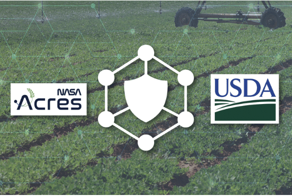
Graphic featuring the NASA Acres and USDA logos flanking a central white icon of a shield inside a hexagonal node network, set against a background of an agricultural crop field with a center-pivot irrigation system.

The grant will support a secure data-sharing system designed to protect farmers’ privacy and give producers control over their information.

USDA’s National Institute of Food and Agriculture (NIFA) has awarded the University of Maryland a $936,310 grant to support the development of the NASA Acres Confidential, Co-created, Collaborative Computational (4-C) System, a new initiative designed to advance agricultural data sharing while protecting producer privacy and data sovereignty. The funding was awarded under NIFA’s Open Data Framework program.

The 4-C System will establish a neutral, secure data cooperative where agricultural producers, land-grant and other universities, nonprofits and private companies can contribute, analyze and benefit from agricultural data and proprietary models without exposing sensitive information or surrendering control over their data and intellectual property.

“We’re building the 4-C System because producers shouldn’t have to choose between retaining sovereignty over their data and benefiting from it,” said Research Professor Alyssa Whitcraft, executive director of NASA Acres. “4-C creates a confidential computing space co-governed by farmers and the researchers that allows farm data, open satellite data, and public-good science to combine only under mutual consent.”

The project builds on the work of NASA Acres, NASA’s consortium supporting American agriculture, led by the University of Maryland. Launched in 2023, NASA Acres brings together farmers, ranchers, researchers, and agricultural organizations across the United States to translate Earth observation science and data into practical solutions that improve agricultural productivity, profitability, and resilience. With more than 40 projects, 11 primary organizations, and over 70 collaborating partners, the consortium connects scientific innovation with the needs and priorities of American agricultural producers.

Read the full article by Adam Zwerner on the NASA Acres website
 

Published on Wed, 11/11/2026 - 15:03

College of Behavioral & Social Sciences
  • Facebook
  • Twitter
  • Instagram
  • YouTube
  • LinkedIn
  • Zenfolio

Department of Geographical Sciences

2181 Samuel J. LeFrak Hall, 7251 Preinkert Drive,
University of Maryland, College Park, MD 20742
Phone: 301-405-4050

Subscribe to Our Newsletter

Contact Us

Links
  • UMD Land Acknowledgement
  • UMD Staff Directory
  • Give to GEOG
  • UMD Web Accessibility
  • Alumni
© 2026 College of Behavioral & Social Sciences. All Rights Reserved.
Login