UMD College of Behavorial & Social Sciences UMD College of Behavorial & Social Sciences
MENU

Topbar Menu

  • About Us
  • People
  • Alumni and Giving
  • Undergraduate
    • Prospective Students
    • Prospective Students
    • Courses & Facilities
    • Advising
    • Special Programs
    • Graduation
    • Geography Club
  • Graduate
    • Prospective Ph.D. Students
    • Prospective Ph.D. Students
    • Graduate Courses
    • Graduate Student Publications
    • Graduate Student Awards
    • Graduate Students
    • Master of Science and Graduate Certificate Programs
    • Combined BS/MS Program
  • Research
    • Research Areas
      • Geospatial-Information Science and Remote Sensing
      • Human Dimensions of Global Change
      • Land Cover and Land Use Change
      • Carbon, Vegetation Dynamics and Landscape-Scale Processes
    • Centers
      • Center for Geospatial Information Science
      • International Center for Innovation in Geospatial Analytics & Earth Observation
  • High School Hub
    • Program Overview
    • High School Awards
    • High School Internship Program
    • GIS Day
    • Request a Geographer
  • Resources
    • Graduate Student Organization
    • Graduate Student Organization
    • Student Life
    • Graduate School
    • Responsible Conduct of Research
    • Emergency Preparedness
    • Job Opportunities
    • Graduation
Search

Main navigation

  • Undergraduate
    • Prospective Students
    • Courses & Facilities
    • Advising
    • Special Programs
    • Graduation
    • Geography Club
  • Graduate
    • Prospective Ph.D. Students
    • Graduate Courses
    • Graduate Student Publications
    • Graduate Student Awards
    • Graduate Students
    • Master of Science and Graduate Certificate Programs
    • Combined BS/MS Program
  • Research
    • Research Areas
      • Geospatial-Information Science and Remote Sensing
      • Human Dimensions of Global Change
      • Land Cover and Land Use Change
      • Carbon, Vegetation Dynamics and Landscape-Scale Processes
    • Centers
      • Center for Geospatial Information Science
      • International Center for Innovation in Geospatial Analytics & Earth Observation
  • High School Hub
    • Program Overview
    • High School Awards
    • High School Internship Program
    • GIS Day
    • Request a Geographer
  • Resources
    • Graduate Student Organization
    • Student Life
    • Graduate School
    • Responsible Conduct of Research
    • Emergency Preparedness
    • Job Opportunities
    • Graduation

Search our site:

MS Program Holds Fall 2025 Capstone Symposium Events Showcasing Student Learning

Breadcrumb

  • Home
  • Featured Content
  • MS Program Holds Fall 2025 Capstone Symposium Events Showcasing Student Learning
Group photo

GIS and GEOINT graduates gather to spotlight projects ranging from spatial analysis to geospatial intelligence.

On Nov. 18 and 20, MS students in both GIS and GEOINT participated in online lightning talks or poster sessions presented their research and design projects. These highly anticipated events are the final step for graduates to earn their MS degree. Projects highlighted applications of GIS, spatial analysis, modeling, remote sensing, web app development, and geospatial intelligence across a wide range of topics and disciplines.

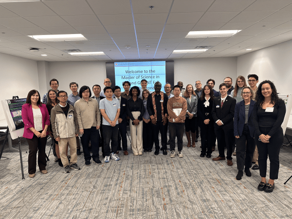
The in-person poster session was attended by students’ mentors, GEOG faculty and staff, fellow students, as well as family and friends joining to celebrate their work.

We congratulate all the M.S. Program graduates on a job well done!

View recordings of the online lightning talks using passcode: #m3$s94Q

Below is the list of online topics and presenters:

Name Capstone Title
Jonathan Adkins Automating Acoustic Leak Survey Coverage Analysis in Municipal Water Systems
Emery, Harley / Koch, Jennifer / Touat, Meghan Remote Sensing and Geospatial Approaches to Monitoring Chinese-Backed Cobalt Mining in the Democratic Republic of the Congo
Kevin Ganjon Assessing Alpine Vegetation Change Across Eastern U.S. Summits in Response to Climate Change
Anna Harmon GIS Integration for Climate Migration Modeling in Oaxaca, Mexico
Emily Harris Post-Wildfire Hydro-Geomorphic Hazards and Critical Infrastructure Cascades in California
Matthew Hunt A Spatial Analysis of Anthrax Infection Risk in Kruger National Park
Charlie Loya A Spatial Analysis of Safe Residential Environments in the State of North Carolina
Jacoby Miles Automating Change Detection during Severe Weather Events Using Remote Sensing
Jessica Peakes Spatial Modeling of the Drivers of Wildfire Susceptibility in Lebanon
Alexis Roccia A Predictive Model Using Vulture Movement Data to Understand Anthrax Risk in Greater Limpopo Transfrontier Park
Justin Salz Vegetation Change Analysis of Hurricane Helene on Rutherford County, North Carolina
David Strickler Automated Spatial Data Correction: Negative H Value Normalization for NOAA Marine Cartography
Anthony Vershov A Spherical Fuzzy Analytic Network Process (SF-ANP) Methodology Applied to Biorefinery Site Suitability on Switchgrass-Suitable Marginal Land in the Southern United States

Learn About the MS Program

Published on Tue, 12/09/2025 - 15:28

College of Behavioral & Social Sciences
  • Facebook
  • Twitter
  • Instagram
  • YouTube
  • LinkedIn
  • Zenfolio

Department of Geographical Sciences

2181 Samuel J. LeFrak Hall, 7251 Preinkert Drive,
University of Maryland, College Park, MD 20742
Phone: 301-405-4050

Join Our Newsletter

Contact Us

Links
  • UMD Land Acknowledgement
  • UMD Staff Directory
  • Give to GEOG
  • UMD Web Accessibility
  • Alumni
© 2025 College of Behavioral & Social Sciences. All Rights Reserved.
Login