

Mapping Maryland, the Henson Week Way
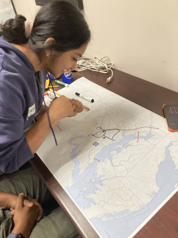
Participants embraced Create, Make and Play as they experimented with maps, GIS tools and ideas for the future.
What would the Maryland of your dreams look like? Metro stations all the way to Frederick? Solar panels on every house? Potable water in every creek? No idea was too far-fetched for “Maryland 2050: Design the Future You Want to Live in,” a mapping activity hosted by the Department of Geographical Sciences (GEOG) as part of Henson Week.
In celebration of what would have been Jim Henson’s 90th birthday, GEOG’s activity was one of many events organized on the themes of Create, Make and Play to honor the legacy of the famous alum during the week of Sept. 20-26.
“These three words [Create, Make, Play] embody the process of learning by doing,” said Sammy Popat, UMD’s innovation and entrepreneurship ecosystem catalyst in the Division of Research’s Office of Innovation, and organizer of Henson Week with the Arts for All initiative. “The theme encourages us to lean into our imaginations, to transform our thoughts into actions by using our hands and to focus our attention, enabling us to be present and mindful, which brings us joy as we are in a state of play.”
At GEOG, few things are more fun than creating a map.
Led by senior lecturer Naijun Zhou, the Sept. 22 activity gave participants several ways to approach mapping. They could draw a map by hand using a basemap prepared by Zhou, use ArcGIS or the open-source QGIS to create a static map, build an online map with ArcGIS StoryMaps or create an online dashboard.
Participants made their choices based on their interests, experience and access to software. Some wanted to practice GIS skills, while others wanted to learn a new tool or try a different way of making maps.
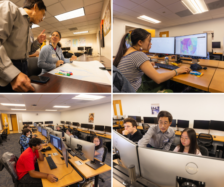
Senior lecturer Naijun Zhou guides participants as they design maps of Maryland using paper sketches and GIS software during GEOG’s Henson Week activity. Credit: Andy Evans at BSOS
Student Imaan Kasim took the opportunity to go further in time and imagine Maryland in the year 3000. Her map featured a DMV Disney, a bullet train for easy access to Baltimore and New York, an international airport in southern Maryland, a series of "Famous Marylanders Statues" statewide, new bridges, various man-made lakes and even a highway system for flying cars.
“I appreciated the chance to hand-draw my own fantastical version of Maryland and unlimit myself to the creative potential and technological possibilities of humankind in Maryland,” Kasim said. “It forced me to think and draw out of the box, especially since I am a geospatial data science student and am used to computer cartography.”
Emilie Murphy, a senior faculty specialist who is originally from France, took a different approach. Inspired by her native country, her hand-drawn map envisioned a network of small farms, local shops, gardens and parks connected by transportation options such as walking and cycling paths.
“The main reason I participated in this event was that it gives an opportunity to everyone, as citizens, to express one's ideas, hopes and dreams for the future,” Murphy said. “My idea, creating this map, was to link a network of medium-/large-sized towns—featuring small businesses like organic farms and local shops that promote craftsmanship—that could be accessed using modes of transport accessible to everyone.”
The event also attracted participants who wanted to experiment with GIS for professional purposes.
Ruth Getachew, a former UMD student, came to the activity hoping to try GIS for a mapping project her company is planning. Although she had initially been interested in learning QGIS, she practiced with ArcGIS during the event and created a map of Maryland’s counties and major cities.
“I’ve always been interested in GIS, and this activity deepened that interest,” Getachew said. “Getting hands-on experience with the mapping tool helped me understand how layers and different data points come together to create a map.”
Zhou said the range of approaches was intentional. Some participants used the GIS data and instructions provided at the event to practice their mapping skills, while more experienced participants worked independently on their own maps.
“I particularly appreciate this aspect of the event because we were able to support participants in achieving their individual goals,” Zhou said. “I greatly enjoyed working with them on such a diverse range of mapping projects. The variety of interests, experience levels and approaches made the event both rewarding and educational.”
Main image: Student Imaan Kasim works on her map "Maryland 3000" on Sept. 22 in LeFrak Hall. Credit: GEOG
Published on Mon, 10/05/2026 - 13:23