
Looking at Home From Space: Sergii Skakun’s Path from Kyiv to Earth Observation Science
From post-Soviet Ukraine to the University of Maryland, Associate Professor Sergii Skakun built a career in satellite data, remote sensing and machine learning now used to monitor agriculture in wartime.
The first time Sergii Skakun ate a banana, he was 11 years old.
It was the early 1990s, and Skakun had traveled from Ukraine to Poland through a school program. The trip was his first experience outside the Soviet sphere, but what he encountered felt like a different world.
He remembers walking through a supermarket and staring in disbelief at shelves filled with products he had never seen before: bananas, pineapples, chocolate and countless other items that were either scarce or unavailable at home.
“It was like going to another planet,” he recalled.
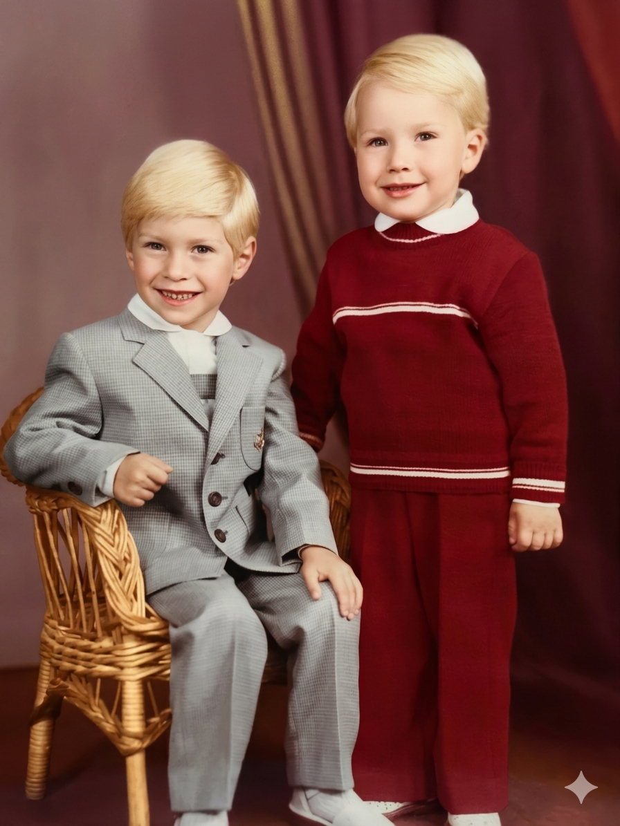 Skakun, left, and brother (circa 1984)
Back in Kyiv, life looked very different. Skakun lived with his parents and younger brother in a one-room apartment for the first 10 years of his life. His mother and father were both electrical engineers, but the family’s circumstances were shaped by late Soviet life and the years that followed Ukraine’s independence in 1991.
Opportunities were limited, but expectations were not. When Skakun was in 8th grade, his father insisted he apply to a specialized math and physics school. He didn’t get in on his first attempt, but the rejection set the pace for what followed: an entire summer studying and working through problems on his own. By the time he retook the entrance exam, he was ready.
In the years after, he continued to treat school breaks as opportunities rather than pauses.
“I was a nerd,” he admitted.
Skakun was competitive, though the competition was often with the problems themselves.
”I just wanted to crack all of those problems,” he said.
But it wasn’t all about school. In winter, the courtyard outside his apartment building was flooded and turned into an ice rink. When the weather warmed, he and his friends played soccer until dark.
“I was crazy about every sport: soccer, basketball, hockey,” said Skakun, who once dreamed of becoming a professional soccer player.
That love of sports never competed with his studies, often intersecting in unexpected ways. One summer, that overlap became especially clear.
When Ukrainian star Andriy Shevchenko transferred from Dynamo Kyiv to AC Milan—one of Skakun’s favorite clubs—it sparked a fascination with Italy. He wanted more than highlights and translations, so he decided to teach himself Italian.
His father had installed a satellite dish on their home, and Skakun would spend hours adjusting it in search of international channels. He first tuned in to Italian soccer broadcasts, but soon found himself exploring far more: cultural programs, new countries and American football. The satellite dish became an early window into worlds far beyond Kyiv.
Years later, satellites would help him watch over the landscapes he knew best.
A Turn Toward Applied Mathematics
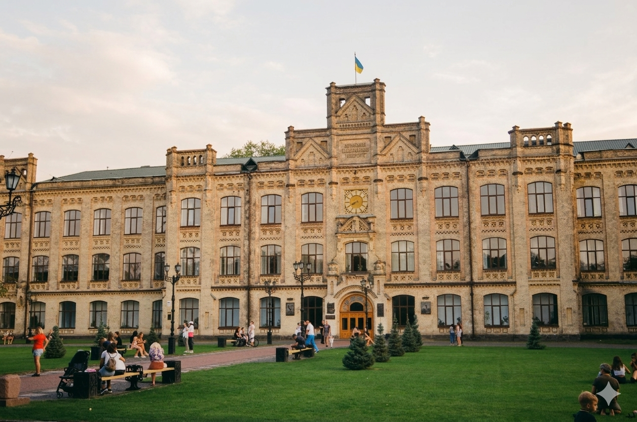 Kyiv Polytechnic Institute in 2019
When Skakun entered Kyiv Polytechnic Institute, he wasn't thinking about remote sensing or artificial intelligence. Many of his friends from math competitions were going there, and he followed a path shaped more by opportunity than planning. He enrolled in applied mathematics and entered a system that combined rigorous coursework with early research experience.
“I didn’t even know what I wanted to do,” he recalled. “It just happened almost by chance.”
Skakun earned bachelor's and master’s degrees in applied mathematics before completing a Ph.D. in computer science at the Space Research Institute of the National Academy of Sciences of Ukraine in 2005.
What began almost by chance soon gained direction. While still a student, he started working at the Space Research Institute. There, he was introduced to satellite data and Earth observation at a time when the field was far less accessible than it is today.
His doctoral research focused on detecting unusual patterns in computer users’ behavior—work that now resembles many modern machine learning applications.
“We tried to see how your current behavior differed from the past one, two or three months … The application was detecting whether there was malicious activity or not,” he said. “We did this through a multi-agent system. The ‘agent’ wasn't an AI agent in today's sense, but the philosophy is the same—it just looked different at the time.”
By 2005, he was working with neural networks to classify Landsat imagery.
“That was the cold age for neural networks. Not many people were using them,” he said.
What made the work possible was not institutional abundance but persistence. Access to journals was limited. International collaboration was difficult. Papers could cost the equivalent of a monthly salary, and writing scientific articles in English required learning largely from scratch.
“You learn in a very old-fashioned way,” he said. “You build your own vocabulary. You try to translate everything into something you understand.”
Watching Crops From Space
Despite those constraints, Skakun and his colleagues began building a body of work that would eventually connect them to international partners, including GEOGLAM Crop Monitor, led by UMD. Early collaborations on floods, agriculture and land use opened doors to summer schools and joint projects that expanded both technical expertise and global networks.
Agriculture, in particular, became a long-term focus. Ukraine’s role in global commodity markets made it a natural testbed for satellite-based crop monitoring and yield estimation.
“That's probably something in DNA, in my blood telling me to love agriculture,” he said.
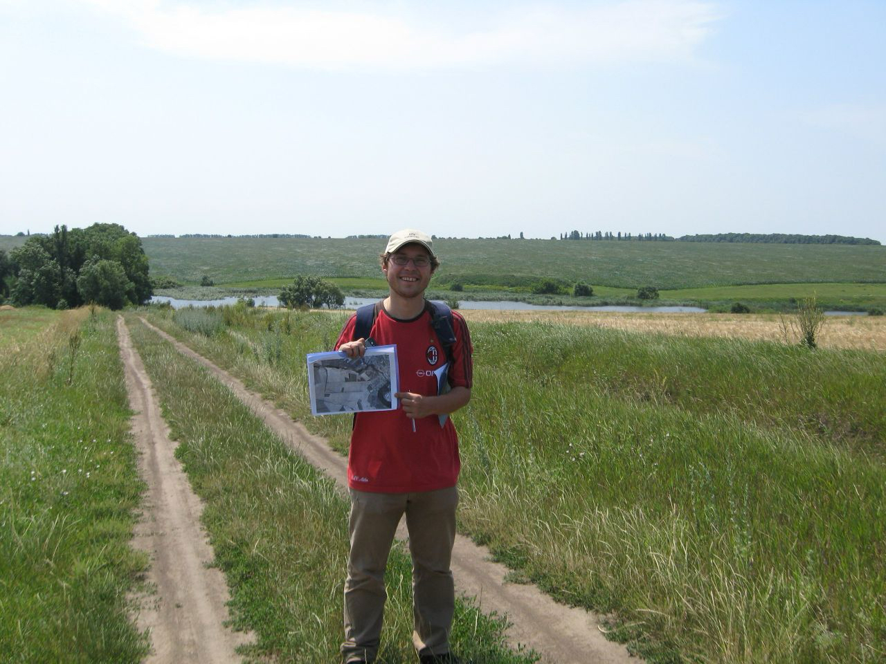 Field campaign for collecting reference crop type data in Ukraine (2009)
That connection is rooted in his family’s history. His ancestors were farmers until the Bolshevik revolution stripped them of their land and nearly their lives when his great-grandfather was jailed for anti-sovietic protests. The Soviet years brought devastating consequences for Ukrainian farmers, culminating in the Holodomor, a state-engineered famine that killed millions and reshaped rural life for generations. In Vinnytsia Oblast, his grandmother, 94, survived it all: the famine, World War II and now Putin’s war.
And yet, as a boy visiting his grandmother’s village, Skakun would get his hands dirty, planting and harvesting potatoes and corn, picking strawberries straight from the field and apples from the tree.
Decades later, he would find himself studying those same fields from space.
Over time, Skakun and his collaborators developed systems for mapping crop types and estimating agricultural production using remote sensing data and machine learning methods.
That work would later feed into projects with organizations such as NASA Goddard Space Flight Center, NOAA collaborators and European Commission initiatives, gradually expanding his scientific footprint beyond Ukraine.
But before his career fully shifted to the University of Maryland, another unexpected chapter began.
In 2013, Skakun was recruited by Samsung for an image processing role in South Korea. The timing was dramatic. As he prepared to relocate, political tensions in Ukraine escalated into the Maidan protests and eventually the annexation of Crimea and parts of Donbass by Russia. While settling into a new job, he was also watching events unfold at home in real time, across a painful time difference.
“It was turmoil,” he said. “I would come home and just watch the news.” During the first months in Suwon, his wife and two twin daughters remained in Kyiv. After three years, with his children approaching school age, he started applying to faculty positions in the United States and Europe.
Science in Wartime
.JPG) Kansas wheat tour: collection of data about the state and projected yields of winter wheat (2018)
Kansas wheat tour: collection of data about the state and projected yields of winter wheat (2018)
That search led him to the University of Maryland, where he was hired in 2015 as an assistant research professor. He was initially hired to work on cooperative agreements at NASA GSFC on satellite data quality and applications. Later, he joined a cluster hire that brought together scholars working on Earth system science and data-intensive environmental research, eventually transitioning into a tenure-track role with a joint appointment in the College of Information and later earning promotion to associate professor.
Now, the mathematician sees himself as a geographical scientist through the prism of remote sensing and Earth observation. That interdisciplinary approach has become increasingly important as advances in artificial intelligence transform science. Skakun’s research group develops methods that combine satellite imagery, machine learning and statistical approaches to estimate crop area and production, particularly in places where traditional surveys are difficult or impossible.
In recent years, that work has taken on added significance in Ukraine.
The ongoing war has disrupted agricultural monitoring and limited access to field data. Satellite-based approaches have become critical tools for estimating crop conditions and supporting decision-making. Some of the methods developed by Skakun and his collaborators have been incorporated into official statistical practices.
For him, those outcomes are among the most rewarding aspects of research.
“Within the NASA Harvest project, we did some cool work supporting Ukrainian agricultural statistics — and that's where you make the link between theoretical, foundational science and real-world implementation with actual impact,” he said. “Over the course of two or three years, Ukraine actually incorporated it into legislation.”
The war is never far from his mind. Skakun calls his parents in Kyiv nearly every day. Recently, his father spent an entire night in a bomb shelter as Russia launched a ballistic missile attack on the city. His mother, staying in a village outside Kyiv, could hear the strikes from a distance.
Skakun’s team has since turned their tools toward a different kind of mapping: using satellite imagery and deep learning to chart millions of artillery strike craters across Ukraine’s agricultural heartland, helping demining teams protect the farmers still working those fields.
The boy from Kyiv once used a satellite dish to look out at the world. Today, from thousands of miles away, satellites help him look back toward Ukraine’s fields.
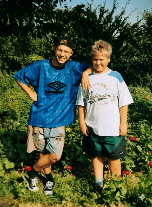
Main image: Sergii Skakun, left, and his brother circa 1993.
All photos courtesy of Skakun, except the photo of the Kyiv Polytechnic Institute, which is by Kseniia Rastvorova on Unsplash
Published on Mon, 01/16/2023 - 10:33