How Spaceborne Lidar is Redefining Our Understanding of Forest Structure
In a new study, a GEDI team offers a detailed look at the arrangement of trees and plants across different forest types.
When exploring different forests, one might notice the distinct character that each possesses. Some are open and bright with tall trees and dispersed meadows, while others are dense and dark due to tightly packed vegetation. The diverse arrangement of trees, leaves and branches in a forest that give it these characteristics is what scientists refer to as its “structural complexity.”
Structural complexity is commonly understood as a reflection of the canopy's heterogeneity—features like the size and height of trees, the amount of carbon vegetation stores and the characteristics of different forest layers. Mapping heterogeneity and 3D structure in forests is important for understanding ecosystem function for a myriad of reasons, including understanding biodiversity, habitat suitability, resilience and resistance to disturbance.
Understanding structural complexity on a global scale across different forest types is the goal of researchers at the University of Maryland Department of Geographical Sciences. In a cutting-edge study led by Ph.D. candidate Tiago de Conto and co-authored by Associate Professor John Armston and GEDI Principal Investigator Professor Ralph Dubayah, spaceborne lidar technology employed by the Global Ecosystem Dynamics Investigation (GEDI) mission is utilized to create the first near-global assessment of 3D structural complexity of Earth's forests.
In contrast to optical and radar remote sensing, lidar remote sensing technology uses lasers to penetrate forest canopy and detect structural variability. The GEDI instrument, mounted on the International Space Station (ISS), has been collecting vertical structure data of Earth’s forests using lidar since 2019. The instrument emits laser pulses toward the Earth’s surface and records detailed 3D profiles of forest structure.
“GEDI’s spaceborne lidar measurements are unique,” said Armston. "They don’t just see the top of the forest canopy but are able to reveal differences between the upper and lower canopy layers, allowing us to map ecosystem 3D structure and complexity across all of Earth’s forests.”

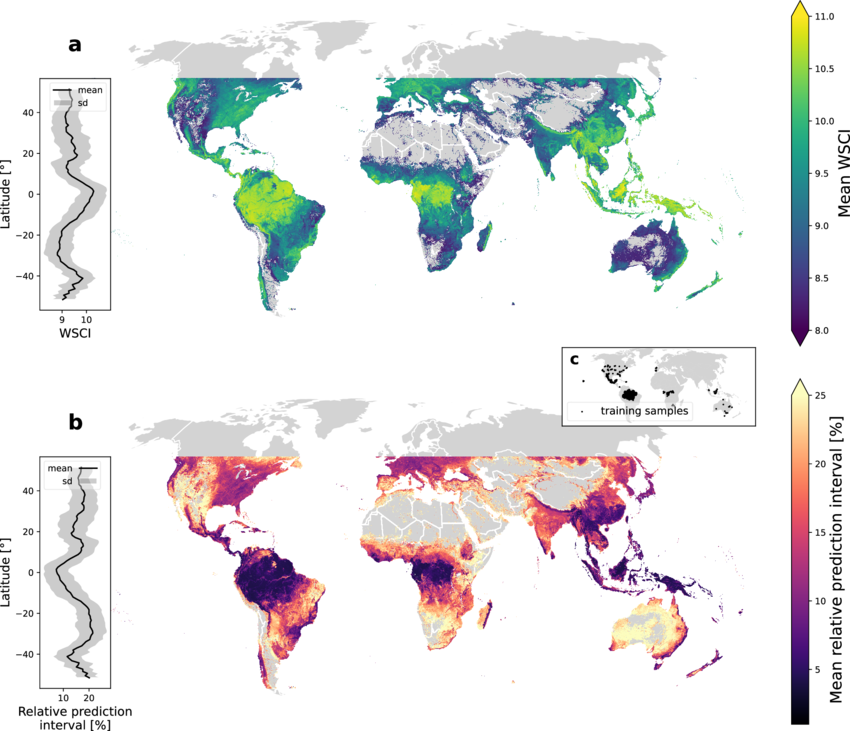
Global patterns of Waveform Structural Complexity Index (WSCI) and model uncertain. From: "Characterizing the Structural Complexity of the Earth’s Forests With Spaceborne Lidar" in Nature Communications.
This study hypothesizes that vertical and horizontal complexity are related. To test this, relationships between collocated GEDI data and existing 3D complexity data derived from Airborne Laser Scanning (ALS) were modeled and applied to 2 billion high-quality GEDI shots between ±51.6° latitude. The dataset derived from the analyses, which is free and readily available via the Oak Ridge National Laboratory, is called the Waveform Structural Complexity Index (WSCI).
The WSCI provides a comprehensive measure that integrates information from multiple structural attributes of forest canopies. “By using GEDI's unique dataset,” said de Conto, “we can now monitor and model the interactions between ecosystem function, biodiversity and structural complexity at an unprecedented global scale.”
Using the WSCI, the UMD researchers were able to discern variation in complexity across biomes and geographic regions as well as identify which vertical canopy layers were linked to complexity most heavily in different forest types. Structural complexity demonstrated clear latitudinal patterns, with peak values observed in tropical regions. In these areas, median complexity values surpassed those of temperate forests by 82% and exceeded other forest types by 96%.
This complexity gradient showed a consistent decline as latitude increased. "Our results confirm the unparalleled complexity of tropical forests, but they also highlight the value of rare temperate forests that have comparable canopy complexity to their tropical counterparts," explained de Conto. "This data provides critical insights for ecologists and conservationists working to preserve these ecosystems."
"Our results confirm the unparalleled complexity of tropical forests, but they also highlight the value of rare temperate forests that have comparable canopy complexity to their tropical counterparts."
- Ph.D. candidate Tiago de Conto
Beyond predicting geographical patterns, the WSCI offers insight into how vertical forest layers and plant functional types impact complexity. The researchers found that the upper canopy is most important for determining complexity in temperate forests, but that lower understory layers were more important for tropical forests.
"This study underscores the importance of considering biome-specific variations when assessing forest structure and biodiversity," said Dubayah. "By offering a comprehensive and consistent global dataset, we now have a powerful tool to study how forest ecosystems function and how we can better manage and protect them."
As climate change accelerates, forests are undergoing significant structural changes that impact biodiversity, habitat, and the ecological services they provide like carbon storage and water regulation. Identifying patterns of structural complexity in different forest types and how they change over time can help scientists and policymakers mitigate and adapt to changes as they unfold, guiding efforts to conserve forests more effectively.
Dubayah shared his enthusiasm for the study and the future work ahead, stating, “The GEDI data allows us to assess canopy structure at a resolution and scale that was previously unavailable. What is exciting is that the mission now will continue potentially to 2030. This will provide invaluable data on the structure and function of the Earth’s forests as they respond to many changes they are experiencing.”
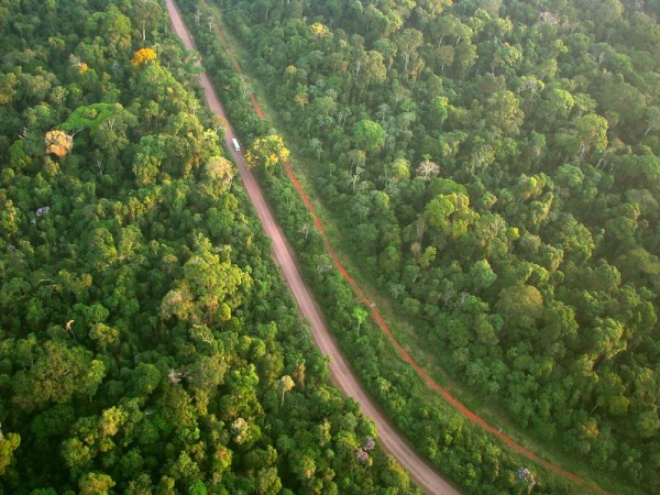
Photo credit: Aerial shot of two parallel roads in the Amazon forest by Ana Cotta on Flickr
Published on Mon, 11/11/2024 - 15:11


