

High School Students Saw the Wildfire Smoke Coming From a UMD Classroom
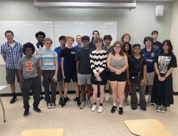
A GEOG summer course is teaching high school students to read satellite imagery, while exploring how geospatial science connects to their interests and future careers.
As smoky skies settled over the Washington, D.C., region this summer, residents were checking air quality alerts. But inside a University of Maryland classroom, students had already seen it coming.
Days before smoke from Canadian wildfires drifted into the region, students in GEOG 172: Earth From Space—a course offered through the Department of Geographical Sciences as part of the Terp Young Scholars program—used satellite data and wildfire forecasting tools to track the smoke’s path. By the time hazy skies reached the region, they already understood what was happening and why.
"Before we got hit by the smoke, I showed them the forecast and said, 'We're going to get hit in a couple of days,'" said instructor Evan Ellicott, an associate research professor in the Department of Geographical Sciences who studies wildfire science and remote sensing. "Sure enough, we did. It was an opportunity to show how satellite observations can help us understand what's happening before it affects us."
For Ava Greens, a rising senior at the Academy of the Holy Cross in Kensington, the timing made the lesson unforgettable.
"It was really interesting to see that happen in real time as we were learning about it in class," she said. "Before it became national news, we were already following it."
The three-week course introduces high school students to remote sensing, satellite imagery and geographic thinking through hands-on exploration of real-world events. Students work with freely available tools from organizations such as NASA and NOAA, analyze satellite imagery and learn how scientists monitor changes across Earth's landscapes.
Students arrived with different interests, but the course gave many of them new ways to explore subjects they already cared about.
Ava enrolled because of her interest in natural disasters. Natalia Labrador, a rising junior at Sherwood High School, came with a lifelong fascination with weather.
Growing up, Natalia watched the evening news forecasts and tracked radar loops on her tablet. She enrolled in Earth From Space hoping to gain "a deeper, more technical understanding of a passion I've had almost all my life."
Simon Mitchell, a student at Jackson-Reed High School in Washington, D.C., had a different motivation: a future in aviation.
"I chose to take the Earth From Space class as I wanted to take a class related to my future career path as a pilot," he said. "Learning about the weather and satellite imagery is a crucial part of that."
Much of the course centers on active exploration. Students present an "Image of the Day" from NASA Earth Observatory or another satellite source, explaining what the imagery reveals and why they chose it. They also complete projects that examine how places change over time.
Ava said those presentations have been one of her favorite parts of the class.
"I really like the presentations and the Image of the Day," she said. "It's less busy work and more discussions and actually learning and engaging with the material."
Ava used the Fire Information for Resource Management System (FIRMS) to identify 200 fire hotspots during the 2025 Belfast 11th Night celebrations, exploring how satellite data can reveal patterns in political and social events. Her parents are from Belfast, making the project particularly meaningful to her.
For her “Image of the Day,” Natalia selected a near-infrared satellite image showing the scar left behind by the 2013 Moore tornado in Oklahoma.
"It was fascinating to see the stark contrast between the bright red, healthy vegetation and the path of destruction the tornado left behind," she said. "Being able to apply what we learned in class to a topic I chose myself made me even more intrigued."
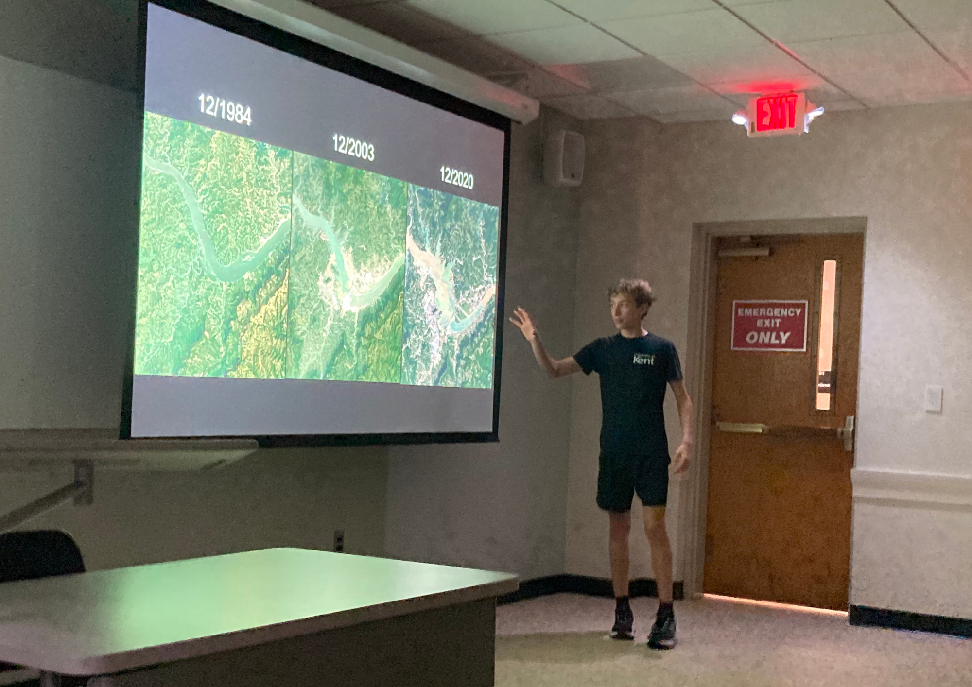
High school student Simon Mitchell presents on the impacts of the Three Gorges Dam in China.
Simon was also interested in using satellite imagery to examine how a specific area changed over time. For his project, he analyzed imagery of the Three Gorges Dam in China from 1984 to 2020, exploring how the massive hydroelectric project transformed the landscape and displaced communities through flooding.
"I really enjoyed working on the project and I learned so much about the topic I chose as well as how impactful satellite imagery can really be," he said.
The course also challenged students' assumptions about geographical sciences.
Ava expected a class focused primarily on Earth science but was surprised by how much mathematics and data analysis underpin satellite observations.
"I thought it was going to be one thing," she said. "Now that I know what I know, it's so much bigger. It's way more of a spectrum than I expected."
Simon had a similar experience with remote sensing.
"Before taking the class, I was practically clueless on this topic," he said. "The only thing I knew was how remote sensing could be used to track weather. After taking the class, I looked at geography and Earth science completely differently."
He was particularly surprised to learn how satellite sensors can use electromagnetic wavelengths beyond visible light to reveal information about Earth's surface.
"I learned so much that I didn't even expect to know about this topic, such as how different EM waves that are not visible light can still reflect differently off of surfaces, which just shocked me," he said.
For Natalia, the experience reinforced her long-standing interest in weather.
"This class has truly transformed how I view Earth science and has made me more passionate about the field than ever," she said.
Ellicott, who is teaching high school students for the first time, said the students' enthusiasm has been one of the biggest surprises.
"They seem very engaged in class," he said. "They speak up probably more than my undergraduates I've taught in the past."
Their questions have ranged from animal migration to political gatherings viewed from space, sometimes sending even Ellicott searching for answers.
"I learn a lot from them," Ellicott said. "The questions they raise—I often don't get that from undergraduates. Sometimes I have to say, 'I don't know the answer to that.' Then I go home and learn something new."
The course has also prompted students to think differently about their futures.
Ava entered the program planning to major in chemistry. Now, she says, she's considering ways to combine that interest with geographical sciences.
Simon also sees connections between geographical sciences and his plans for aviation. “This class covered so much more information that is necessary for someone in aviation than I expected,” he said.
Natalia said the course has strengthened a goal she has held for years. She hopes to study meteorology in college and says Earth From Space has helped prepare her for that path.
"Taking Earth From Space has built a strong foundation for my future studies and reinforced my dream of turning this lifelong passion into a career," she said.
GEOG 172: Earth From Space is one of three Terp Young Scholars courses offered by the Department of Geographical Sciences. The summer program also includes two online GEOG classes, GEOG 373: Geographic Information Systems, which teaches students to collect, analyze and visualize geographic data, and GEOG 276: Principles of Python Programming, which introduces coding, data analysis and spatial data applications.
Main image: Associate Research Professor Evan Ellicott (far left) stands alongside students in GEOG 172: Earth from Space during the Terp Young Scholars 2026 program at the University of Maryland.
Published on Mon, 08/17/2026 - 11:16