
Graduate Research Combines Data and Storytelling to Tackle Wildlife Trafficking
A living digital platform aims to raise awareness and foster interdisciplinary solutions for pangolin conservation.
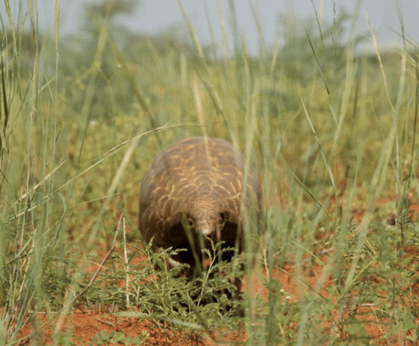
Pangolins are often described as the most heavily trafficked mammals in the world, yet these scaly nocturnal animals remain largely unknown. Like many people, graduate student Rya Inman had only come across occasional mentions in articles about wildlife trafficking, and more memorably, when pangolins appeared in early media coverage as a possible source of COVID-19.
That combination of urgency, underexposure and GEOG expertise is what drew Inman (MS Geographical Sciences, Spring ‘25) to center her project on pangolins.
“All eight pangolin species are facing a threat from the trafficking of their scales and meat by criminal networks,” she said. “They are a unique and highly charismatic mammal, but they are not widely known to the general global public.”
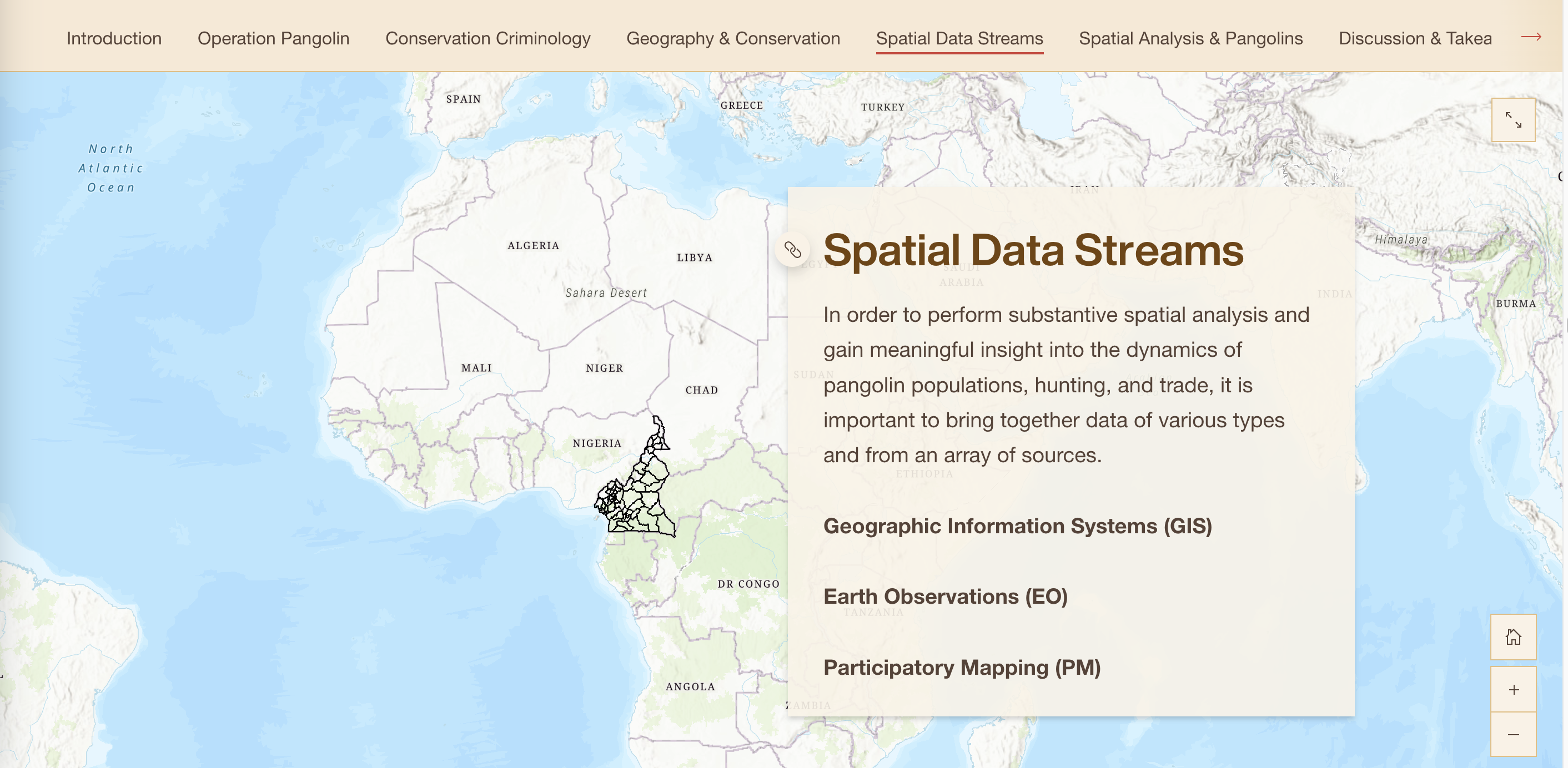
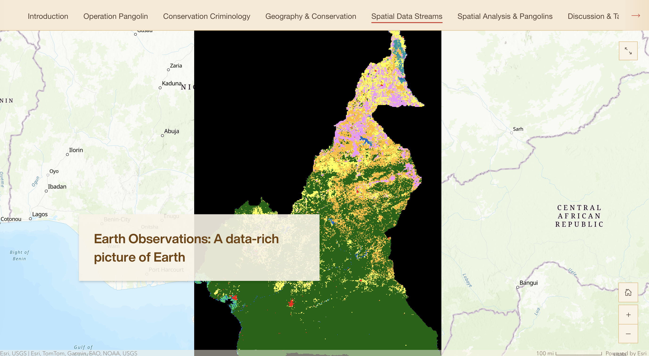
With this understanding, Inman set out to develop a tool that could bring together diverse data sources to better inform pangolin conservation efforts. Under the guidance of postdoctoral researcher Takem Mbi and faculty mentor Professor Meredith Gore, she created an ArcGIS StoryMap—an Esri platform for interactive, map-based storytelling—that integrates case studies, field data from Cameroon and geospatial analysis to support conservation strategies.
“The StoryMap is important because it illustrates how different spatial data streams can come together to provide a better picture to inform pangolin conservation,” Gore said. “Rya and Takem worked deliberately to highlight how participatory mapping, Earth observation and GIS can be linked for awareness raising.”
Inman selected Cameroon as a case study site due to the availability of open-source data and field data from Operation Pangolin, a research initiative co-led by Gore. Mbi, a postdoctoral associate on the project, provided ongoing mentorship and subject matter expertise as the StoryMap took shape.
“There is a large amount of data available from a wide, disparate array of sources,” Mbi said. “It is challenging but important to work on ways to bring these data sources together.”
The StoryMap was designed to support real-world decision-making by integrating global remote sensing data with insights gathered from pangolin experts and local community members. Through regular collaboration, Inman, Mbi and Gore created a platform that demonstrates how geospatial science can contribute to species protection.
The team sees the project as a living document, with plans to continue updating it as research advances. A French-language version is also in development to support conservation efforts in francophone African countries.
One of the biggest surprises, Inman said, was how meaningful the integration of such diverse data sources became.
“I was fascinated by the process of combining data from so many various sources—open-source law enforcement data, participatory mapping, remote sensing data, land cover data and conservation science,” she said. “I was pleasantly surprised at the outcome of combining them all to produce the StoryMap, which I hope will be helpful to inform decision-making.”
While proud of the project as a whole, she’s particularly pleased with how interactive maps and case studies helped transform complex information into an accessible, visual narrative.
“The fact that I could employ interactive maps and case studies to illustrate a situation that transitions from abstract statistics to real-world applications made me particularly proud,” she said. “I truly hope that this product serves as a concrete, accessible example of science communication in action.”
Ultimately, Inman envisions the StoryMap as a resource for policymakers, conservation professionals and community members alike.
“I hope people will gain a greater understanding of the complexities involved in monitoring international wildlife trade trafficking, and that tracking the global dynamics of the pangolin trade and other wildlife species requires thoughtfully coordinated interdisciplinary efforts to be effective,” she said, noting that new steps, including a recent U.S. proposal to grant pangolins Endangered Species Act protections, are adding to the momentum.
“Ideally, resources such as this StoryMap will also assist in bringing a greater understanding of the complexities of this issue to local communities so that more individuals feel motivated to contribute to efforts such as participatory mapping research and other localized pangolin protection efforts,” Mbi observed.
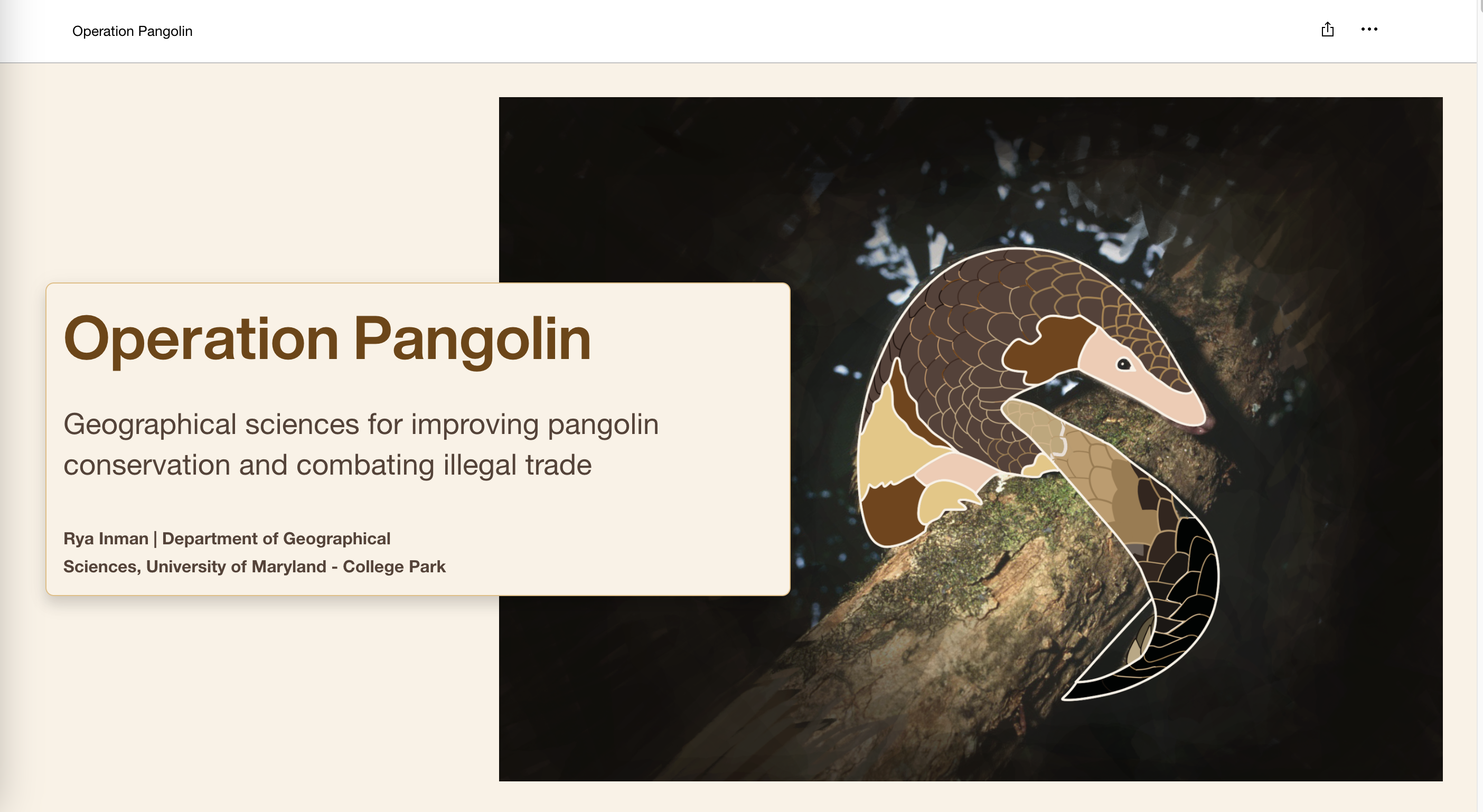
All images are screenshots of the StoryMap
Operation Pangolin: Geographical Sciences for Improving Pangolin Conservation and Combating Illegal Trade
Published on Mon, 06/16/2025 - 10:22