UMD College of Behavorial & Social Sciences UMD College of Behavorial & Social Sciences
MENU

Topbar Menu

  • About Us
  • People
  • Alumni and Giving
  • Diversity
  • Undergraduate
    • Prospective Students
    • Courses & Facilities
    • Advising
    • Special Programs
    • Graduation
    • Geography Club
  • Graduate
    • Prospective Ph.D. Students
    • Graduate Courses
    • Graduate Student Publications
    • Graduate Student Awards
    • Graduate Students
    • Master of Science and Graduate Certificate Programs
    • Combined BS/MS Program
  • Research
    • Research Areas
      • Geospatial-Information Science and Remote Sensing
      • Human Dimensions of Global Change
      • Land Cover and Land Use Change
      • Carbon, Vegetation Dynamics and Landscape-Scale Processes
    • Centers
      • Center for Geospatial Information Science
      • International Center for Innovation in Geospatial Analytics & Earth Observation
  • High School Hub
    • Program Overview
    • High School Awards
    • High School Internship Program
    • GIS Day
  • Resources
    • Graduate Student Organization
    • Student Life
    • Graduate School
    • Responsible Conduct of Research
    • Emergency Preparedness
    • Job Opportunities
    • Graduation
Search

Main navigation

  • Undergraduate
    • Prospective Students
    • Courses & Facilities
    • Advising
    • Special Programs
    • Graduation
    • Geography Club
  • Graduate
    • Prospective Ph.D. Students
    • Graduate Courses
    • Graduate Student Publications
    • Graduate Student Awards
    • Graduate Students
    • Master of Science and Graduate Certificate Programs
    • Combined BS/MS Program
  • Research
    • Research Areas
      • Geospatial-Information Science and Remote Sensing
      • Human Dimensions of Global Change
      • Land Cover and Land Use Change
      • Carbon, Vegetation Dynamics and Landscape-Scale Processes
    • Centers
      • Center for Geospatial Information Science
      • International Center for Innovation in Geospatial Analytics & Earth Observation
  • High School Hub
    • Program Overview
    • High School Awards
    • High School Internship Program
    • GIS Day
  • Resources
    • Graduate Student Organization
    • Student Life
    • Graduate School
    • Responsible Conduct of Research
    • Emergency Preparedness
    • Job Opportunities
    • Graduation
  • About Us
  • People
  • Alumni and History
  • Diversity

Search our site:

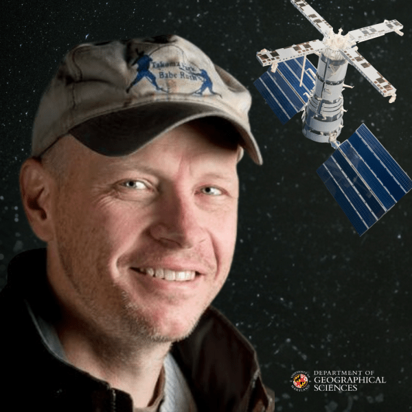
Excellence in Remote Sensing: Professor Hansen Receives 50th Annual William T. Pecora Award

Breadcrumb

  • Home
  • Featured Content
  • Excellence In Remote Sensing: Professor Hansen Receives 50th Annual William T. Pecora Award
Professor Matthew Hansen

As Professor Matthew Hansen Joins Past UMD Pecora Award Recipients, His Dedication to Global-Scale Remote Sensing and Creating Globally Consistent, Locally Relevant Maps Remains Steadfast

The 50th annual William T. Pecora Award, a prestigious honor jointly bestowed by the United States Geological Survey (USGS) and the National Aeronautics and Space Administration (NASA), shines a spotlight on the remarkable contributions of individuals who have reshaped the understanding of planet Earth through remote sensing innovations.

This year, the Pecora Award recognizes Professor Matthew Hansen for his groundbreaking work in advancing Earth observation applications for land use change and standardizing accuracy assessment of remote sensing products. Throughout his career, Professor Hansen has been at the forefront of using satellite data to monitor and analyze global land cover dynamics.

"Matt has had an outstanding career in remote sensing, first developing a capability for global AVHRR monitoring of land cover and then pioneering the use of global Landsat data,” said Distinguished Professor Chris Justice, who nominated Hansen for the award. 

Through the Global Land Analysis and Discovery (GLAD) laboratory, led by Hansen and  Research Professor Peter Potapov, he established a real-time deforestation monitoring system based on Landsat imagery on a global scale. This capability was later integrated into the publicly accessible Global Forest Watch platform in collaboration with the World Resources Institute (WRI). The GLAD lab now offers a variety of new global land cover and change products. 

“No one has done more to show the global capability of Landsat than Matt and he is fully deserving of the Pecora Award,” Justice remarked.

In the words of the honoree himself, the Pecora Award symbolizes more than just individual achievement; it represents a collective endeavor to unravel the complexities of our changing planet. 

“As we have gained more and more experience, gained access to better and better data, and advanced new approaches, we are getting a more precise picture of human-induced and natural impacts on the global land surface,” Hansen said, underscoring the evolution of remote sensing.

As Hansen joins the past Pecora Award recipients from the UMD faculty, including Chris Justice, John Townshend and Sam Goward, he feels a deep sense of honor. Building upon their legacy, Hansen remains steadfast in his commitment to global-scale remote sensing.

”I have pushed hard to create what Tom Loveland, another Pecora recipient and colleague, used to say were ‘maps that are globally consistent and locally relevant.’ We are continually advancing to that standard.”

Learn more the Pecora Award


Published on Wed, 04/24/2024 - 11:25

College of Behavorial & Social Sciences
  • Facebook
  • Twitter
  • Instagram
  • YouTube
  • LinkedIn
  • Zenfolio

Department of Geographical Sciences

2181 Samuel J. LeFrak Hall, 7251 Preinkert Drive,
University of Maryland, College Park, MD 20742
Phone: 301-405-4050

Join Our Newsletter

Contact Us

Links
  • UMD Land Acknowledgement
  • UMD Staff Directory
  • Give to GEOG
  • UMD Web Accessibility
  • Alumni
© 2025 College of Behavorial & Social Sciences. All Rights Reserved.
Login