
Egg-citing Finding on Future Food Prices
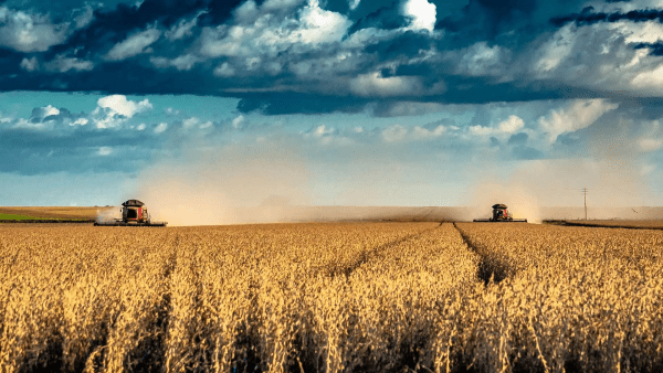
Farmers can use satellite data and the difference in the timing of growing seasons in the Northern and Southern Hemispheres to optimize the availability and affordability of certain foods, including soybeans (pictured) in Brazil, finds a new study led in part by a UMD researcher.
Hikes in grocery prices—11% last year alone—often arise from factors outside of governments’ control, whether it’s bird flu driving up egg costs or heavy rain and flooding in California drowning crops of veggies, nuts and berries.
But farmers can gain more control over the availability—and affordability—of certain foods by taking advantage of satellite data and the difference in the timing of growing seasons in the Northern and Southern Hemispheres, finds a new study led in part by a University of Maryland researcher and published last month in Communications, Earth & Environment, a Nature journal.
Remote sensing has been used to track and make predictions about crop harvests for years. But governments have been hesitant to heavily invest in the technology for collaborative crop monitoring and planting because they lacked evidence of its ability to produce quantifiable economic benefits—until now.
“The simulations we created show that remote sensing forecasting can reduce country-level prices in import-dependent countries by 1.1-12.5 percentage points,” said Laixiang Sun, a professor in the Department of Geographical Sciences (GEOG) and the paper’s corresponding author. “We found in three cases that if we can use remote sensing to predict a poor harvest in the Northern Hemisphere, the Southern Hemisphere can plant more so they can avoid a shortage. If the Northern Hemisphere will have a good harvest, the Southern can plant less to avoid an oversupply. This will keep prices stable.”
The researchers first created models to predict how much heads up farmers in the opposite hemisphere could have of impending shortages or surpluses. To do so, the researchers used all available remote-sensing data before a 2008 poor wheat harvest in Russia and Ukraine, before a 2012 good wheat harvest in Russian and Ukraine, and before 2012’s poor soybean harvest in Brazil.
The wheat-forecasting models accurately predicted production in 2008 and 2012 one to two months before the harvests.
“We demonstrated that timely forecasts for major exporting countries can help inform planting decisions in the opposite hemisphere that can help to offset impending crop shortfalls and thereby help to stabilize global food supplies and prices,” said Inbal Becker-Reshef, who led the GEOG research team that created the models. She serves as the program director of NASA Harvest, NASA’s Global Food Security and Agriculture Consortium led and implemented by the Harvest Hub at the University of Maryland.
Xiaopeng Song, a GEOG assistant professor and another paper co-author, created the soybean-forecasting model, which predicted yields in the Southern Hemisphere up to a month before planting would have begun in the Northern Hemisphere.
The researchers also developed economic models to show how predictions of forthcoming shortages and surpluses could prevent food price fluctuations. With data from 2007 and 2011, the years immediately preceding the wheat and soybean harvests, the models showed that consumers in import-dependent countries could save some money if farmers were able to see and respond to the predicted harvests of farmers living in the opposite hemisphere.
Song said the paper’s findings justify continued monitoring of crop growth from space—and not a moment too soon, either.
“This is important, as global food security is increasingly threatened by regional human conflicts and extreme weather events from climate change,” he said.
Image: iStock
Published on Tue, 10/24/2023 - 09:52