
EDGE Mission Reaches Key Milestones as Scientific Momentum Builds

Proposed NASA lidar mission completes Phase A study and engages the Earth science community ahead of selection.
The Earth Dynamics Geodetic Explorer (EDGE) mission, a proposed satellite laser altimetry mission under NASA’s Earth System Explorer (ESE) program, reached two major milestones in 2025. The EDGE team completed its Phase A Concept Study in June 2025 and hosted the ESE Evaluation Panel at NASA Goddard Space Flight Center. If selected, EDGE would launch in 2030 for a two-year mission to collect measurements on Earth’s terrestrial ecosystems, land and sea ice. NASA’s final selection decision is expected in January 2026.
 EDGE PI Helen Fricker presenting on the mission at AGU25. Photo: Tali Schwelling
The mission has continued to engage the scientific community, including at the American Geophysical Union (AGU)’s annual meeting in New Orleans. At AGU25, EDGE, in partnership with the Surface Topography and Vegetation (STV) community, hosted two oral sessions focused on geodetic mapping of ecosystems, ice sheets and Earth’s changing surface. The sessions drew participation from an international group of researchers and reflected the range of science supporting the proposed mission.
EDGE is led by Principal Investigator Helen Fricker (professor at the University of California, San Diego) and supported by a collaborative leadership team spanning academia and NASA. John Armston, associate professor at the University of Maryland’s Department of Geographical Sciences, serves as Deputy Principal Investigator, leading the mission’s terrestrial ecosystem structure science. Bryan Blair serves as Deputy PI (Instrument) and Scott Luthcke (NASA Goddard Space Flight Center) as Project Manager, bringing together decades of experience in satellite laser altimetry.
“EDGE fills a critical gap in Earth observation,” said Fricker. “With global, swath-imaging lidar, the mission delivers the fine-scale measurements needed to reveal the processes driving ice mass loss.”
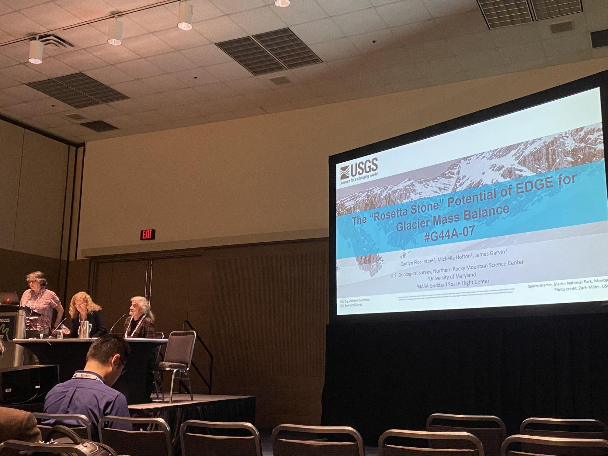
EDGE Co-I Michelle Hofton presenting on the potential of the mission to improve our understanding of geodetic mass balance for remote glaciers. Photo: Tali Schwelling
EDGE builds on decades of collaboration between UMD and NASA Goddard that produced pioneering mission concepts such as VCL and DESDynI, and ultimately the Global Ecosystem Dynamics Investigation (GEDI). Led by Professor Ralph Dubayah, GEDI has revolutionized measurements of forest structure and carbon dynamics from the International Space Station. ICESat-2, also involving UMD researchers and EDGE PI Fricker, has transformed observations of ice sheets and sea ice. Together, these missions have delivered unprecedented insights, yet neither alone nor combined can provide the integrated, global coverage required to observe both terrestrial ecosystems and ice consistently.
EDGE is designed to meet that need—the mission is “the natural successor to GEDI and the global imaging lidar we have worked toward for decades,” said Dubayah. “Missions like GEDI and ICESat-2 have established the UMD–GSFC partnership as a center of excellence in spaceborne lidar for ecosystems, and EDGE builds directly on that foundation.” As the first global swath-imaging lidar mission, EDGE would move beyond track-based profiling to map broad swaths of Earth’s surface from an independent satellite, enabling consistent, high-resolution measurements across the globe. “By learning from the development and operations of earlier systems such as GEDI, the EDGE team has been able to optimize the mission’s design to maximize the quality and quantity of surface measurements and the science data within the NASA ESE budget,” said Blair.
The mission’s capabilities open new opportunities for applications, including biodiversity monitoring, wildfire risk assessment and carbon accounting. Associate Researcher Chris Hakkenberg (UCLA), an invited speaker in the AGU EDGE sessions, highlighted this potential: “EDGE delivers first-of-its-kind capabilities that enable consistent, high-precision monitoring of 3D forest habitat from the tropics to the boreal. These same measurements will inform next-generation wildfire management tools that reduce risk to communities while improving public health and national security.”
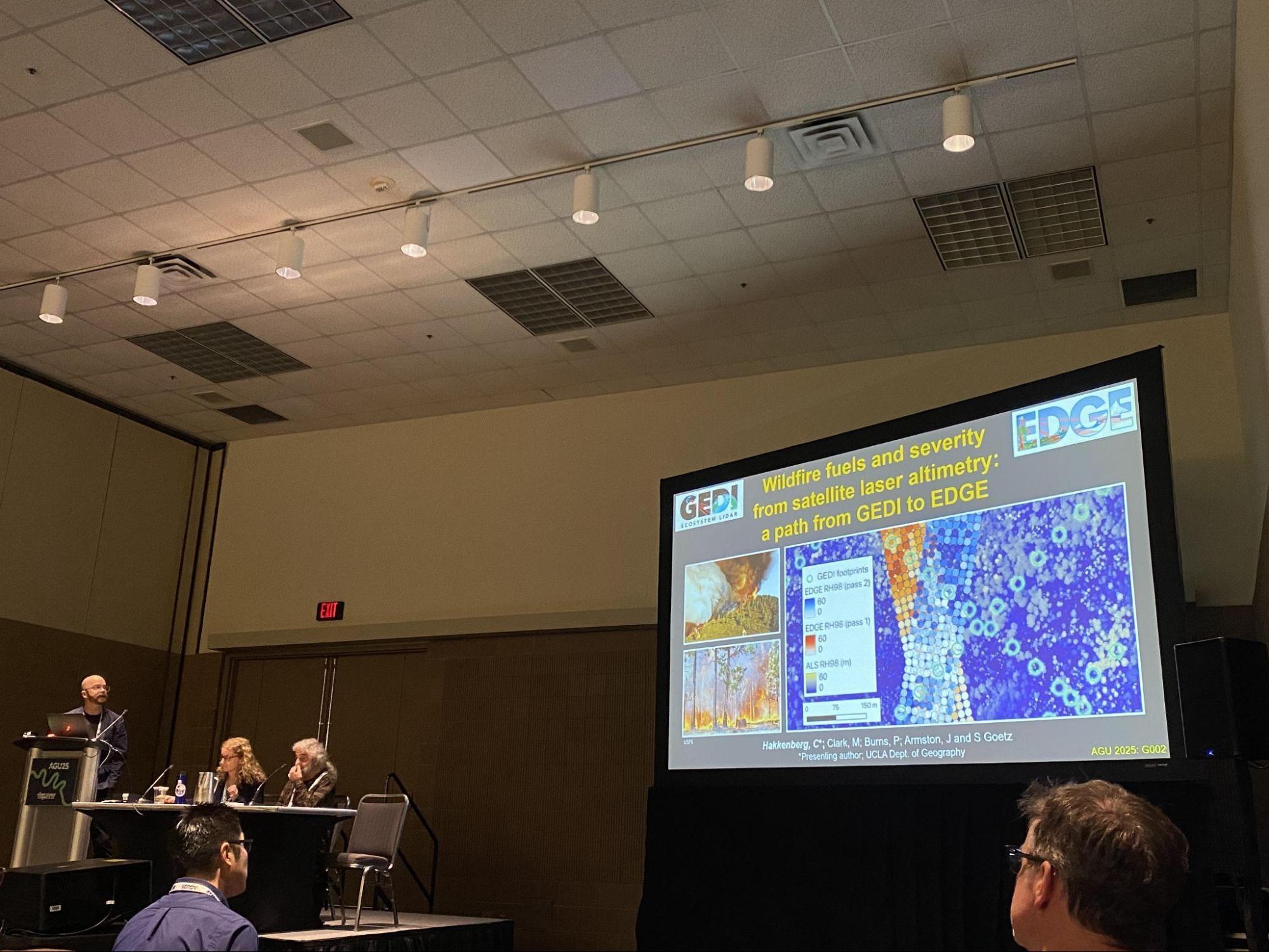
EDGE Co-I Chris Hakkenberg, one of the session’s invited speakers, shared how the mission’s swath-mapping lidar technology will significantly improve our ability to generate fuel structure products and allied fire behavior models. Photo: Tali Schwelling
As the EDGE team and broader scientific community await NASA’s final selection decision, the mission continues outreach and engagement efforts. Additional information about EDGE, including opportunities for collaboration, is available on the mission website and in the program factsheet.
Main image: EDGE site visit at NASA Goddard Space Flight Center on Sept. 25, 2025. Photo: EDGE team
Published on Fri, 12/19/2025 - 12:34