UMD College of Behavorial & Social Sciences UMD College of Behavorial & Social Sciences
MENU

Topbar Menu

  • About Us
  • People
  • Alumni and Giving
  • Diversity
  • Undergraduate
    • Prospective Students
    • Courses & Facilities
    • Advising
    • Special Programs
    • Graduation
    • Geography Club
  • Graduate
    • Prospective Ph.D. Students
    • Graduate Courses
    • Graduate Student Publications
    • Graduate Student Awards
    • Graduate Students
    • Master of Science and Graduate Certificate Programs
    • Combined BS/MS Program
  • Research
    • Research Areas
      • Geospatial-Information Science and Remote Sensing
      • Human Dimensions of Global Change
      • Land Cover and Land Use Change
      • Carbon, Vegetation Dynamics and Landscape-Scale Processes
    • Centers
      • Center for Geospatial Information Science
      • International Center for Innovation in Geospatial Analytics & Earth Observation
  • High School Hub
    • Program Overview
    • High School Awards
    • High School Internship Program
    • GIS Day
  • Resources
    • Graduate Student Organization
    • Student Life
    • Graduate School
    • Responsible Conduct of Research
    • Emergency Preparedness
    • Job Opportunities
    • Graduation
Search

Main navigation

  • Undergraduate
    • Prospective Students
    • Courses & Facilities
    • Advising
    • Special Programs
    • Graduation
    • Geography Club
  • Graduate
    • Prospective Ph.D. Students
    • Graduate Courses
    • Graduate Student Publications
    • Graduate Student Awards
    • Graduate Students
    • Master of Science and Graduate Certificate Programs
    • Combined BS/MS Program
  • Research
    • Research Areas
      • Geospatial-Information Science and Remote Sensing
      • Human Dimensions of Global Change
      • Land Cover and Land Use Change
      • Carbon, Vegetation Dynamics and Landscape-Scale Processes
    • Centers
      • Center for Geospatial Information Science
      • International Center for Innovation in Geospatial Analytics & Earth Observation
  • High School Hub
    • Program Overview
    • High School Awards
    • High School Internship Program
    • GIS Day
  • Resources
    • Graduate Student Organization
    • Student Life
    • Graduate School
    • Responsible Conduct of Research
    • Emergency Preparedness
    • Job Opportunities
    • Graduation
  • About Us
  • People
  • Alumni and History
  • Diversity

Search our site:

Dr. Yiqun Xie Received the Best Paper Award at the 2021 IEEE International Conference on Data Mining

Breadcrumb

  • Home
  • Featured Content
  • Dr. Yiqun Xie Received The Best Paper Award At The 2021 IEEE International Conference On Data Mining
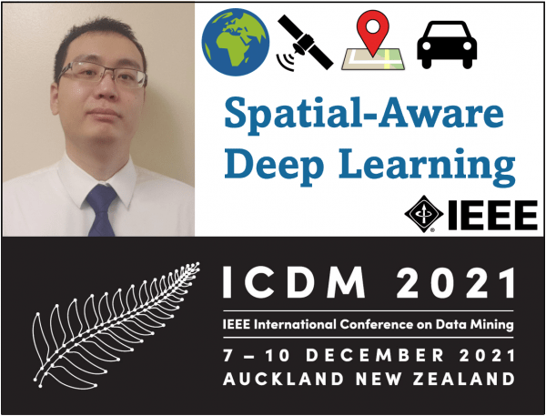
Headshot of Dr. Xie and ICDM 2021 conference logo

Assistant Professor Dr. Yiqun Xie received the Best Paper Award with collaborators for their work: "A Statistically-Guided Deep Network Transformation and Moderation Framework for Data with Spatial Heterogeneity," at the 2021 IEEE International Conference on Data Mining (ICDM).

Background: IEEE ICDM is a top data mining venue in the computing field, and has a highly-selective peer-review process (e.g., 9.9% acceptance rate for regular full-length papers). The conference received 990 full-length submissions in 2021. Xie's work is also invited to be presented at the Sister Conference Best Paper Track of IJCAI-ECAI 2022, a premier artificial intelligence forum. Conferences in general computing research are considered as important as journals based on both selectivity and impact, as illustrated in this National Academy Press article and this page featuring an informative video on the detailed peer-review process.

Xie's research tackles a fundamental challenge posed by spatial data to general machine learning approaches: spatial heterogeneity (e.g., see a recent PNAS article). As the processes/functions from observed features (e.g., spectral values from satellite imagery) to prediction targets (e.g., land cover classes) are often nonstationary over space — which violates the common identical distribution assumption underlying machine learning methods — attempts that train a model with a single set of parameters for different regions may lead to "hit or miss" solutions and significantly limit model performance. Making the problem more challenging, the spatial footprints of different processes are often unknown in practice.

The paper offers a new approach that addresses this key challenge by statistically-guided spatial transformation, which can automatically recognize heterogeneous spatial processes in the input data and capture their footprints. It also introduces a spatial moderator that can generalize heterogeneity patterns learned in one region to a new location. The framework can be applied to general deep learning architectures, and experiment results have demonstrated substantial performance improvement on fully-connected (e.g., ANN) and recurrent (e.g., LSTM) neural networks.

Published on Wed, 02/02/2022 - 18:09

College of Behavorial & Social Sciences
  • Facebook
  • Twitter
  • Instagram
  • YouTube
  • LinkedIn
  • Zenfolio

Department of Geographical Sciences

2181 Samuel J. LeFrak Hall, 7251 Preinkert Drive,
University of Maryland, College Park, MD 20742
Phone: 301-405-4050

Join Our Newsletter

Contact Us

Links
  • UMD Land Acknowledgement
  • UMD Staff Directory
  • Give to GEOG
  • UMD Web Accessibility
  • Alumni
© 2025 College of Behavorial & Social Sciences. All Rights Reserved.
Login