
Assistant Professor Danghan Xie’s Path to Coastal Resilience
Growing up in a coastal town in China, Xie saw firsthand floods and typhoons disrupt daily life. Today, he combines geospatial science, remote sensing and coastal process modeling to better understand coastal hazards and help protect communities from rising water.
Growing up in Putian, a fishing city on China’s southeastern coast, Assistant Professor Danghan Xie spent his time swimming, playing on the beach and racing his remote-controlled cars with friends. His favorite season was summer, when typhoons became more frequent and schools would close for days before a storm hit. To him, that meant no classes and no homework. However, for his family, who ran a local business, it meant intense preparation.
“There was extreme rainfall and strong gusts, causing power outages, leaks and floodwater everywhere.” Xie recalled. “Our family had to prepare carefully. Sometimes we used towels to soak up leaking water, moved heavy furniture to keep doors from being blown open by the wind and used basins to scoop water out of the yard.”
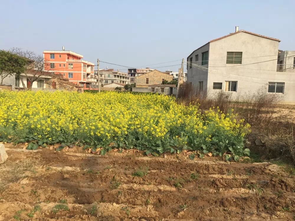 Outside Xie's family house in Putian (2023), a view that has been changed by new constructions.
During those dark typhoon nights, Xie stayed close to his grandfather, a teacher and hydrologic engineer, listening as he explained the science behind the storm.
“My grandpa was someone who seemed to know everything,” Xie said. He explained how lightning happens, how wind moves during a typhoon and how people can survive a disaster. His grandfather also shared lessons from his engineering work, including designing a bridge over soft soil. “He showed me a picture of the bridge he designed,” Xie said. “I thought that was so cool and I wanted to be an engineer like him.”
Through these experiences, Xie saw that the impact of a storm went far beyond his own doorstep. “Every time there was a typhoon, my grandfather would tell me not to just look at our own home, but also to look at other families, because they would be flooded too,” Xie said. Many traditional homes had large yards, and some families stored rice in large tanks above the ground. Flooding could spoil the rice and destroy both homes and livelihoods.
When Xie went on to study coastal engineering at Hohai University—whose name means “river and ocean” in Chinese—he learned fluid mechanics, geometry and architecture, and how to apply them to design harbors, dikes and other coastal infrastructure. At the time, China was investing heavily in coastal construction, and engineering was widely seen as a stable and respected profession. Like many students, Xie focused on grades and research projects, aiming to become a coastal engineer.
Engineering Meets Geography
 Xie poses at the base of a Mazu statue along the coast of his hometown during his high school years. Many local families rely on fishing and worship Mazu, a sea goddess believed to protect those at sea.
After earning his bachelor’s degree in coastal engineering, Xie faced an unexpected hurdle: the job market had weakened as government investment in coastal infrastructure slowed. With fewer projects and fewer openings, he decided to continue his education and pursue a master’s degree.
“It might not be true now, but at that time, if you wanted a decent job, you had to have a higher degree,” he said.
As he advanced in his studies, Xie noticed gaps in how coastal areas were managed and protected. He was trained to design structures such as harbors and seawalls, paying close attention to materials, structural calculations and costs. But he began thinking beyond technical specifications to the bigger picture: What are the most urgent problems facing coastal ecosystems? And are there better ways to protect coastlines than relying solely on gray infrastructure?
The more he learned about coastal processes, the more those questions stayed with him. He became increasingly interested in erosion, vegetation loss along shorelines and the effects those changes have on farmland and nearby communities.
“Engineering can help in the short term, but it often comes with high construction and maintenance costs. Over the long term, nature-based solutions may offer a better alternative,” he said.
That shift in perspective drew him toward physical geography and a more process-based understanding of coastal resilience. He came to believe that engineers can make better decisions when they also understand the natural systems they are working with.
“The real promise for coastal regions isn’t engineering alone,” Xie explained. “Natural ecosystems can help keep water from reaching farmland and cities, making shorelines more resilient. You learn a lot by looking closely at what's happening in nature.”
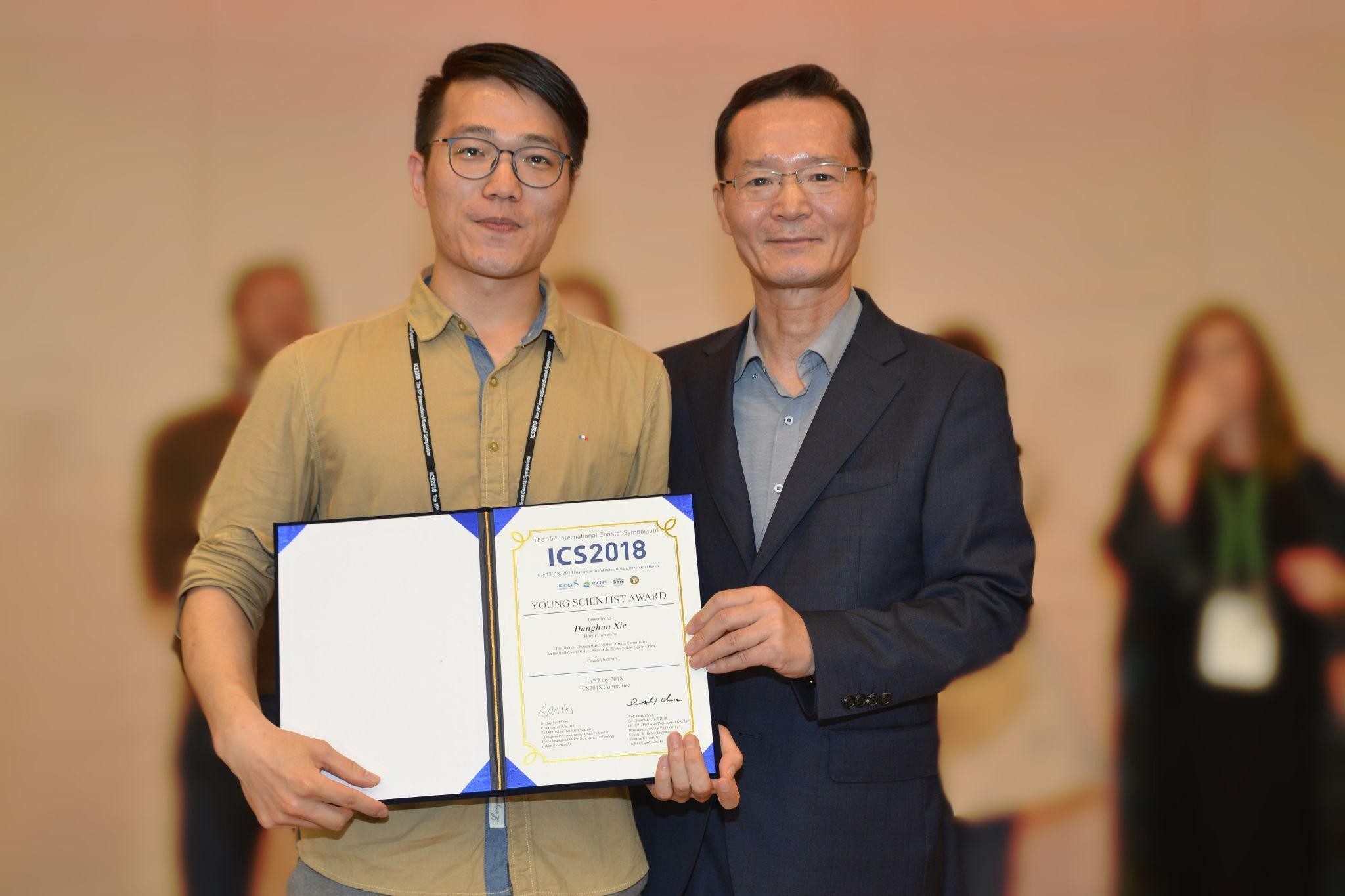
Xie (left) receives the Young Scientist Award at the 2018 International Coastal Symposium in Busan, South Korea.
During his master’s, Xie focused on flood modeling and coastal dynamics. He attended international conferences, began presenting his work and gained recognition in the field. Those experiences also helped clarify the kind of career he wanted.
“I realized I enjoyed academic work more than industry,” he said. “I wanted to keep pursuing the questions that interested me, to understand more about nature and coastal systems, not just to build structures.”
That led him to Utrecht University in the Netherlands, where he pursued a Ph.D. program in physical geography. There, he studied coastal ecosystems in an interdisciplinary project that combined vegetation dynamics with physical geography.
Building a Future in Coastal Resilience
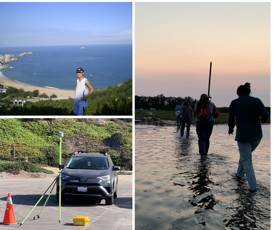
Clockwise from top left: Sandy beach in Putian; students wading through Plum Island Sound, MA, for salt marsh analysis (2022); and high-precision GPS surveying for a 2025 California lidar project.
Much of Xie’s Ph.D. coincided with the COVID-19 pandemic, forcing him, like many others, to work from home. But after a few months, he asked to return to the office.
“I am basically in the office every day. I can’t focus at home,” he said. Xie is used to what’s known in China as the “996” work rhythm—9 a.m. to 9 p.m., six days a week. “If the office closes at 8, I move to another location,” he said. “On the weekend, I study at the library.”
After completing his Ph.D., Xie took on two postdoctoral positions. At Boston University, he focused on simulations of coastal erosion during storms. He then joined Scripps Institution of Oceanography at UC San Diego, where he worked with lidar and explored remote sensing, broadening both his technical expertise and his understanding of coastal systems.
“Throughout my master’s and Ph.D., it was all about numerical modeling,” he said. “But you want to have multiple skills. You want your expertise to be as strong and robust as possible.”
Using lidar to study California’s coastline, he began asking new questions: “How can remote sensing help my modeling work, and how can my modeling work help the interpretation of my remote sensing data?” This approach helped him become a great fit when the department was looking for an assistant professor specializing in coastal processes.
“I am so happy and proud of myself that I got this job at the University of Maryland!” he said. “It’s a great university, and I feel super welcomed here.”
Now, Xie hopes to build a strong research group focused on coastal resilience and nature-based solutions. He’s especially excited to mentor students who want to better understand how coastal systems work and how communities can adapt to future change.
“I want to train my students to think critically about coastal systems,” he said. “Why did a hurricane flood one farm but not the other? "Why did one shoreline retreat this time but not last time? Numbers matter, but what is more important is understanding the process behind them. In the end, can we do anything to prevent or reduce those impacts?”
That philosophy also shapes the way he approaches teaching. Rather than simply giving students answers, he wants to help them learn how to ask the right questions and solve problems for themselves.
Remote sensing, he noted, can reveal what’s happening on the landscape today, but it can’t by itself predict what will happen next. That’s where predictive modeling becomes essential.
“I’m trying to build a model that bridges what is happening today with what can happen in the future,” Xie said.
He points to storm impacts in the Chesapeake Bay region as one example. A process-based model can simulate past events and explore future scenarios, showing where flooding might occur, how far inland it could spread, whether infrastructure such as bridges could be affected, and how farmland or natural ecosystems might respond.”
At Maryland, he sees many opportunities to collaborate with colleagues throughout campus. “I’m excited to work with experts in different fields to better understand coastal change and develop solutions that help communities respond,” Xie said.
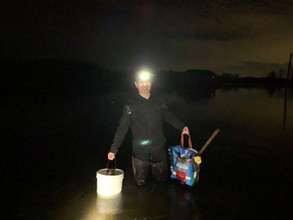
Main image: Xie collects water turbidity data in Massachusetts in 2024. All photos courtesy of Xie.
Published on Fri, 03/20/2026 - 14:20