GEOG Seminar 11/6: Philip W. Dabney, "Turning Scientists’ Dreams into Reality ..."
Join us at 3:30 p.m. on Thursday, Nov. 6 for the seminar "Turning Scientists’ Dreams into Reality: Your Wish Is an Instrument Scientist’s Command" at River Road and via Zoom with Philip W. Dabney of the NASA Goddard Space Flight Center.
An Instrument Scientist (IS) sits at the intersection of applied science, modeling, physics, technology, and calibration. A working knowledge of these subjects is necessary to flow top-level science products to downstream products, methodologies, measurements, and instrument requirements that systems engineers can allocate and specify to the various subsystems and components. Research institutions such as NASA use formal Science Traceability Matrices (STM) to capture and communicate this process. Many products (e.g. Evapotranspiration) depend on multi-modal sensor data fusion, resulting in various trades being performed at architectural, observatory, instrument, and algorithmic levels.
Other roles include tracking emerging technologies, improving existing/developing new measurement methodologies, and guiding technology development to advance science benefiting life on earth. This talk will provide examples from Phil’s work with lidar altimetry/bathymetry, and passive visible through short-wave IR (VSWIR) and long-wave IR (LWIR)/TIR multi/hyperspectral imaging. Applications in Cryospheric, Biospheric, and Aquatic Sciences will be highlighted, with specific instrument and spacecraft requirement flow-downs highlighted and discussed. These will pull from Landsat (including L-Next), IceSAT2, SIMPL, SAFE, and other airborne missions. There will also be a short discussion on requirement considerations for an AI enabled Expert System versus deterministic driven system, followed by a Q&A.
About the Speaker
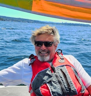
Philip W. Dabney has over 38 years of experience in the conceptualization, development, application, calibration, and operations of active and passive airborne prototype and spaceborne sensors. He received a Master of Science degree in Electro-Physics from the University of Maryland, College Park and holds Bachelor’s degrees in Electrical Engineering and Physics.
Recently, he served as the Instrument Scientist for the Sustainable Land Imaging (SLI) Mission, which includes Landsat-8, Landsat-9, Landsat-Next, and SLI-Technology development; the Structure and Function of Ecosystems (SAFE) mission formulation; and several NASA R&D projects.
He also served as the ICESat-2/ATLAS Instrument Pre-launch Calibration and Validation Scientist; Instrument Scientist and Systems Engineer for the Swath Imaging Multi-polarization Photon-counting Lidar (SIMPL); P.I. for the development of a Prototype Inter-planetary Asynchronous Laser Transponder; and the Instrument Systems Engineer for the Shuttle Laser Altimeter-03, the photon-counting Multikilohertz Microlaser Altimeter (MMLA); and many more. He also frequently provides Instrument Science support to mission and instrument concept studies involving lidar, thermal radiative, and multi/hyper-spectral reflected light imaging systems.
For the Zoom link, please visit the GEOG Department Calendar.


