

Fall 2026 MS GIS/GEOINT Capstone Presentations and Symposium
The Department of Geographical Sciences will celebrate the outstanding work of our MS GIS and MS GEOINT students at two upcoming events this November.
Faculty, students and alumni are invited to attend two events featuring capstone projects by students in the Master of Science in Geographic Information Systems (MS GIS) and Geospatial Intelligence (GEOINT) program.
The events will feature online lightning talks on Nov. 16 and an in-person symposium on Nov. 17. The symposium will include poster presentations, live demonstrations and refreshments.
Online Lightning Talks
Monday, Nov. 16, 2026 | 5-7 p.m.
Students will give brief presentations on their capstone projects, covering topics ranging from Chesapeake Bay watershed environments and vehicle mobility to nighttime lights, urban development and remote sensing.
Presenters and Projects
- Michael Bonsignore: "The Chesapeake Bay Live Viewer: A Living Library of the Chesapeake Bay Watershed Environment"
- Ian Bradley: "Right-of-Way Obstruction Reporting Application for the DMV Region"
- Joshua Chaney: "Modernizing GIS-Based Cross Country Vehicle Mobility for Marine Corps Geospatial Analysts"
- Trevor Koglin, Emma Curtis and Erin Macri: "Before and After the Boom: A Remote Sensing Comparison of Hyperscale Data Center Construction in China's Pre- and Post-2022 AI Expansion"
- Colin McNamara: "Montgomery County Master Plan Zoning Simulation Web System: Residential Development Capacity and GHG Quantification Modeling"
- Christian Mueller: "Night Sky Brightness Risk Assessment of Dark Sky Communities in the United States"
- Justin Stewart: "Analyzing Nighttime Lights Data to Uncover Spatial Patterns in Kyiv’s Recovery from Drone Warfare"
In-Person Symposium
Tuesday, Nov. 17, 2026 | 5-7:30 p.m.
Location: 4600 River Road, Room 325, Riverdale, Maryland 20737
The symposium will feature poster presentations and live demonstrations of student capstone projects. Food and beverages will be served.
Presenters and Projects
- Drake Beckner: "Creating an Inexpensive Terrestrial Lidar Device and Conducting Practical Field Use"
- Jessica Clyburn: "Evaluating Tidal Marsh Recovery Following Nutria Eradication under Accelerating Coastal Change at Blackwater National Wildlife Refuge, 1991 to 2025"
- Andrew Griffin: "Modeling the Impact of Urban Volumetric Growth on Population Demographic Change in Washington, D.C."
- Mariia Ihnatiuk: "Scenario-Based Simulation of Phyllachora maydis Spread Under an Agroterrorism Scenario"
- Garrett Mahoney: "Mapping Chokepoint Vulnerability in Global Rare Earth Element Supply Chains"
- Lauren Meyers: "Bridging Spatial Gaps: Predicting Canopy Height Using Machine Learning on ICESat-2 and Landsat Observations"
- Adam Mills: "Micromobility Vehicle Analysis in College Park, Maryland"
- Robyn Murray: "East Data, West Computing, and the Geography of Risk"
- Kehinde Ogunbayo: "Multi-Tier Spatial Accessibility Modeling of Maternal Healthcare Across Mississippi"
- Jacob Orser: "How Fine a Detail Can a Commercial Satellite See? Wyvern Dragonette and NASA AVIRIS-3 Within-Field Crop Patterns at Cornell AgriTech, Geneva, New York: A Comparison for Specialty Crops"
- Elle M. Parks: "Municipal Weather Dashboard: A Predictive 3D Digital Twin Incorporating Live Meteorological Feeds to Assess Coastal Impacts in Tampa Bay, Florida"
- Jacob Rosado-Bravo: "Participatory Risk Mapping of Vulture Conservation and Wildlife Health Concerns in the Great Limpopo Transfrontier Conservation Area"
- Yutian Tao: "Implicit Neural Representation-Based Terrain Topology Analysis for Landslide Susceptibility Assessment"
- Alexander Temoshok: "Multispectral Remote Sensing and Spatial-Statistical Detection of Turbidity Anomalies in the Occocquan Reservoir in Virginia"
- Frank Wills: "Geocoding Pipeline for Automated Meta-analysis of Global Evidence"
All faculty, students and alumni are welcome to attend either or both events to support the students and learn about their work.
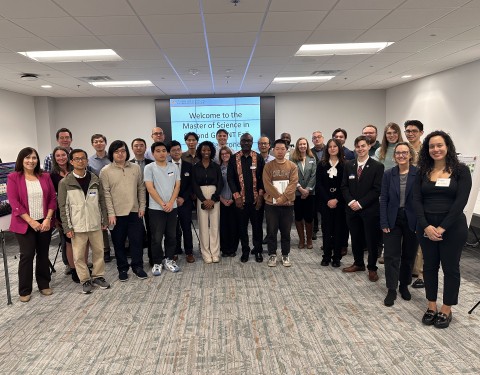
Image: Fall 2025 MS GIS/GEOINT Capstone Poster Symposium
When:
to: