NASA's FireSense Team Selects GEOG Researchers to Tackle Wildfire Challenges
These fire experts will work to enhance fire management strategies using advanced Earth science technologies.
Three GEOG faculty members—Professor and Chair Tatiana Loboda, Associate Research Professor Evan Ellicott and Assistant Research Professor Adrián Pascual Arranz—have been selected to join NASA's FireSense Implementation (FSI) Team. This initiative aims to enhance wildland fire management across the United States using advanced Earth science technologies.
The FireSense program, a project of NASA’s Earth Science Division, received 62 applications and chose 20 proposals, with a total first-year funding of $2 million pending final budget negotiations. The strong representation of GEOG faculty is a notable achievement.
“Our department has long been a leader in satellite fire monitoring,” said Loboda, highlighting contributions from Professor and Distinguished Researcher Chris Justice, who spearheaded NASA’s fire monitoring efforts through the MODIS instrument, and Research Professor Louie Giglio, who developed global algorithms for active fire detection and burned area mapping. “We remain deeply engaged in fire science, from understanding vegetation to tracking fire progression and post-fire impacts,” she added.
The new members will contribute to FireSense’s key areas, including technology development and airborne science. The FSI team will also collaborate with stakeholders to address urgent challenges in fire management, leveraging FireSense’s cutting-edge technologies to provide timely, impactful solutions.
Tatiana Loboda to Improve Fire Management and Air Quality

Her current research focuses on forecasting lightning in boreal and tundra ecosystems, a critical factor in fire risk, which she plans to pursue within the FireSense strategic planning process. Loboda brings extensive experience in algorithm development and modeling to this work.
Loboda has successfully led large, multidisciplinary teams on complex projects, collaborating with stakeholders ranging from local and state agencies in Maryland to public health officials in Myanmar.
A seasoned expert in analyzing the health impacts of wildfire emissions across Alaska, Loboda is strongly aligned with the Air Quality goal of the FireSense Implementation and will establish connections within stakeholder communities in the field of public health.
Evan Ellicott to Bridge Data Gaps in Wildfire Management

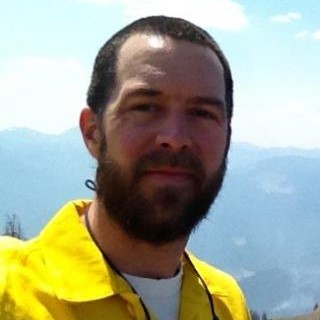
“I've been a qualified wildland firefighter for 29 years, which keeps me engaged with operational personnel,” he said. “I have participated in numerous prescribed and wildland fire campaigns.”
Ellicott's background also includes a decades-long leadership role in NOAA's Proving Ground and Risk Reduction program. His research covers various aspects of wildfire ecology, from emissions caused by crop residue burning to the effects of fuel moisture on fire behavior. He has also contributed to advanced fire-spread models and is involved in projects assessing the health impacts of wildfire smoke exposure
Currently, Ellicott leads a subgroup in the XPRIZE-Wildfire Challenge, focusing on innovative fire detection solutions, and is evaluating the transition from the aging Terra-MODIS fire detection system to the European Space Agency's Sentinel-3.
Adrián Pascual Arranz to Leverage Lidar Technology for Enhanced Fire Management Planning

By utilizing GEDI data, Pascual aims to enhance understanding of pre-fire conditions through metrics of vegetation structure and aboveground biomass density (AGBD), which correlates closely with fuel loads.
As a first-time FireSense team member, Pascual is excited to be involved in wildfires science-based plans.”There is a lot of emerging data power from remote sensing scientists, and this cohort can showcase ways to implement wildfire-oriented planning ” he said.
With GEDI data, he sees opportunities to inform pre-fire management strategies and identify critical areas for active forest management, particularly in the Western U.S., where decision-making models using spatial optimization—the topic he built his Ph.D. around—can be fueled with information on wildfire risk trajectories derived from GEDI and other sensors such as ECOSTRESS.
Main image: FireSense logo from the FireSense website
Published on Mon, 11/11/2024 - 14:52


