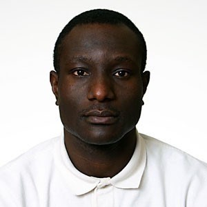
Adusei, Bernard Bio Use multisource satellite remotely sensed imagery for land-use and land-cover characterization especially field crops (soybean, corn, and wheat) at national scale. Projects: Researcher Quantifying Spatio-Temporal Trends in the Expansion of South American Agriculture, 1985 to Present Publications: Munzimi, Y. A., Hansen, M. C., Adusei, B., & Senay, G. B. (2015) Characterizing Congo Basin rainfall and climate using Tropical Rainfall Measuring Mission (TRMM) satellite data and limited rain gauge ground observations. Journal of Applied Meteorology and Climatology, 54(3), 541-555 Dempewolf, J., Adusei, B., Becker-Reshef, I., Hansen, M., Potapov, P., Khan, A., Barker, B. (2014) Wheat Yield Forecasting for Punjab Province from Vegetation Index Time Series and Historic Crop Statistics. Remote Sensing 2014, 6(10), 9653-9675. Potapov, P.V., Turubanova, S.A., Hansen, M.C., Adusei, B., Broich, M., Altstatt, A., Mane, L., and Justice, C.O., (2012) Quantifying forest cover loss in Democratic Republic of the Congo, 2000-2010, with Landsat ETM+ data, Remote Sensing Environment, 2012, 122, 106-116. Broich, M., Hansen, M., Stolle, F., Potapov, P., Margono, B.A. and Adusei, B. (2011) Remotely sensed forest cover loss shows high spatial and temporal variation across Sumatra and Kalimantan, Indonesia 2000-2008, Environmental Research Letters, 6. Broich, M., Hansen, M.C., Potapov, P., Adusei, B., Lindquist, E., Stehman, S.V. (2011) Time-series analysis of multi-resolution optical imagery for quantifying forest cover loss in Sumatra and Kalimantan, Indonesia, International Journal of Applied Earth Observation and Geoinformation, 13, 277-291. Research Topics Geospatial Information Science and Remote Sensing Land Cover - Land Use Change CV(s) Geospatial Imagery Analyst Bernard Adusei Faculty Specialist | 4600 River Road, Suite 368 (send mail to 2181 LeFrak) | badusei@umd.edu | (301) 405-2140